

nWo
BGP Meteorologist
-
Joined
-
Last visited
Everything posted by nWo
-
El Niño-Southern Oscillation (ENSO) conditions are one of several variables that can affect tornado activity in Kentucky. Sea surface temperatures in the central Pacific are usually neither unusually warm nor cold when the ENSO is in a neutral phase (neither El Niño nor La Niña). The climate is typically more variable under neutral ENSO conditions, which can affect tornado frequency and severity in the following ways: Severe Weather in the Spring: In Kentucky, tornadoes are most likely to happen in the spring, especially from March to May. Depending on other atmospheric factors such as the position of the jet stream and the amount of moisture present, springtime in neutral ENSO years may see a higher frequency of severe thunderstorms, including tornadoes. Climatology: Unpredictable weather patterns are frequently the result of neutral conditions. Because of favorable conditions (such as strong low-pressure systems or warm, humid air colliding with colder air masses), tornadoes may occur more frequently in some years than in others. Storm Tracks: Storm tracks and related severe weather events may differ from year to year due to the lack of a significant El Niño or La Niña influence. Neutral weather can sometimes contribute to calmer seasons and other times to more active tornado seasons. Kentucky's Historical Tornado Data (Neutral ENSO Years) 1. Neutral ENSO in 2014 In 2014, there were eighteen tornadoes in Kentucky. The largest outbreak happened on April 28, when Kentucky and the Midwest and Southeast were impacted by a massive severe weather system. Numerous EF2 tornadoes were caused by this outbreak. Tornado Season: As is typical for Kentucky, April saw the most activity. Given the neutral ENSO conditions, the tornado count was comparatively normal for the state. 2. Neutral ENSO in 2017 In 2017, there were sixteen tornadoes in Kentucky. On March 1, there was a significant outbreak that affected areas of Kentucky, Tennessee, and Mississippi with multiple powerful tornadoes (EF2-EF3). Tornado Season: Although there were a few more tornadoes than usual during this season, they were dispersed throughout the spring. With a few powerful tornadoes, March and April had the highest tornado activity. 3. Neutral ENSO in 2020 Tornadoes: There were eighteen tornadoes in Kentucky. The state was hit by an EF3 tornado on March 2, which was the biggest event. Tornado Season: The busiest months were March and April. With the most tornadoes occurring in the early spring, the tornado activity in 2020 was largely in line with neutral ENSO patterns. During this period, there were multiple powerful tornadoes in the state. 4. Neutral ENSO in 2023 Tornadoes: In 2023, a comparatively mild year for the state, Kentucky recorded 11 tornadoes. The most notable tornadoes occurred in April 2023, but none of them had an EF4 or greater intensity. Tornado Season: Tornado activity was somewhat below average despite the neutral ENSO, probably because there weren't many especially favorable conditions for tornadoes in the spring. Frequency of Tornadoes in Years with Neutral ENSO In Kentucky, tornado activity typically peaks in March, April, and May during neutral ENSO years. In Kentucky, there are typically 15 to 20 tornadoes per neutral ENSO year. Outbreaks are still possible, especially in April, when tornado formation is most likely due to severe weather. In summary: Based on past data, tornado activity in Kentucky should fall within the normal range for neutral ENSO years in 2026:
-
Temperature Outlook: The eastern half of Kentucky is likely to see above-average temperatures, with the southeast of the state likely to see a particularly robust warm-up. Temperatures in the Tennessee and Ohio Valleys should be significantly above average. Due to mid-level troughing throughout the area, western Kentucky is predicted to see a slight tilt toward near-normal temperatures. Precipitation Outlook: Due in large part to moisture advection from the Gulf of Mexico and the impending mid-latitude trough over the Interior West, Kentucky is predicted to see above-normal precipitation. The central and southern regions of the state, which extend into the Ohio Valley and include portions of the Lower and Middle Mississippi Valley and the Appalachians, are predicted to experience above-normal precipitation with the highest confidence (greater than 60%). Particularly in the second half of the forecast period, this could lead to widespread rain and thunderstorms with the possibility of severe weather, including strong winds, hail, and heavy rain. Severe Weather: The active weather pattern, especially across the central and eastern U.S., suggests a higher likelihood of severe weather outbreaks in Kentucky. This could include thunderstorms with strong winds, hail, and localized flooding from excessive rainfall. While the exact timing and locations are uncertain, there will be an increased risk of severe thunderstorms as the low-pressure system progresses eastward. Key Points: Above-normal temperatures in eastern Kentucky, with near-normal temperatures in the west. Above-normal precipitation, especially for central and southern Kentucky, leading to potential severe weather events. Confidence in the potential for thunderstorms, with the risk of severe weather increasing as the system moves into Kentucky during this period. Stay tuned for updates as the event approaches, as the specific timing and intensity of severe weather will become clearer.
-
Sorry I missed this, Semper Fi!
-
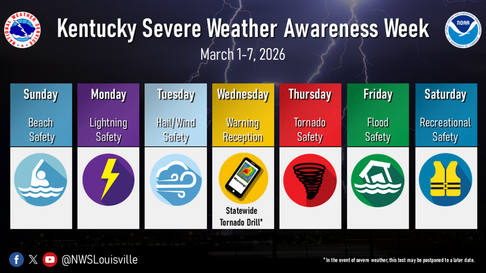
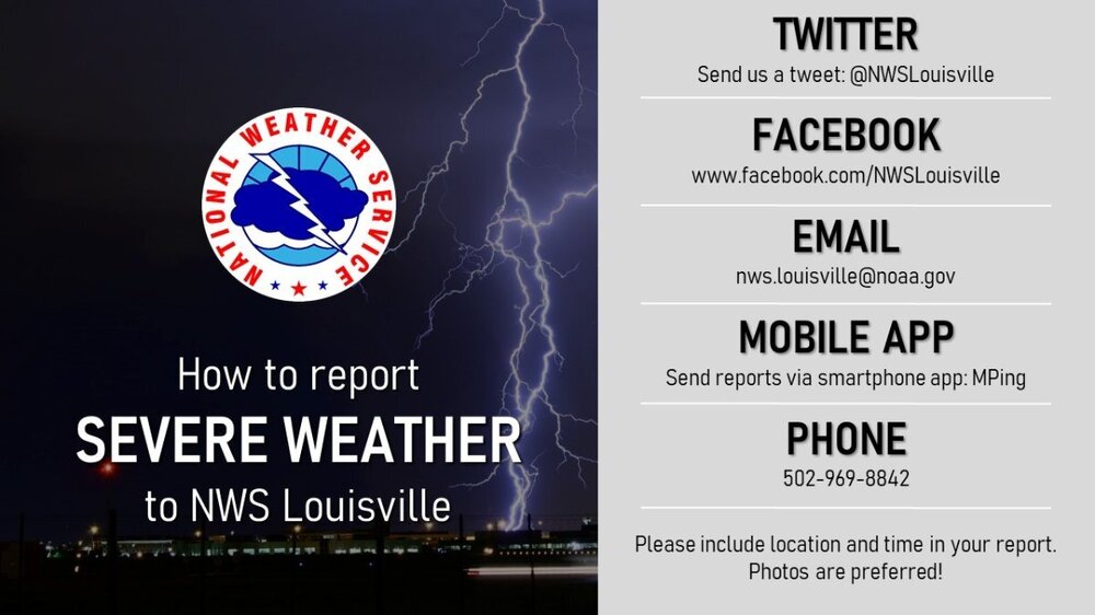
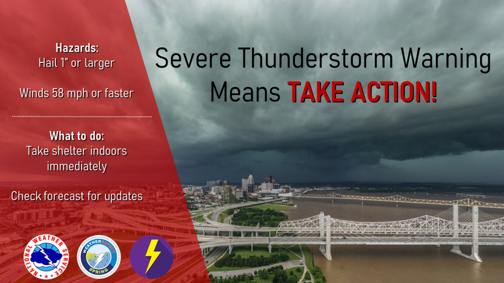
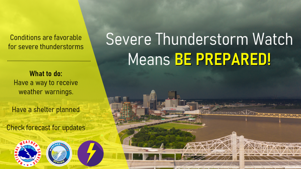
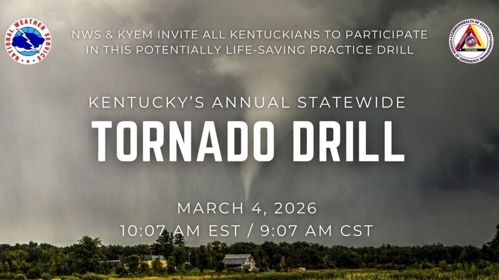
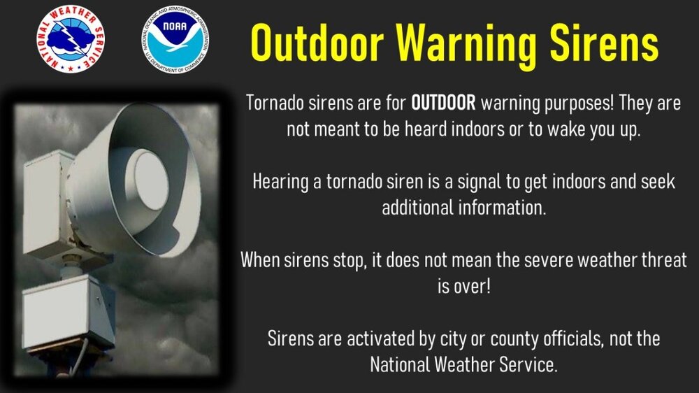
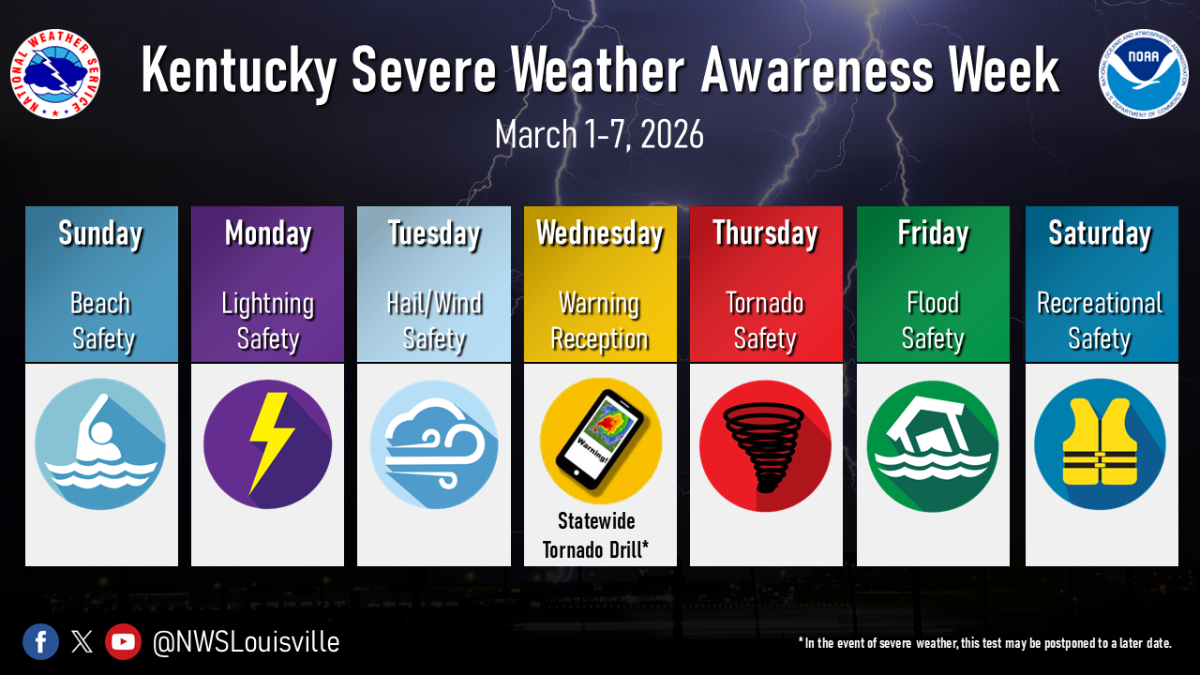
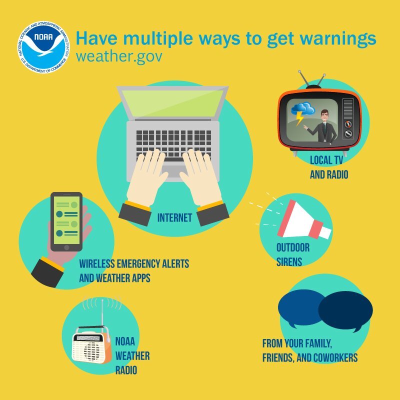
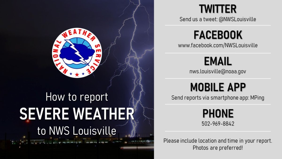
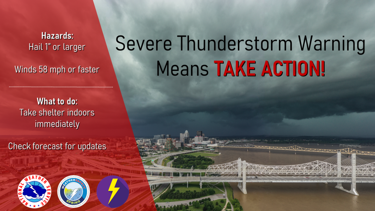
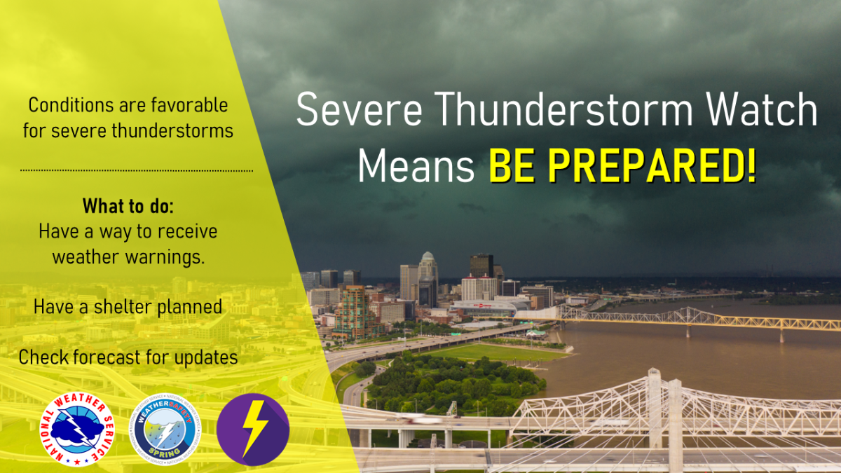
March 1-7, 2026, is Severe Weather Awareness Week in Kentucky. Severe weather can occur anytime of the year and can bring many different hazards and impacts to the region. Severe Weather Awareness week is your reminder that you need to be Weather Ready for all types of hazards, such as tornadoes, severe thunderstorms, large hail, lightning, heavy rain, flooding, and high winds. NWS Louisville will feature a day dedicated to Beach Safety, because many people from our state travel for Spring Break and Summer Vacation to the beach and may not be as prepared for severe weather or beach hazards as the locals are. All week long, the National Weather Service office in Louisville, KY will be sharing information on how to prepare for severe weather, which will be viewable on our social media platforms (Facebook and X). Please Share/Retweet to share this knowledge with others.


-
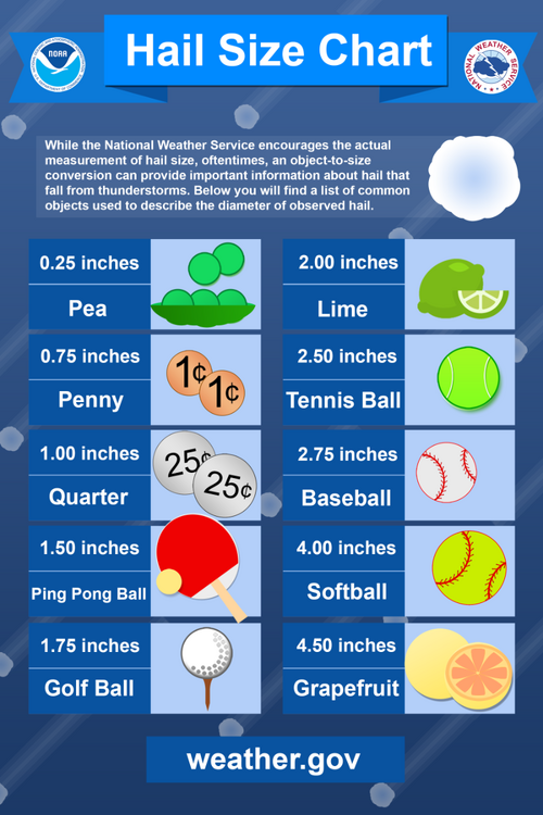
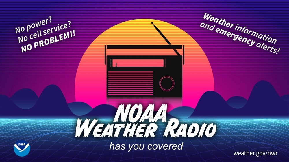
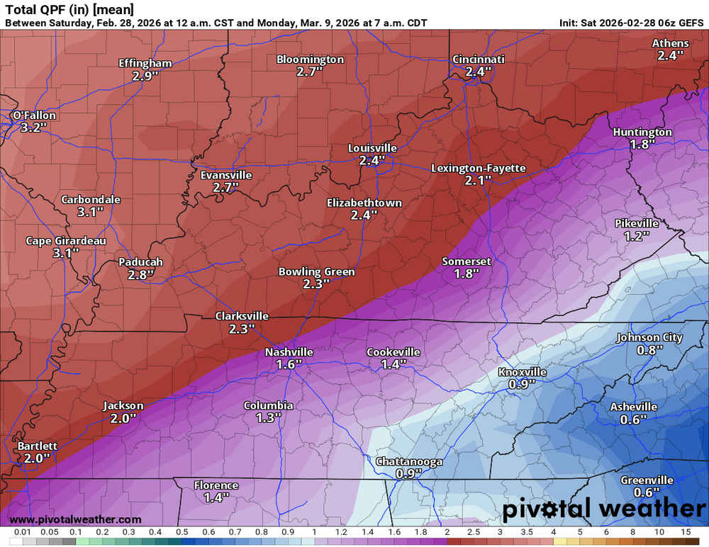
Special Weather Statement National Weather Service Louisville KY 327 AM EST Sun Mar 1 2026 INZ076>079-083-084-089>092-KYZ023>025-028>031-033>043-045>049-056- 057-012000- Orange-Washington IN-Scott IN-Jefferson IN-Dubois-Crawford-Perry- Harrison IN-Floyd-Clark IN-Hancock-Breckinridge-Meade-Hardin- Bullitt-Jefferson-Oldham-Henry-Shelby-Franklin-Scott KY- Harrison KY-Spencer-Anderson-Woodford-Fayette-Bourbon-Nicholas- Nelson-Washington KY-Mercer-Jessamine-Clark KY-Garrard-Madison- Including the cities of Paoli, Salem, Scottsburg, Madison, Jasper, English, Tell City, Corydon, New Albany, Jeffersonville, Lewisport, Hawesville, Hardinsburg, Brandenburg, Elizabethtown, Shepherdsville, Louisville, La Grange, New Castle, Shelbyville, Frankfort, Georgetown, Cynthiana, Taylorsville, Lawrenceburg, Versailles, Lexington, Paris, Carlisle, Bardstown, Springfield, Harrodsburg, Nicholasville, Winchester, Lancaster, and Richmond 327 AM EST Sun Mar 1 2026 /227 AM CST Sun Mar 1 2026/ ...A Wintry Mix of Precipitation is Expected Late Tonight and Monday Morning... Late tonight, a weather disturbance will move into the region from the west. Precipitation will likely start off as snow across much of southern Indiana, but a wintry mix of snow, sleet, and freezing rain will be possible, mainly in areas north of a line from Hawesville to Elizabethtown to Richmond. A slushy accumulation of up to one inch will be possible in areas along and north of the I-64 corridor. Just to the south of the I-64 corridor a light coating of snow with some very minor icing will be possible. While surface temperatures will be right at freezing, some slick travel will be possible during the Monday morning commute. Motorists should keep abreast of the latest forecasts and allow extra time to reach your destination Monday morning. Stay tuned to NOAA Weather Radio and your local media for the latest forecast updates.Given the anticipated wet conditions, severe weather is possible for Kentucky and the Cincinnati area over the course of the six- to ten-day period. Thunderstorms are predicted to be more likely, particularly as the Gulf of Mexico's moisture interacts with the forming mid-level trough. Particularly in the days preceding the weekend, the area may see a lot of rain, wind, and even powerful storms. Heavy rain and the possibility of flash flooding are the main causes for severe weather, especially in places that receive two to three inches of precipitation or more. There isn't a high chance of widespread severe storms like tornadoes, according to the forecast, but localized strong thunderstorms with destructive winds could be brought on by the unstable weather and the possibility of recurring cyclogenesis (low-pressure system formation). Staying informed about specific severe weather alerts and warnings is crucial as the event draws nearer because the storm pattern may change, raising the likelihood of more severe weather events. Possible rainfall through Monday, March 9th, 7 am EST.
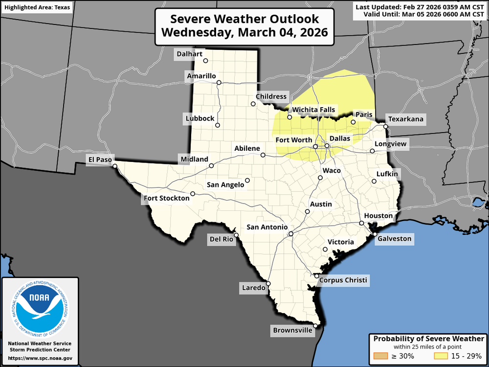
 This change will take affect on March 3, 2026As you can see, this is important. The Storm Prediction Center already has a 15% chance (slight risk) of severe storms in their day 6 outlook. Issuing a slight risk of storms six days out could be significant. This system could approach the Ohio Valley by the weekend Here is the outlook for this area: On Wednesday, a cold front will move into the southern Plains, bringing thunderstorms, especially as temperatures warm. The storms are expected along the cold front and further south, fueled by moist air from Texas. There’s a risk of severe weather with large hail and strong winds in the afternoon and evening. The timing of the storms may change depending on how quickly the system moves, so it’s important to stay updated.
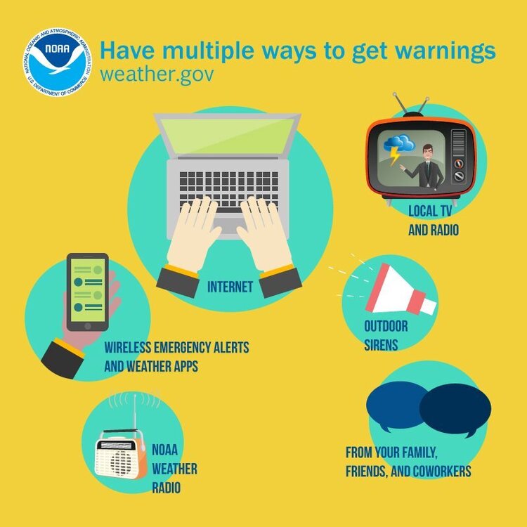
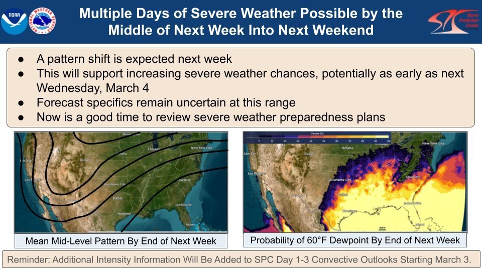
 As of now, the weekend of March 7 needs to be watched. There is a chance of some strong storms before then, though.A pattern shift will support increasing severe weather chances starting the middle of next week & beyond. Mid-level troughing in the West with 60+°F dewpoints in the East should result in an extended period of active severe weather from the Southern Plains to the Southeast & perhaps into the Ohio Valley. Now is a good time to review severe weather preparedness plans as the spring severe weather season starts to ramp up.
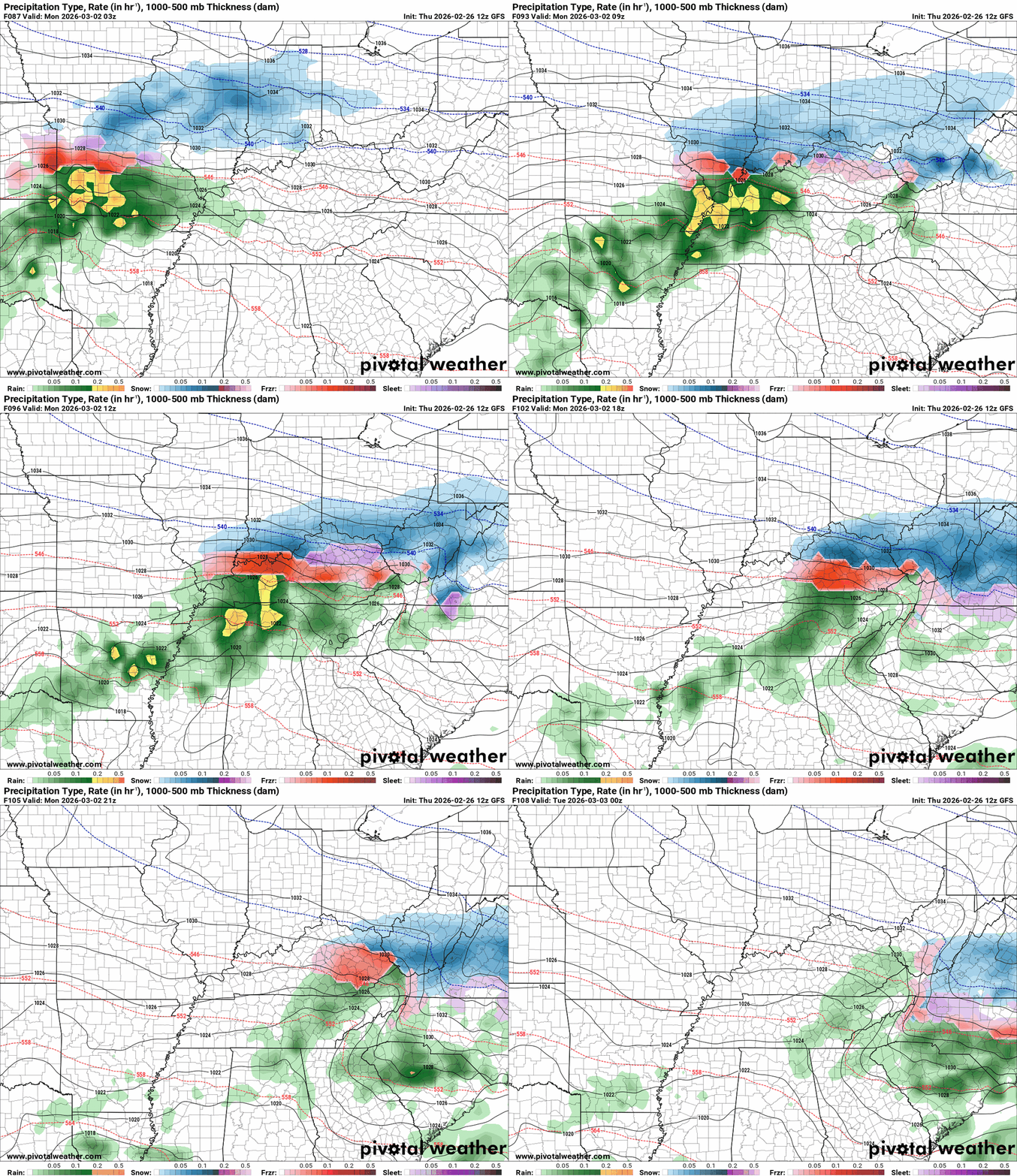
 Hazardous Weather Outlook National Weather Service Wilmington OH 203 AM EST Fri Feb 27 2026 INZ050-058-059-066-073>075-080-KYZ089>100-OHZ026-034-035-042>046- 051>056-060>065-070>074-077>082-088-280715- Wayne-Fayette-Union-Franklin-Ripley-Dearborn-Ohio-Switzerland- Carroll-Gallatin-Boone-Kenton-Campbell-Owen-Grant-Pendleton-Bracken- Robertson-Mason-Lewis-Hardin-Mercer-Auglaize-Darke-Shelby-Logan- Delaware-Miami-Champaign-Clark-Madison-Licking-Preble-Montgomery- Greene-Pickaway-Fairfield-Butler-Warren-Clinton-Ross-Hocking- Hamilton-Clermont-Brown-Highland-Adams-Pike-Scioto- 203 AM EST Fri Feb 27 2026 This Hazardous Weather Outlook is for east central Indiana, southeast Indiana, northeast Kentucky, northern Kentucky, central Ohio, south central Ohio, southwest Ohio and west central Ohio. .DAY ONE...Today and tonight. Hazardous weather is not expected at this time. .DAYS TWO THROUGH SEVEN...Saturday through Thursday. Accumulating snowfall will be possible from Sunday into Monday. .SPOTTER INFORMATION STATEMENT... Spotter activation is not expected at this time.This is what the GFS and Euro are displaying. The time frame is from Sunday night at 10 p.m. EST to Monday night at 7 p.m. EST. There is still some variation in the potential accumulations because they are different on the system's track. If the GFS is right, it's easy to see why there might be some problems on Monday. I'll update in the morning.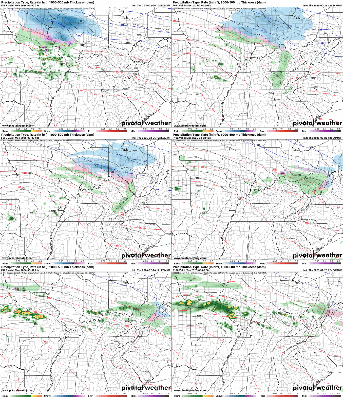
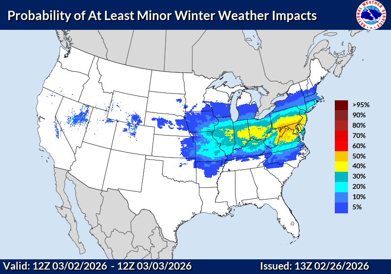
 Here are the latest probability of at least minor winter impacts maps Sunday to Monday. Monday to Tuesday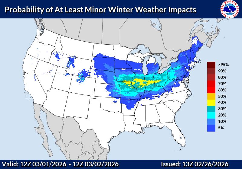
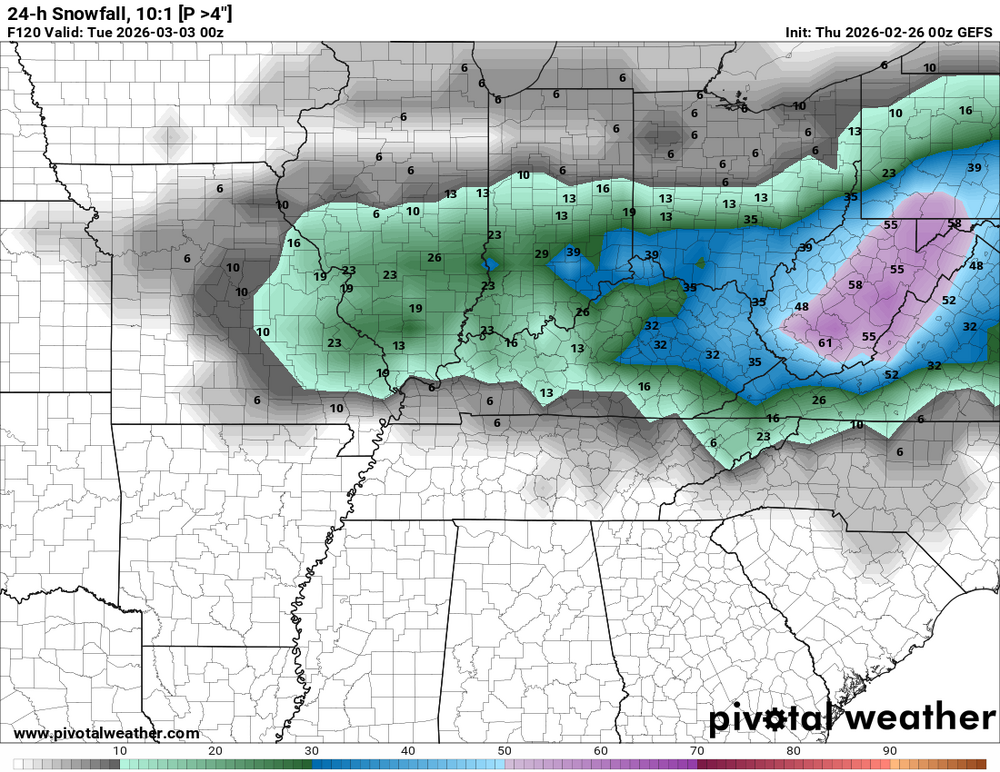
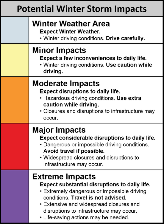 I've been very busy the past couple of days, so I haven't been able to post before now. March 1 to 3: On Sunday, March 1, a developing system will bring light to moderate snow and mixed precipitation to western Kentucky (primarily the MS Valley into the Ohio Valley). Snowfall should start to spread eastward, affecting central Kentucky by late afternoon/evening. On Monday, March 2, this is when the impacts will likely peak for Kentucky. The system will continue moving east, bringing a swath of snow, sleet, and freezing rain across central and eastern Kentucky. Snow will likely be in the northern and western parts of the state, especially along and north of I-64. Accumulations could be significant (possibly 3–6 inches) in some areas. Sleet/freezing rain will be more probable for central and southeastern Kentucky, especially south of I-64. The potential for ice could make travel dangerous in these regions. On Tuesday, March 3, the system should push east of Kentucky, but lingering snow showers or light freezing rain could remain in eastern parts of the state, especially along the Appalachian foothills. Precipitation Types & Timing: As the system pushes northward, the colder air in place across Kentucky will allow for snow, sleet, and freezing rain to develop. The heaviest snow should be across the western and northern portions of the state, while sleet and freezing rain will be more likely in the central and southern parts. Snow accumulation is expected to be 2–5 inches in the western part of the state, with possible ice mixed in. Central Kentucky (Lexington, Frankfort) will see a mix of snow and sleet, with totals around 1–3 inches of snow and potential for up to 0.1" of ice accumulation. Eastern Kentucky (Pikeville, Hazard) will experience more sleet and freezing rain, with up to 1 inch of snow and up to 0.1" to 0.2" of ice possible in some areas. Impacts: The biggest threat will be from ice accumulation, especially across the central and southern portions of the state. Slick roads, power outages, and downed trees/branches could be significant concerns. In the northern and western parts, snow will accumulate and create hazardous driving conditions, especially during Monday's peak snowfall. The heaviest impacts are likely to be from Monday afternoon into Tuesday morning.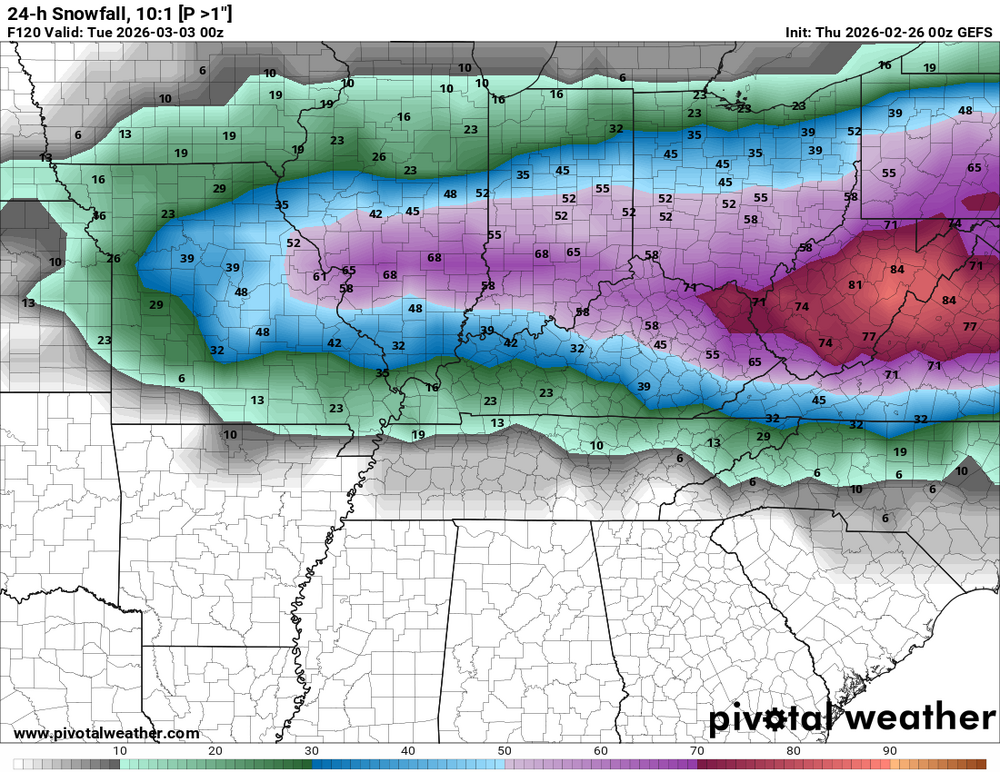
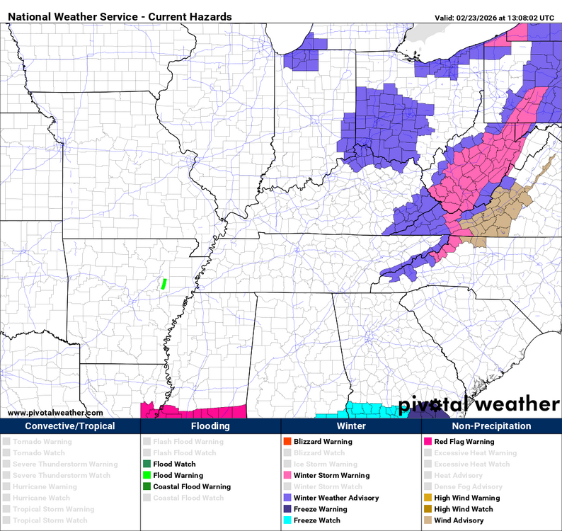
 I've been very busy the past couple of days. I'm getting ready to post about this.Temperature Above-normal temperatures are expected for the western and southern parts of the state, including areas like Louisville and Bowling Green. Near-normal temperatures are favored for central and eastern parts of Kentucky. Below-normal temperatures could affect the northern portions of the state, particularly along the Ohio River, as the cold air advection from the Northeast may extend into northern Kentucky. Precipitation Above-normal precipitation is likely, especially in the eastern two-thirds of the state, due to an incoming system from the Great Plains and the Midwest. Expect moderate rainfall, potentially totaling more than an inch in some areas, especially around Lexington, Frankfort, and areas to the east. The Southern and Western parts of Kentucky, including Paducah and Owensboro, might experience lighter precipitation, but chances for above-normal rainfall are still slightly elevated. Slightly elevated chances for above-normal precipitation will also extend into the Northeast, around Ashland and surrounding regions. Winter Precipitation Possibilities Given the expected temperature patterns, there could be some light snow or ice potential, particularly in the northern and eastern parts of the state. If the cold air advection extends farther south than currently expected, areas near the Ohio River and parts of northern Kentucky might see snow or sleet as the mid-level trough over eastern Canada may bring brief periods of colder air. However, this is expected to be isolated and likely not widespread. Accumulation amounts are expected to be light, with the heaviest potential for winter precipitation being in areas around Maysville, Covington, and parts of Lexington. Overall, winter weather impacts in Kentucky are unlikely to be significant, but it’s something to keep an eye on as cold air may bring a few isolated wintery showers to the northern sections of the state. General Overview Overall, the pattern indicates a wetter trend with increased rainfall for Kentucky. Temperature-wise, expect a mixture of above-normal and near-normal conditions across the state, with colder trends possibly affecting the far northern parts of Kentucky. Confidence is moderate due to some uncertainty in the exact placement of the cold front and precipitation patterns.This event has been canceled.URGENT - WINTER WEATHER MESSAGE National Weather Service Wilmington OH 647 AM EST Mon Feb 23 2026 INZ050-058-059-066-073>075-080-KYZ089>100-OHZ026-034-035-042>046- 051>056-060>065-070>074-077>082-088-231600- /O.NEW.KILN.WW.Y.0006.260223T1147Z-260223T1600Z/ Wayne-Fayette-Union-Franklin-Ripley-Dearborn-Ohio-Switzerland- Carroll-Gallatin-Boone-Kenton-Campbell-Owen-Grant-Pendleton- Bracken-Robertson-Mason-Lewis-Hardin-Mercer-Auglaize-Darke-Shelby- Logan-Union-Delaware-Miami-Champaign-Clark-Madison-Franklin- Licking-Preble-Montgomery-Greene-Fayette-Pickaway-Fairfield- Butler-Warren-Clinton-Ross-Hocking-Hamilton-Clermont-Brown- Highland-Adams-Pike-Scioto- Including the cities of Dillsboro, Lawrenceburg, Greenville, Erlanger, Camp Dix, Fairfield, Mount Carmel, Vanceburg, Bellefontaine, Osgood, Delaware, Peebles, Vevay, Beavercreek, West Jefferson, Dry Ridge, Ada, Tipp City, Springfield, Waverly, Crittenden, Landen, Butler, Piketon, Seaman, Versailles, Fort Thomas, Chillicothe, Mason, Dayton, Hillsboro, Liberty, Manchester, Summerside, Portsmouth, Oakbrook, Hidden Valley, Winchester, Owenton, Falmouth, Aberdeen, West Union, Wapakoneta, Aurora, Hamilton, Plain City, Fairborn, Springboro, Franklin, Downtown Cincinnati, Lebanon, Mount Orab, Greendale, Pickerington, Connersville, Piqua, Head Of Grassy, Downtown Dayton, Bellevue, Maysville, Warsaw, Oxford, Tollesboro, Milford, Newark, Wheelersburg, Withamsville, Kettering, Sidney, Richmond, Rising Sun, Camden, Augusta, Independence, London, Highland Heights, Troy, Logan, Mount Repose, Downtown Columbus, Pike Lake, Milan, Ripley, Minster, New Bremen, Urbana, Greenfield, Florence, West College Corner, Batesville, Wilmington, Xenia, Mulberry, Brookville, Eaton, Circleville, Burlington, Washington Court House, Blanchester, Coldwater, Carrollton, Lancaster, Celina, Williamstown, Covington, Alexandria, Kenton, Bright, St. Marys, Brooksville, Mount Olivet, Middletown, Marysville, Georgetown, Newport, and Day Heights 647 AM EST Mon Feb 23 2026 ...WINTER WEATHER ADVISORY IN EFFECT UNTIL 11 AM EST THIS MORNING... * WHAT...Snow. Additional snow accumulations up to one inch. Snow melt and refreezing overnight has resulted in the development of black ice on roads. * WHERE...Portions of east central and southeast Indiana, northeast and northern Kentucky, and central, south central, southwest, and west central Ohio. * WHEN...Until 11 AM EST this morning. * IMPACTS...Plan on slippery road conditions. Areas of blowing snow could significantly reduce visibility. The hazardous conditions could impact the Monday morning commute. PRECAUTIONARY/PREPAREDNESS ACTIONS... Slow down and use caution while traveling. In Indiana, visit 511in.org or call 1-800-261-7623 for the latest road information. In Kentucky, visit goky.ky.gov for the latest road information. In Ohio, visit ohgo.com for the latest road information.
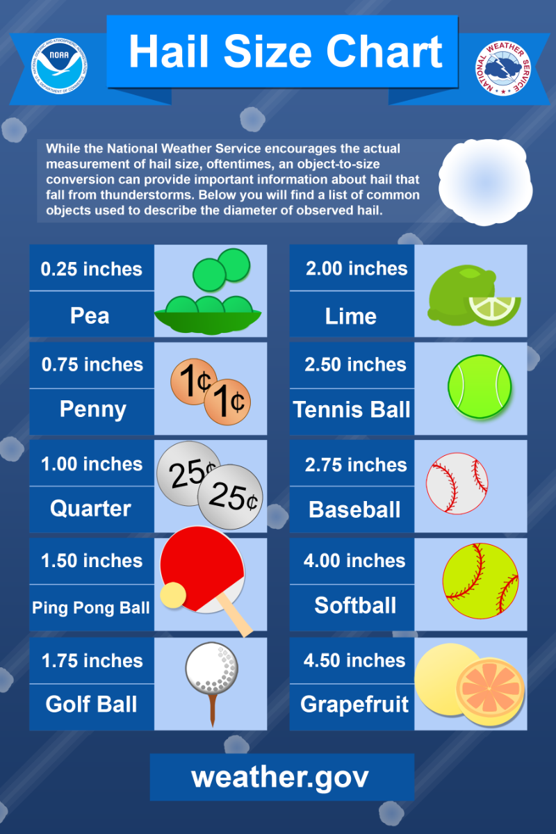
 Forecast for February 20 to March 4: Temperature: Kentucky will likely experience near- to above-normal temperatures over the coming days. This is supported by the consensus of the ECMWF, GEFS, and Canadian ensemble forecasts. The northern and central parts of the state may experience slightly cooler conditions due to the influence of the negative 500-hPa height anomalies over the northern CONUS, particularly affecting the Northern Plains, Upper Mississippi Valley, and Great Lakes. However, most of Kentucky is expected to remain mild. Probabilities for above-normal temperatures are highest for the southwestern CONUS, which could extend into the southern part of Kentucky. Precipitation: Near- to above-normal precipitation is expected for much of Kentucky. The forecast indicates favorable conditions for precipitation across most of the CONUS, including Kentucky, with near-normal to slightly above-normal chances. The ridge over the western CONUS should bring drier conditions to parts of the region, but Kentucky’s central and eastern regions should see adequate rainfall. There are no strong signals indicating significant dry spells, so regular precipitation, possibly with moderate intensity, is anticipated. General Weather Pattern: A ridge of high pressure will be situated over the southwestern and south-central CONUS, which may keep Kentucky in relatively mild weather, particularly in the southern regions. A trough over the northern CONUS may influence temperatures and precipitation, especially in the northern parts of Kentucky, where slightly cooler temperatures and enhanced precipitation chances may be felt. Summary: Kentucky should expect near-normal to slightly above-normal temperatures over the 6-10 day period. Precipitation is likely to be near to slightly above normal, with moderate rainfall in most areas, particularly in central and eastern Kentucky. The southern and western parts of the state may be slightly warmer due to the ridge pattern, while the northern regions may experience cooler temperatures due to the broader northern trough.evere Weather Statement National Weather Service Louisville KY 414 PM EST Thu Feb 19 2026 KYC017-049-067-192130- /O.CON.KLMK.SV.W.0005.000000T0000Z-260219T2130Z/ Clark KY-Bourbon KY-Fayette KY- 414 PM EST Thu Feb 19 2026 ...A SEVERE THUNDERSTORM WARNING REMAINS IN EFFECT UNTIL 430 PM EST FOR NORTHWESTERN CLARK...SOUTH CENTRAL BOURBON AND EAST CENTRAL FAYETTE COUNTIES... At 413 PM EST, a severe thunderstorm was located near Cadentown, moving east at 35 mph. HAZARD...Quarter size hail. SOURCE...Emergency management and broadcast media reported quarter size hail in Lexington. IMPACT...Damage to vehicles is expected. Locations impacted include... Winchester, Pretty Run, Chilesburg, Constant Station, Renick, Stony Point, Avon, Tebbs, Judianne Estates, and Clintonville. PRECAUTIONARY/PREPAREDNESS ACTIONS... A Tornado Watch remains in effect until 900 PM EST for central Kentucky. For your protection move to an interior room on the lowest floor of a building.Mesoscale Discussion 0100 NWS Storm Prediction Center Norman OK 0256 PM CST Thu Feb 19 2026 Areas affected...portions of southeastern Illinois...southern Indiana...and northern Kentucky Concerning...Tornado Watch 10... Valid 192056Z - 192300Z The severe weather threat for Tornado Watch 10 continues. SUMMARY...Storm intensity will continue to gradually increase over the next 1-2 hours with additional development expected across the watch area. Modest buoyancy and favorable shear profiles will continue to support a threat for all severe hazards across WW0010, with some increase in tornado potential expected into this evening. DISCUSSION...Thunderstorms have gradually increased in coverage over the past 1-2 hours, primarily over northern/central Kentucky, with several discrete/semi-discrete supercells noted across the area. While only a few isolated instances of marginally severe hail have been noted thus far, gradual strengthening has been observed with some cells as surface heating/moistening coupled with cold temperatures aloft has yielded a modestly unstable air mass (MLCAPE of 500-1000 J/kg) overlapped by favorable deep layer shear profiles (effective bulk shear of 50+ kts). Farther west, latest guidance continues to depict additional thunderstorm development and strengthening across the western portions of the watch area. As storms continue to strengthen, all severe hazards will be possible, with steep mid-level lapse rates and elongated hodographs supporting the threat for large hail and favorable low-level veering wind profiles (0-1 km SRH of 100-150+ m2/s2 per regional VWP) supporting a risk for tornadoes. While the gradual loss of diurnal heating is expected to contribute to low-level stabilization with time later this evening, strengthening flow is expected to support additional increases to low-level hodograph curvature. The favorable shear profiles and increasing SRH will support an increasing tornado threat over the next couple of hours, with the potential for a strong tornado or two.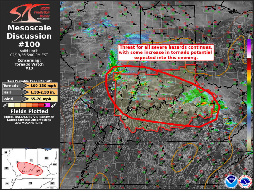

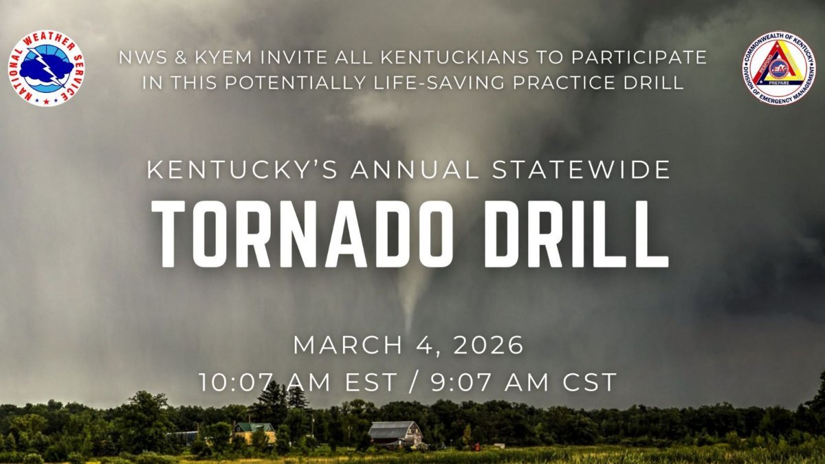
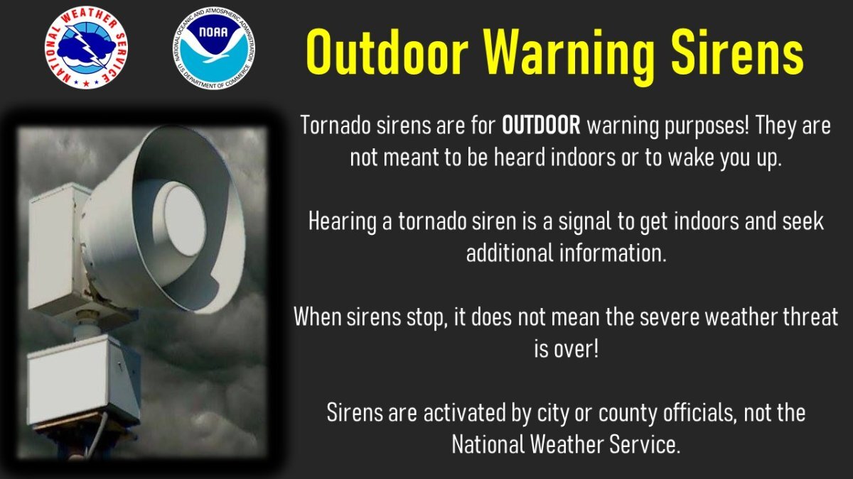


.png.56540e87805b8216eda7d8d54f54a4c9.png)


.png.5ab525670cc09a1bbcf030f7fad582f6.png)
.png.139441b59df842144c6e591eb38bd89c.png)
.png.b050a4f9de5159e459487158ba714e19.png)





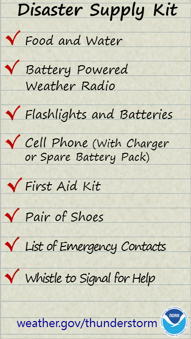


Account
Navigation
Search
Configure browser push notifications
Chrome (Android)
- Tap the lock icon next to the address bar.
- Tap Permissions → Notifications.
- Adjust your preference.
Chrome (Desktop)
- Click the padlock icon in the address bar.
- Select Site settings.
- Find Notifications and adjust your preference.
Safari (iOS 16.4+)
- Ensure the site is installed via Add to Home Screen.
- Open Settings App → Notifications.
- Find your app name and adjust your preference.
Safari (macOS)
- Go to Safari → Preferences.
- Click the Websites tab.
- Select Notifications in the sidebar.
- Find this website and adjust your preference.
Edge (Android)
- Tap the lock icon next to the address bar.
- Tap Permissions.
- Find Notifications and adjust your preference.
Edge (Desktop)
- Click the padlock icon in the address bar.
- Click Permissions for this site.
- Find Notifications and adjust your preference.
Firefox (Android)
- Go to Settings → Site permissions.
- Tap Notifications.
- Find this site in the list and adjust your preference.
Firefox (Desktop)
- Open Firefox Settings.
- Search for Notifications.
- Find this site in the list and adjust your preference.