
nWo
BGP Meteorologist
-
Joined
-
Last visited
Everything posted by nWo
-
The weather for football in Kentucky, Cincinnati, and Northern Kentucky looks promising tonight. Expect mostly sunny skies during the day, with mild afternoon temperatures turning cooler in the evening. The good news is that rain is not expected. Western Kentucky, including Paducah, will see afternoon highs in the mid-70s. Temperatures will drop into the 50s during evening games, with readings falling into the 40s overnight. Around Bowling Green and south-central Kentucky, mild weather will continue through the afternoon, with highs in the mid-70s. It will turn cooler after sunset, but dry conditions should hold for tonight's games. Louisville and the Bluegrass Region, including Lexington and Richmond, will see highs in the upper 60s to lower 70s. Temperatures should be in the 50s around kickoff, so fans may want to bring a jacket. Eastern Kentucky, including Ashland, will have dry weather and comfortable afternoon conditions, with temperatures dropping noticeably by evening. Cincinnati and Northern Kentucky will see highs near 70 degrees. Evening temperatures will fall through the 50s before dropping into the lower 40s overnight.
-
Football weather looks good across Kentucky, Cincinnati, and Northern Kentucky this Friday night. Sunshine is expected during the day, with temperatures cooling off after sunset. Rain shouldn't be a concern for most games, but fans should brace for cooler evening temperatures. Western Kentucky will see plenty of sunshine, with afternoon highs in the lower to mid-70s. Temperatures will drop into the 50s by kickoff, making for a cooler second half. South-central Kentucky can expect a sunny day with highs in the lower 70s. Evening temperatures will fall into the 50s. Central Kentucky, including the Louisville area and the Bluegrass Region, should see highs around 70 degrees under sunny skies. Temperatures will cool into the 50s Friday evening. Eastern Kentucky will see afternoon highs in the upper 60s to lower 70s. As soon as the sun sets, temperatures will fall, bringing a chill to the air during the games. Cincinnati and Northern Kentucky should see a high near 70 degrees with mostly sunny skies. Temperatures will drop through the 50s Friday evening, with overnight lows reaching the mid-40s.
-
High school football Friday night is looking good for all of Kentucky, Cincinnati, and Northern Kentucky. We’ll see plenty of sunshine, and afternoon temperatures will be moderate, but it will turn chilly. Most games should not have to worry about rain, so it will be a great night under the lights. Western Kentucky, including Paducah, will see plenty of sunshine, with afternoon temperatures reaching the mid-70s. Conditions will be comfortable for players and fans, although temperatures will drop after sunset. Around Bowling Green and south-central Kentucky, sunny skies and highs in the lower to mid-70s are expected. Temperatures will gradually fall through the evening, so fans staying for the entire game may want to bring a light jacket. Louisville and the Bluegrass Region, including Lexington, can expect a pleasant fall day with highs generally in the upper 60s to lower 70s. Clear skies should continue into Friday night, with temperatures cooling into the 50s. Eastern Kentucky, including Ashland, will also enjoy generally dry weather and mild afternoon temperatures. It will turn cooler after sunset, but no significant weather problems are expected to interrupt the games. In Cincinnati and Northern Kentucky, sunshine will help temperatures climb into the upper 60s. By kickoff, readings will be falling through the 50s and lower 60s, with colder conditions developing later at night. Bring a jacket if you plan to stay through the fourth quarter, as temperatures will continue to fall during the evening.
-
Friday night looks to be a great night for high school football across Kentucky, Cincinnati and Northern Kentucky. Sunshine is expected during the day, with mild temperatures giving way to cooler conditions by kickoff. Western Kentucky, including Paducah, should see mostly sunny skies and mild afternoon temperatures, with a possible high near 76°F and a low around 51°F. Bowling Green and south-central Kentucky can expect pleasant fall weather, with a possible high near 74°F and a low around 48°F. Temperatures will drop during the evening. Around Louisville and the Bluegrass Region, including Lexington, dry weather and sunshine should make for favorable conditions for football. Louisville could reach a high near 72°F, with a low around 46°F. Lexington may see a high near 70°F, with temperatures falling to around 44°F overnight. Eastern Kentucky, including Ashland, should see generally favorable weather for Friday night's games. Afternoon highs may reach around 70°F, with overnight lows dropping to near 45°F. In Cincinnati and Northern Kentucky, sunny skies are expected, with a possible afternoon high near 68°F and an overnight low around 44°F. Temperatures will fall into the 50s during the evening, so fans may want to bring a jacket or sweatshirt. Dry weather is favored across the region, with no significant storm threat currently indicated. Temperatures at kickoff should generally be in the 50s and lower 60s, falling into the 40s and 50s later in the evening. Overall, conditions look good for players, coaches, and fans, although it will turn chilly after sunset. This is an early forecast, and conditions may change before Friday. Please check back for updates.
-
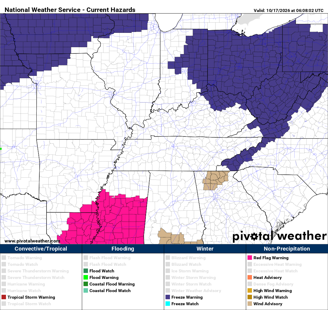
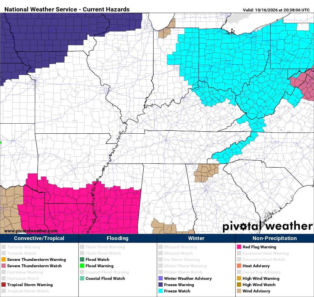
URGENT - WEATHER MESSAGE National Weather Service Jackson KY 100 AM EDT Sat Oct 17 2026 KYZ058>060-068-069-079-080-083>088-104-106>120-171600- /O.NEW.KJKL.FR.Y.0010.261018T0500Z-261018T1300Z/ Estill-Powell-Menifee-Rockcastle-Jackson-Pulaski-Laurel-Wayne- McCreary-Whitley-Knox-Bell-Harlan-Elliott-Morgan-Johnson-Wolfe- Magoffin-Floyd-Lee-Breathitt-Knott-Owsley-Perry-Clay-Leslie-Letcher- Martin-Pike- Including the cities of Middlesboro, Burnside, Clay City, Beattyville, Inez, Hindman, Manchester, Jenkins, Stearns, Mount Vernon, Harlan, Elkhorn City, Salyersville, Campton, Irvine, Paintsville, Pippa Passes, Pikeville, Frenchburg, Stanton, Somerset, Monticello, Wheelwright, Jackson, Annville, London, Sandy Hook, Williamsburg, South Williamson, Cumberland, Pineville, West Liberty, Booneville, Prestonsburg, Ravenna, Hyden, Coal Run, McKee, Brodhead, Barbourville, Whitesburg, Hazard, Whitley City, and Corbin 100 AM EDT Sat Oct 17 2026 ...FROST ADVISORY IN EFFECT FROM 1 AM TO 9 AM EDT SUNDAY... * WHAT...Temperatures as low as 32 degrees will result in widespread frost formation. * WHERE...Portions of east central, northeast, south central, and southeast Kentucky. * WHEN...From 1 AM to 9 AM EDT Sunday. * IMPACTS...Frost could harm sensitive outdoor vegetation. Sensitive outdoor plants may be killed if left uncovered. PRECAUTIONARY/PREPAREDNESS ACTIONS... Take steps now to protect tender plants from the cold.
-
URGENT - WEATHER MESSAGE National Weather Service Paducah KY 1200 AM CDT Sat Oct 17 2026 ILZ075>078-080>094-INZ081-082-085>088-KYZ001>022-MOZ076-086-087-100- 107>112-114-172000- /O.NEW.KPAH.FR.Y.0001.261018T0200Z-261018T1300Z/ Jefferson-Wayne IL-Edwards-Wabash-Perry IL-Franklin-Hamilton- White-Jackson-Williamson-Saline-Gallatin-Union-Johnson-Pope-Hardin- Alexander-Pulaski-Massac-Gibson-Pike-Posey-Vanderburgh-Warrick- Spencer-Fulton-Hickman-Carlisle-Ballard-McCracken-Graves-Livingston- Marshall-Calloway-Crittenden-Lyon-Trigg-Caldwell-Union KY-Webster- Hopkins-Christian-Henderson-Daviess-McLean-Muhlenberg-Todd-Perry MO- Bollinger-Cape Girardeau-Wayne MO-Carter-Ripley-Butler-Stoddard- Scott-Mississippi-New Madrid- Including the cities of Vienna, Princeton, Murray, Paducah, Calhoun, Wickliffe, Poseyville, Perryville, Jackson, New Madrid, Carbondale, Piedmont, Mayfield, Carmi, Pinckneyville, Herrin, Elizabethtown, Marble Hill, Owensboro, Bloomfield, Hickman, Greenville, Mound City, Marion, Hopkinsville, Sikeston, Morganfield, Bardwell, Poplar Bluff, Shawneetown, Golconda, Mount Carmel, Petersburg, Van Buren, Cairo, Doniphan, Cadiz, Murphysboro, Eddyville, Albion, Henderson, Jonesboro, Boonville, Harrisburg, Mount Vernon, West Frankfort, Fairfield, Evansville, Rockport, Clinton, Benton, Dixon, Elkton, Charleston, Metropolis, Cape Girardeau, Madisonville, Smithland, Fort Branch, and McLeansboro 1200 AM CDT Sat Oct 17 2026 /100 AM EDT Sat Oct 17 2026/ ...FROST ADVISORY IN EFFECT FROM 9 PM CDT /10 PM EDT/ THIS EVENING TO 8 AM CDT /9 AM EDT/ SUNDAY... * WHAT...Temperatures as low as 33 will result in frost formation. * WHERE...All of southern Illinois, southwest Indiana, western Kentucky, and southeast Missouri. * WHEN...From 9 PM CDT /10 PM EDT/ this evening to 8 AM CDT /9 AM EDT/ Sunday. * IMPACTS...Frost could harm sensitive outdoor vegetation. Sensitive outdoor plants may be killed if left uncovered. PRECAUTIONARY/PREPAREDNESS ACTIONS... Take steps now to protect tender plants from the cold.
-
URGENT - WEATHER MESSAGE National Weather Service Louisville KY 1257 AM EDT Sat Oct 17 2026 INZ076>079-083-084-089>092-KYZ023>035-038>040-045>048-053>057- 061>067-070>078-081-082-172000- /O.NEW.KLMK.FR.Y.0007.261018T0500Z-261018T1300Z/ Orange-Washington IN-Scott IN-Jefferson IN-Dubois-Crawford-Perry- Harrison IN-Floyd-Clark IN-Hancock-Breckinridge-Meade-Ohio- Grayson-Hardin-Bullitt-Jefferson-Oldham-Trimble-Henry-Shelby- Franklin-Spencer-Anderson-Woodford-Nelson-Washington KY-Mercer- Jessamine-Larue-Marion-Boyle-Garrard-Madison-Butler-Edmonson-Hart- Green-Taylor-Casey-Lincoln-Logan-Warren-Simpson-Allen-Barren-Monroe- Metcalfe-Adair-Russell-Cumberland-Clinton- Including the cities of Elizabethtown, New Castle, Richmond, Providence, New Albany, Liberty, Nicholasville, Jeffersonville, La Grange, Brownsville, Columbia, Springfield, Salem, Greensburg, Lewisport, Jamestown, Lawrenceburg, Tell City, Horse Cave, Paoli, Jasper, Louisville, Hartford, Scottsburg, Burkesville, Bardstown, Milton, Glasgow, Leitchfield, Shelbyville, Campbellsville, Hodgenville, Edmonton, Corydon, Hardinsburg, Bowling Green, Stanford, Tompkinsville, English, Harrodsburg, Bedford, Morgantown, Scottsville, Danville, Russellville, Franklin, Shepherdsville, Frankfort, Lebanon, Versailles, Madison, Hawesville, Brandenburg, Taylorsville, Lancaster, and Albany 1257 AM EDT Sat Oct 17 2026 /1157 PM CDT Fri Oct 16 2026/ ...FROST ADVISORY IN EFFECT FROM 1 AM EDT /MIDNIGHT CDT/ TO 9 AM EDT /8 AM CDT/ SUNDAY... * WHAT...Temperatures as low as 33 will result in frost formation. * WHERE...Portions of south central Indiana and east central, north central, northwest, and south central Kentucky. * WHEN...From 1 AM EDT /midnight CDT/ to 9 AM EDT /8 AM CDT/ Sunday. * IMPACTS...Frost could harm sensitive outdoor vegetation. Sensitive outdoor plants may be killed if left uncovered. PRECAUTIONARY/PREPAREDNESS ACTIONS... Take steps now to protect tender plants from the cold.
-
URGENT - WEATHER MESSAGE National Weather Service Jackson KY 100 AM EDT Sat Oct 17 2026 KYZ044-050>052-171600- /O.UPG.KJKL.FZ.A.0005.261018T0500Z-261018T1300Z/ /O.NEW.KJKL.FZ.W.0006.261018T0500Z-261018T1300Z/ Fleming-Montgomery-Bath-Rowan- Including the cities of Camargo, Flemingsburg, Mount Sterling, Owingsville, Jeffersonville, and Morehead 100 AM EDT Sat Oct 17 2026 ...FREEZE WARNING IN EFFECT FROM 1 AM TO 9 AM EDT SUNDAY... * WHAT...Sub-freezing temperatures as low as 30 degrees expected. * WHERE...Bath, Fleming, Montgomery, and Rowan Counties. * WHEN...From 1 AM to 9 AM EDT Sunday. * IMPACTS...Frost and freeze conditions could kill crops, other sensitive vegetation, and possibly damage unprotected outdoor plumbing. PRECAUTIONARY/PREPAREDNESS ACTIONS... Take steps now to protect tender plants from the cold.URGENT - WEATHER MESSAGE National Weather Service Wilmington OH 1218 AM EDT Sat Oct 17 2026 INZ050-058-059-066-073>075-080-KYZ089>100-OHZ026-034-035-042>046- 051>056-060>065-070>074-077>082-088-172000- /O.UPG.KILN.FZ.A.0004.261018T0500Z-261018T1300Z/ /O.NEW.KILN.FZ.W.0005.261018T0500Z-261018T1300Z/ Wayne-Fayette-Union-Franklin-Ripley-Dearborn-Ohio-Switzerland- Carroll-Gallatin-Boone-Kenton-Campbell-Owen-Grant-Pendleton-Bracken- Robertson-Mason-Lewis-Hardin-Mercer-Auglaize-Darke-Shelby-Logan- Union-Delaware-Miami-Champaign-Clark-Madison-Franklin-Licking-Preble- Montgomery-Greene-Fayette-Pickaway-Fairfield-Butler-Warren-Clinton- Ross-Hocking-Hamilton-Clermont-Brown-Highland-Adams-Pike-Scioto- Including the cities of Marysville, Ripley, Pickerington, Mount Repose, St. Marys, West Jefferson, Alexandria, Brooksville, Hamilton, Eaton, Wapakoneta, Wheelersburg, Portsmouth, Lawrenceburg, Augusta, Warsaw, Piqua, Springboro, Williamstown, Mount Carmel, Hidden Valley, New Bremen, Pike Lake, Versailles, Oakbrook, Fairborn, Logan, Florence, Washington Court House, Greenfield, Celina, Bellevue, Coldwater, Peebles, West College Corner, Mulberry, Richmond, Wilmington, Camp Dix, Day Heights, Mount Olivet, Lancaster, Kettering, Connersville, Butler, Camden, Chillicothe, Liberty, Kenton, Dry Ridge, Milan, Plain City, Crittenden, Lebanon, Summerside, Dillsboro, Franklin, Landen, Vanceburg, Georgetown, Independence, Piketon, Downtown Columbus, Downtown Dayton, West Union, Seaman, Dayton, Minster, Fort Thomas, Burlington, Xenia, Brookville, Osgood, Oxford, Springfield, Hillsboro, Delaware, Middletown, Mason, Aberdeen, Winchester, Erlanger, Batesville, Vevay, Manchester, Aurora, London, Covington, Fairfield, Withamsville, Greendale, Newark, Owenton, Ada, Newport, Maysville, Blanchester, Greenville, Mount Orab, Falmouth, Downtown Cincinnati, Waverly, Beavercreek, Carrollton, Bellefontaine, Sidney, Troy, Head Of Grassy, Rising Sun, Milford, Urbana, Circleville, Highland Heights, Tipp City, Tollesboro, and Bright 1218 AM EDT Sat Oct 17 2026 ...FREEZE WARNING IN EFFECT FROM 1 AM TO 9 AM EDT SUNDAY... * WHAT...Sub-freezing temperatures in the upper 20s and lower 30s expected. * WHERE...Portions of east central and southeast Indiana, northeast and northern Kentucky, and central, south central, southwest, and west central Ohio. * WHEN...From 1 AM to 9 AM EDT Sunday. * IMPACTS...Frost and freeze conditions could kill crops, other sensitive vegetation and possibly damage unprotected outdoor plumbing. PRECAUTIONARY/PREPAREDNESS ACTIONS... Take steps now to protect tender plants from the cold.URGENT - WEATHER MESSAGE National Weather Service Louisville KY 1257 AM EDT Sat Oct 17 2026 KYZ036-037-041>043-049-172000- /O.UPG.KLMK.FZ.A.0002.261018T0500Z-261018T1300Z/ /O.NEW.KLMK.FZ.W.0004.261018T0500Z-261018T1300Z/ Scott KY-Harrison KY-Fayette-Bourbon-Nicholas-Clark KY- Including the cities of Carlisle, Winchester, Paris, Cynthiana, Lexington, and Georgetown 1257 AM EDT Sat Oct 17 2026 ...FREEZE WARNING IN EFFECT FROM 1 AM TO 9 AM EDT SUNDAY... * WHAT...Sub-freezing temperatures as low as 30 expected. * WHERE...Bourbon, Clark KY, Fayette, Harrison KY, Nicholas, and Scott KY Counties. * WHEN...From 1 AM to 9 AM EDT Sunday. * IMPACTS...Frost and freeze conditions could kill crops, other sensitive vegetation and possibly damage unprotected outdoor plumbing. PRECAUTIONARY/PREPAREDNESS ACTIONS... Take steps now to protect tender plants from the cold.
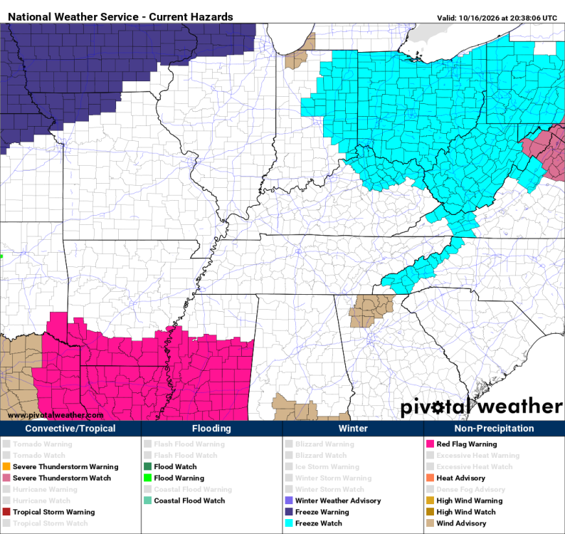
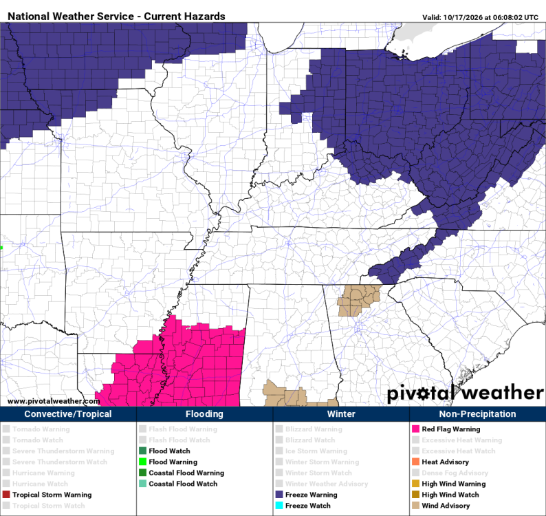 You're welcome. I appreciate it.URGENT - WEATHER MESSAGE National Weather Service Wilmington OH 130 PM EDT Fri Oct 16 2026 INZ050-058-059-066-073>075-080-KYZ089>100-OHZ026-034-035-042>046- 051>056-060>065-070>074-077>082-088-170900- /O.NEW.KILN.FZ.A.0004.261018T0500Z-261018T1300Z/ Wayne-Fayette-Union-Franklin-Ripley-Dearborn-Ohio-Switzerland- Carroll-Gallatin-Boone-Kenton-Campbell-Owen-Grant-Pendleton-Bracken- Robertson-Mason-Lewis-Hardin-Mercer-Auglaize-Darke-Shelby-Logan- Union-Delaware-Miami-Champaign-Clark-Madison-Franklin-Licking-Preble- Montgomery-Greene-Fayette-Pickaway-Fairfield-Butler-Warren-Clinton- Ross-Hocking-Hamilton-Clermont-Brown-Highland-Adams-Pike-Scioto- Including the cities of Manchester, Landen, Milford, Seaman, Logan, Mulberry, Tollesboro, Eaton, Mount Repose, Chillicothe, Greenfield, Fairfield, Troy, Springfield, Kettering, Covington, Falmouth, Richmond, Oxford, Warsaw, Peebles, Lebanon, Fairborn, Day Heights, Maysville, Aurora, Springboro, Rising Sun, Camp Dix, Newport, Winchester, Hillsboro, Portsmouth, Mount Orab, Greendale, Camden, Xenia, Alexandria, Oakbrook, Osgood, Mount Carmel, Williamstown, Dillsboro, Brookville, Marysville, Downtown Columbus, Beavercreek, Vanceburg, Mount Olivet, Urbana, Withamsville, Newark, Independence, Wheelersburg, Kenton, Brooksville, Fort Thomas, Versailles, Franklin, Summerside, Pickerington, Ripley, Wilmington, Crittenden, Circleville, Delaware, West College Corner, West Union, Milan, London, Liberty, Carrollton, Owenton, Plain City, Augusta, Piqua, Tipp City, Lawrenceburg, Wapakoneta, Vevay, Sidney, Bellevue, Aberdeen, Blanchester, Downtown Dayton, Erlanger, Waverly, Hamilton, Downtown Cincinnati, Georgetown, Coldwater, Celina, Pike Lake, Highland Heights, New Bremen, Minster, Florence, St. Marys, Mason, Hidden Valley, West Jefferson, Bellefontaine, Batesville, Middletown, Ada, Dry Ridge, Washington Court House, Lancaster, Greenville, Burlington, Dayton, Connersville, Bright, Piketon, Butler, and Head Of Grassy 130 PM EDT Fri Oct 16 2026 ...FREEZE WATCH IN EFFECT FROM LATE SATURDAY NIGHT THROUGH SUNDAY MORNING... * WHAT...Sub-freezing temperatures in the upper 20s to lower 30s possible. * WHERE...Portions of east central and southeast Indiana, northeast and northern Kentucky, and central, south central, southwest, and west central Ohio. * WHEN...From late Saturday night through Sunday morning. * IMPACTS...Frost and freeze conditions could kill crops, other sensitive vegetation. PRECAUTIONARY/PREPAREDNESS ACTIONS... Be prepared to take steps to protect tender plants from the cold.URGENT - WEATHER MESSAGE National Weather Service Jackson KY 148 PM EDT Fri Oct 16 2026 KYZ044-050>052-170900- /O.NEW.KJKL.FZ.A.0005.261018T0500Z-261018T1300Z/ Fleming-Montgomery-Bath-Rowan- Including the cities of Morehead, Owingsville, Camargo, Mount Sterling, Flemingsburg, and Jeffersonville 148 PM EDT Fri Oct 16 2026 ...FREEZE WATCH IN EFFECT FROM LATE SATURDAY NIGHT THROUGH SUNDAY MORNING... * WHAT...Sub-freezing temperatures as low as around 32 possible. * WHERE...Bath, Fleming, Montgomery, and Rowan Counties. * WHEN...From late Saturday night through Sunday morning. * IMPACTS...Frost and freeze conditions could kill crops, other sensitive vegetation and possibly damage unprotected outdoor plumbing. PRECAUTIONARY/PREPAREDNESS ACTIONS... Take steps now to protect tender plants from the cold.URGENT - WEATHER MESSAGE National Weather Service Louisville KY 135 PM EDT Fri Oct 16 2026 KYZ036-037-041>043-049-170900- /O.NEW.KLMK.FZ.A.0002.261018T0500Z-261018T1300Z/ Scott KY-Harrison KY-Fayette-Bourbon-Nicholas-Clark KY- Including the cities of Georgetown, Cynthiana, Winchester, Paris, Carlisle, and Lexington 135 PM EDT Fri Oct 16 2026 ...FREEZE WATCH IN EFFECT FROM LATE SATURDAY NIGHT THROUGH SUNDAY MORNING... * WHAT...Temperatures as low as 32 possible. * WHERE...Bourbon, Clark KY, Fayette, Harrison KY, Nicholas, and Scott KY Counties. * WHEN...From late Saturday night through Sunday morning. * IMPACTS...Frost and freeze conditions could kill crops, other sensitive vegetation and possibly damage unprotected outdoor plumbing. PRECAUTIONARY/PREPAREDNESS ACTIONS... Take steps now to protect tender plants from the cold. URGENT - WEATHER MESSAGE National Weather Service Jackson KY 148 PM EDT Fri Oct 16 2026 w
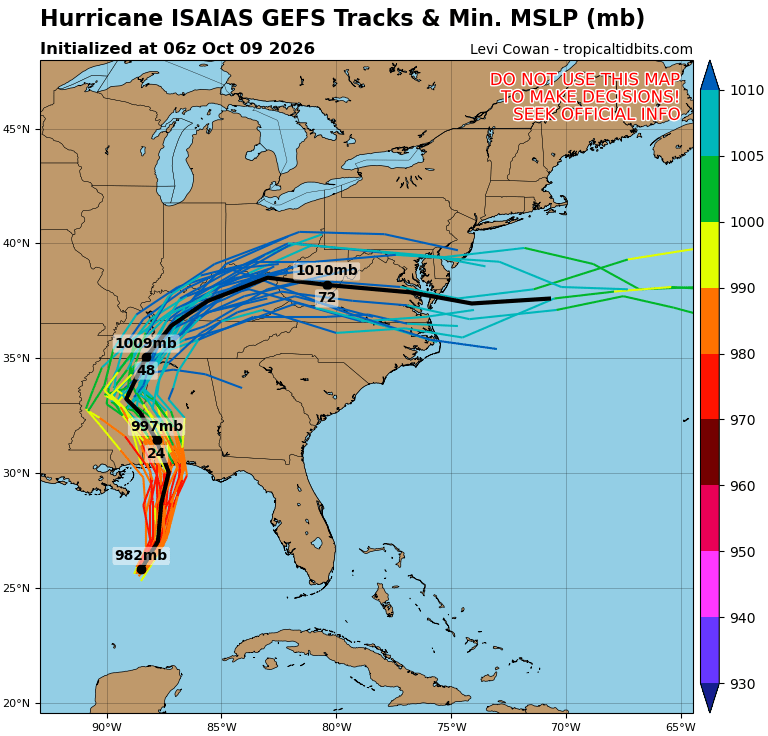
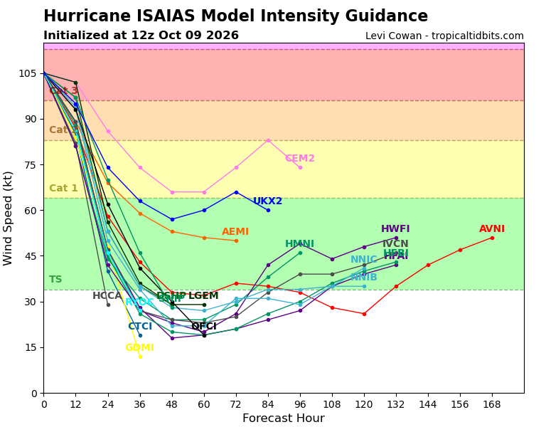
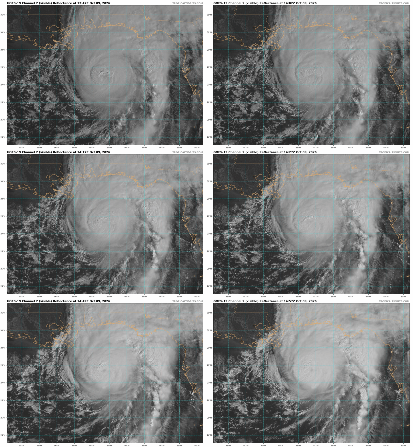
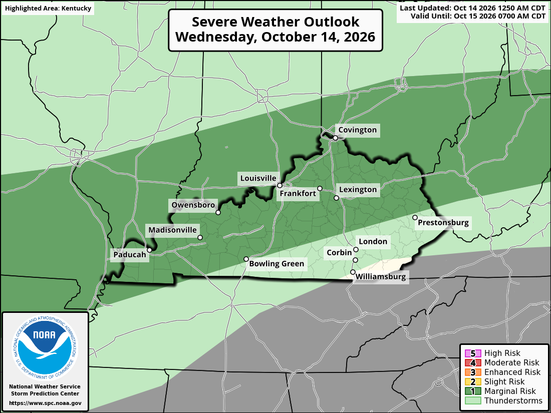
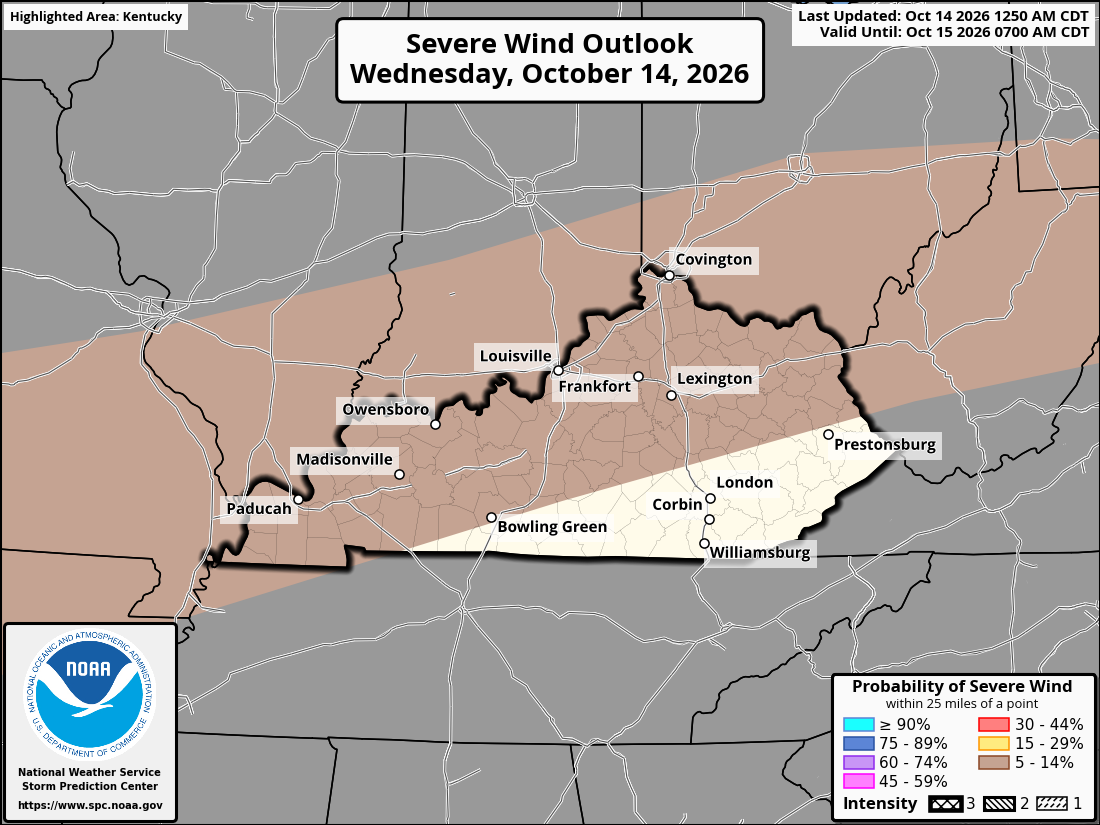
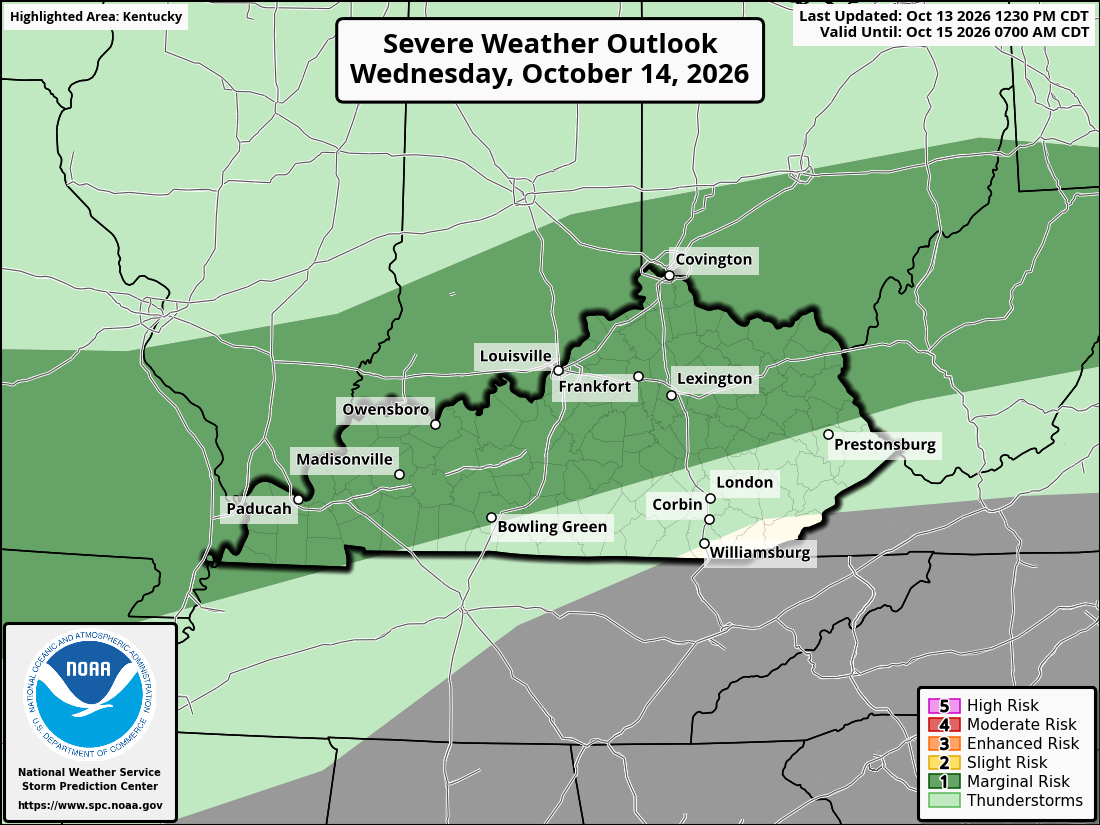
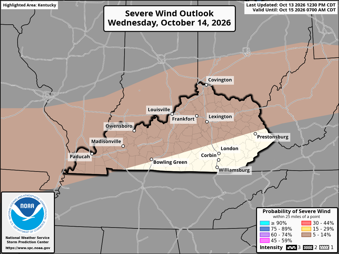
 It’s going to feel more like fall football across Kentucky, Cincinnati, and Northern Kentucky tonight. Cooler air is moving in behind a cold front, bringing falling temperatures, breezy conditions, and a chance for a few showers. Northern Kentucky and Cincinnati: Temperatures should be in the lower to mid-50s around kickoff, dropping into the 40s later tonight. A few showers are possible, especially early in the evening. Central Kentucky: Expect temperatures in the upper 40s to mid-50s during games, with readings continuing to fall overnight. A few lingering showers and a cool northwest breeze may make it feel colder. Eastern Kentucky: Temperatures will generally range from the upper 40s to mid-50s during the evening, falling into the upper 30s and 40s overnight. A few showers may linger into the evening. Western Kentucky: Temperatures should fall through the 50s during the evening, with cooler temperatures overnight. Breezy conditions are expected behind the front, and any lingering showers could affect field conditions.Behind a cold front, cooler air will move into Kentucky and the Cincinnati area, giving us a taste of fall football weather Friday. Clouds and some showers may impact portions of the region, with temps dipping through the evening. Western Kentucky-Paducah Cooler conditions are expected, with afternoon temperatures in the upper 60s. Clouds will mix with periods of sunshine, and a passing shower cannot be ruled out. Temperatures will gradually fall during Friday night’s games. South-Central Kentucky - Bowling Green Afternoon temperatures will reach around 70 degrees before cooler air arrives. Clouds and a chance of showers could affect the area, although conditions may vary by location. Fans should bring a jacket for the game. Central Kentucky-Lexington and Frankfort Clouds and a few showers may accompany the passing cold front. Temperatures will trend downward through the afternoon and evening, making for a cooler atmosphere at kickoff. North-Central Kentucky-Louisville Expect a mix of clouds and possible showers as cooler air moves into the region. Northwest winds may make temperatures feel cooler than they are, especially during the second half of Friday night’s games. Northern Kentucky and Cincinnati Cooler weather is expected by kickoff, with a chance of showers depending on the timing of the front. Fans should prepare for a chilly finish to the evening and keep rain gear handy. Eastern Kentucky-Pikeville and the Appalachian Mountains Clouds and scattered showers may affect parts of eastern Kentucky. Temperatures will turn cooler Friday night, particularly in the higher elevations. A jacket will be useful for players and fans alike.Friday night football across Kentucky and the Cincinnati area will have a cool fall feel as a cold front moves through the region. Temperatures will be cooler than earlier in the week, and a breeze could make it feel chilly for players, coaches, and fans at kickoff. Western Kentucky — Paducah: Mostly cloudy early, with a slight chance of showers. Conditions may improve through the afternoon. Temperatures will be cool for pregame warmups, with highs near the upper 60s. South-Central Kentucky — Bowling Green: A mix of clouds and a few possible showers early in the day. Cooler air will move in, with afternoon temperatures in the upper 60s. Expect a comfortable but breezy evening for football. North-Central Kentucky — Louisville: A few showers may linger early, followed by partial clearing. Afternoon temperatures will reach the mid-60s, with cooler conditions developing by kickoff. Bluegrass Region — Lexington: Clouds and a chance of an early shower could give way to some breaks in the clouds. Highs will be in the mid-60s, with a noticeable chill settling in during Friday evening. Northern Kentucky and Cincinnati—Cincinnati: Breezy and cool, with a chance of showers early and improving conditions later. Afternoon highs will be in the middle 60s, followed by a chilly evening for games. Northeastern Kentucky — Ashland: Mostly cloudy early, with a chance of a lingering shower. Temperatures will reach the lower to mid-60s before falling during the evening. Southeastern Kentucky—London: A few early showers are possible, with cooler weather taking over through the afternoon. Highs will be in the mid-60s, and temperatures will drop after sunset. Players and fans should plan for jackets and warm layers, especially for games starting after sunset. Temperatures will gradually fall through the evening, with a cool northwest breeze adding to the fall feel. If showers develop during the day, check the latest local forecast for any changes before kickoff.Warm and humid conditions will prevail across Kentucky and the Cincinnati area today as a cold front sags south toward the area. Daytime heating will help develop the storm, with a chance for scattered showers and thunderstorms to form this afternoon and evening. The Storm Prediction Center (SPC) has issued a Level 1 Marginal Risk for severe thunderstorms for most of Kentucky. No widespread severe weather is forecast, but a few storms may be strong to severe. The biggest threat from any stronger storms will be damaging wind gusts. Heavy rain and frequent lightning are also possible. Storm coverage will likely be scattered across the region, so some communities could see thunderstorms while others remain dry. Keep an eye on the changing weather conditions throughout the afternoon and evening, particularly if storms start to strengthen.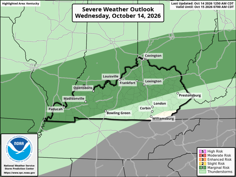
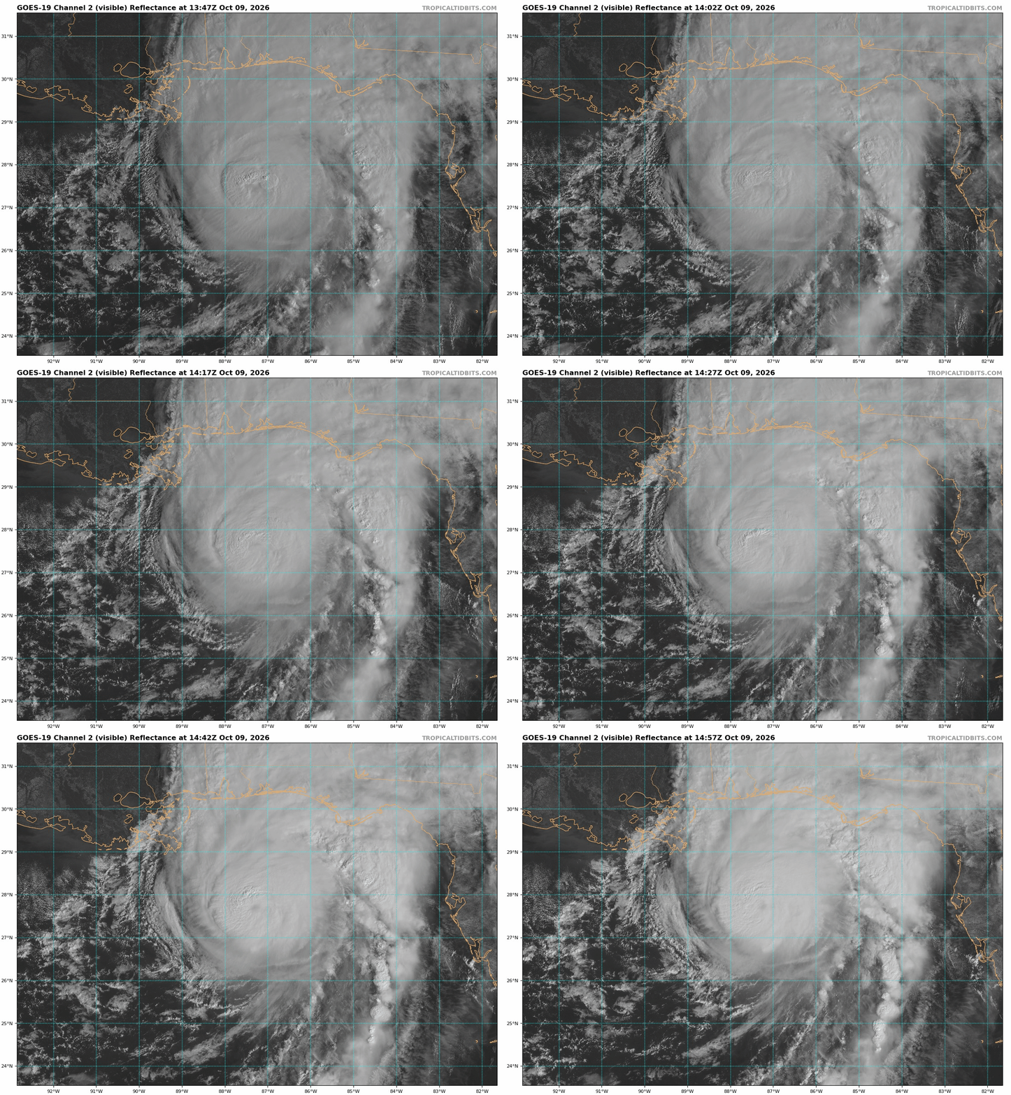
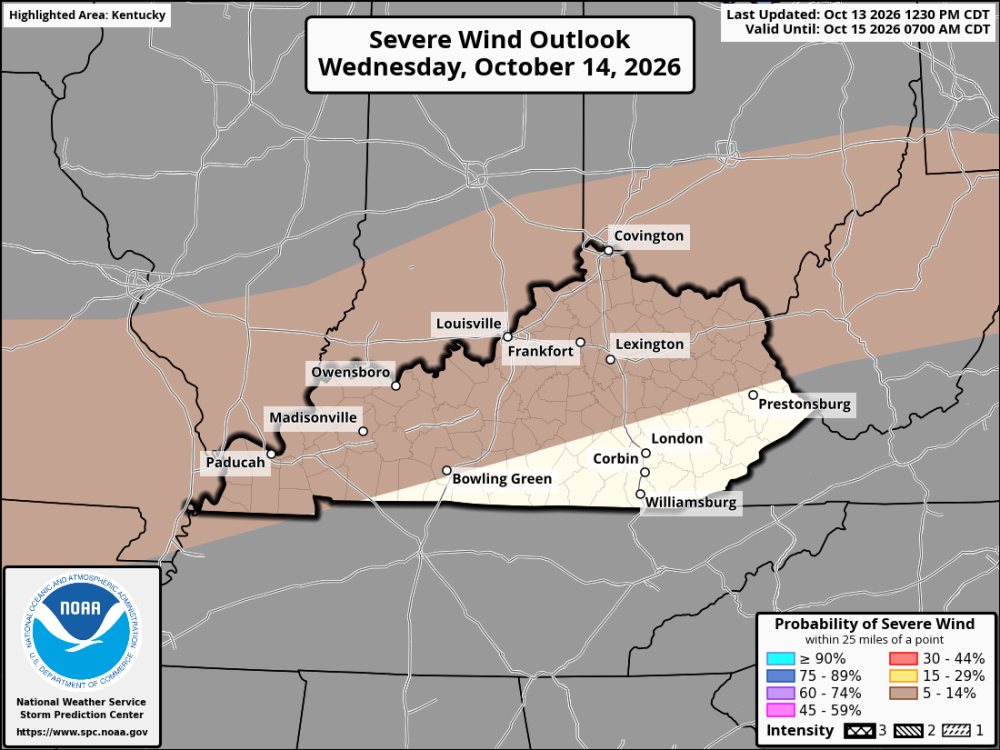
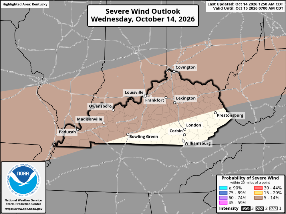 Louisville is in central Kentucky. North Central, to be exact.Warm, humid conditions will continue across Kentucky and the Cincinnati area Wednesday ahead of an approaching cold front. High temperatures are expected to reach the low to mid-80s, with scattered showers and thunderstorms developing or increasing in coverage during the afternoon and evening. Rain chances will range from 50–70% across much of Kentucky, with chances near 80% around Cincinnati. A few storms could become strong, with isolated damaging wind gusts possible. Brief heavy rainfall, frequent lightning, and locally gusty winds will also be concerns. Showers and thunderstorms may linger into the evening before gradually decreasing as the cold front moves through the region.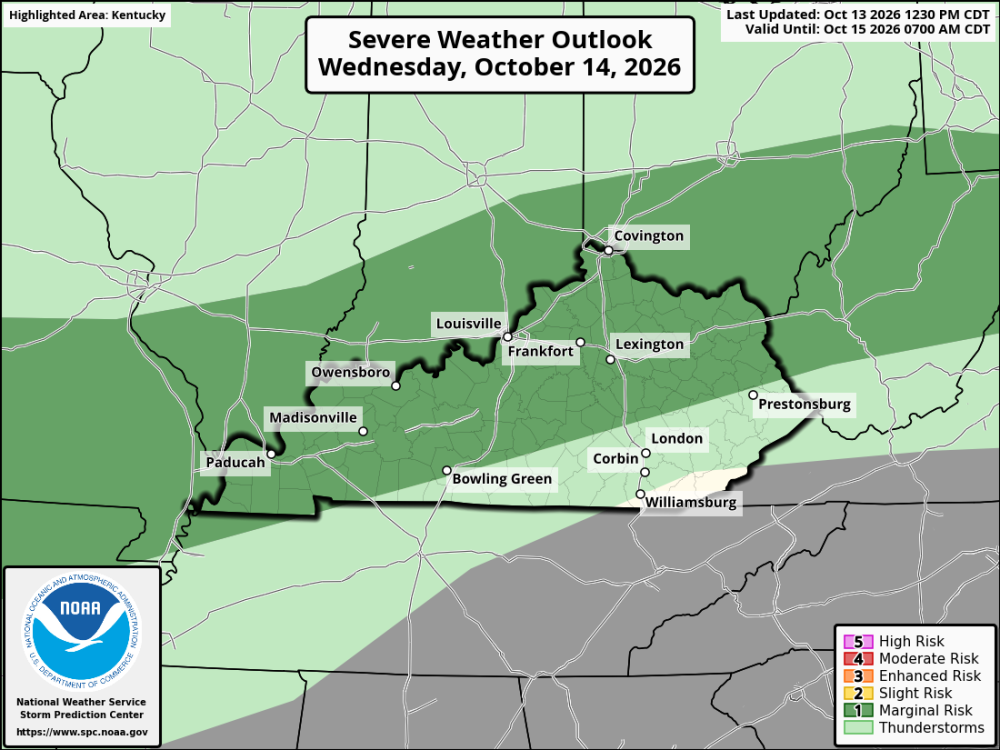
 Fall weather will be in the air Friday night as cooler temperatures settle across Kentucky and the Cincinnati area. Teams and fans should prepare for a chilly finish, especially at games that run late into the evening. Western Kentucky: Cooler air is expected to move in during the day. Check local updates for the timing of any showers and how quickly temperatures fall Friday night. Central Kentucky: A cooler afternoon is expected, with a chance of showers early in the day. Skies should trend drier by evening, with temperatures falling into the 40s overnight. Eastern Kentucky: Temperatures should turn cooler after sunset. Conditions may vary across the mountains, so check the local forecast before kickoff. Southern Kentucky: Expect a fall-like evening as cooler air moves into the region. Any lingering showers will depend on the timing of the front. Northern Kentucky & Cincinnati: Cooler conditions are expected, with temperatures falling through the evening. Fans should bring jackets or extra layers for outdoor games. Some areas could dip into the upper 30s overnight, making jackets and warm layers a good idea.A strong El Niño is continuing to develop in the Pacific Ocean, and it could play an important role in this winter’s weather across Kentucky and the Cincinnati area. Recent ocean temperatures show that El Niño has strengthened considerably, raising the possibility of one of the strongest events in decades. This pattern can influence the jet stream and storm tracks across the United States, potentially affecting temperatures and precipitation throughout the Ohio Valley. However, a strong El Niño does not automatically mean a warm winter or less snow. Much will depend on how storms track across the region and whether cold air is in place when they arrive. What to expect across Kentucky and Cincinnati Central Kentucky and the Bluegrass: Temperatures could fluctuate between mild periods and colder outbreaks. Rain may accompany passing storm systems, with opportunities for snow, sleet, or freezing rain when colder air moves into the region. Northern Kentucky and Cincinnati: The area could see a mix of rain and occasional winter weather. Temperatures near freezing will be especially important, as small changes could determine whether a storm brings rain, accumulating snow, or icy conditions. Eastern Kentucky: Colder air across the Appalachian region could support accumulating snow during favorable storm systems. Higher elevations may have better opportunities for snowfall, while freezing rain could create hazardous travel in some areas. Western Kentucky: Rain may be more common during milder periods, but strong cold fronts could bring a change to snow or a wintry mix. Rapid temperature changes will be possible as storm systems move through. Looking ahead December through February could bring several rounds of unsettled weather. January and February will be important months to watch for potential winter storms, although significant snow or ice events could occur earlier in the season. El Niño can favor a more active southern storm track, but Kentucky and Cincinnati are in a region where the exact storm path and timing of cold air often determine the outcome. A storm arriving during mild conditions may produce rain, while a similar system meeting colder air could bring accumulating snow or ice. The developing El Niño makes the winter of 2026–27 worth watching across Kentucky and Cincinnati. Periods of mild weather could alternate with colder outbreaks, and opportunities for snow and ice will remain. At this stage, it is too early to determine whether the region will experience above-normal or below-normal snowfall. The strength of El Niño provides an important piece of the puzzle, but it cannot determine the entire winter by itself. BluegrassPreps will continue to monitor the developing pattern as the winter season approaches, with particular attention to cold-air outbreaks, storm tracks, and the potential for snow and ice across Kentucky and the Cincinnati area.Hurricane Isaias strengthened into a Category 3 major hurricane Friday morning, with winds reaching an estimated 120 mph. Hurricane Hunter aircraft measured powerful winds inside the storm's eastern eyewall, while the central pressure settled near 959 millibars. The latest measurements suggest Isaias may be reaching its peak intensity. Even with stronger wind shear affecting the storm, Isaias has continued to strengthen. Forecasters believe favorable conditions higher in the atmosphere are helping the hurricane maintain its strength. The National Hurricane Center expects Isaias to remain a major hurricane as it approaches the western Florida Panhandle this evening, with winds near 115 mph at landfall. Once Isaias moves onshore, it should gradually weaken. However, the storm will still pack a punch well inland. Dangerous winds could continue along its path, with hurricane-force gusts possible as far north as central Alabama. The latest forecast track has shifted slightly east, placing the potential landfall near the western Florida Panhandle. From there, Isaias is expected to move north through Alabama before turning northeast across the Tennessee and Ohio Valleys on Sunday. By then, the storm is expected to lose its tropical characteristics. Kentucky and Cincinnati Outlook As Isaias moves north, Kentucky and the Cincinnati area could see periods of rain and gusty winds. The biggest factors will be the storm's path and how quickly it weakens after moving inland.