.png.ffa34568722b20f38e3c3ecfcb9a2cd2.png)


nWo
-
Posts
25,597 -
Joined
-
Last visited
-
Days Won
2
Everything posted by nWo
-
May feel that way but 2016 was the first above normal hurricane season since 2012.
-
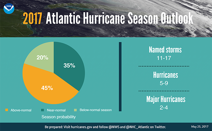
For the upcoming Atlantic hurricane season, which runs from June 1 through November 30, forecasters predict a 45 percent chance of an above-normal season, a 35 percent chance of a near-normal season, and only a 20 percent chance of a below-normal season. Above-normal Atlantic hurricane season is most likely this year | National Oceanic and Atmospheric Administration

-
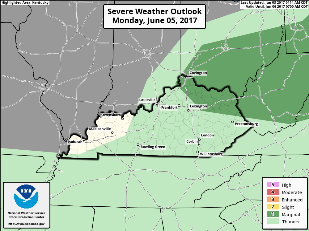
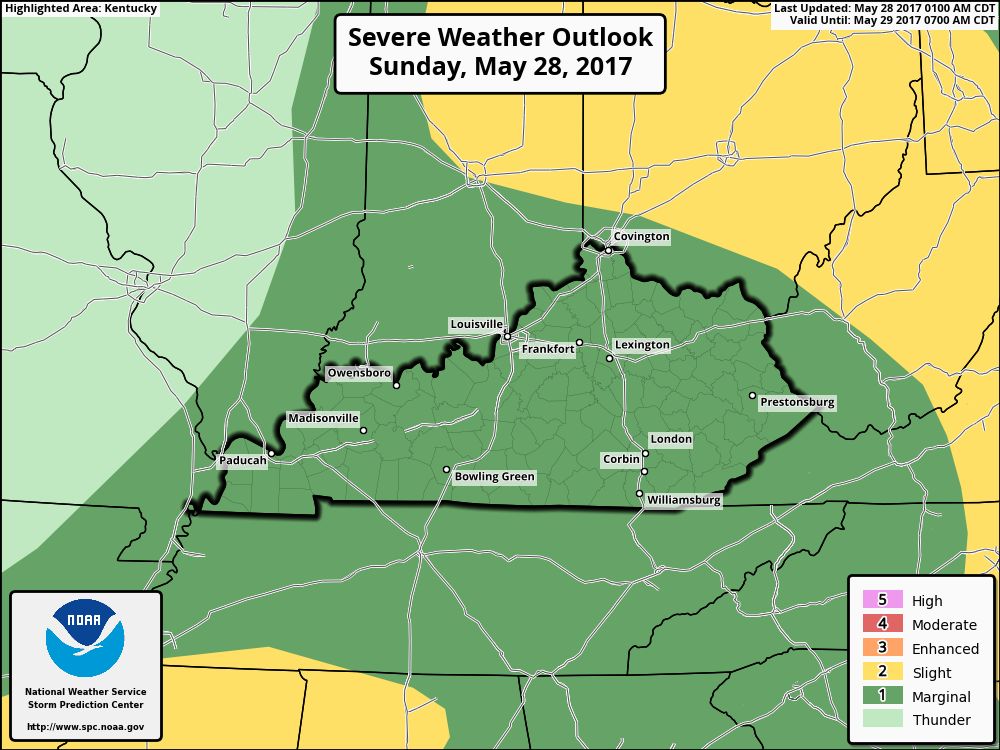
Parts of Kentucky, mainly northern and northeastern Kentucky, could have a chance for strong thunderstorms on Monday. There will be the possibility of isolated severe storms. These are expected to develop by early afternoon. Hail and wind are the primary risks with this activity. I will update later.
-
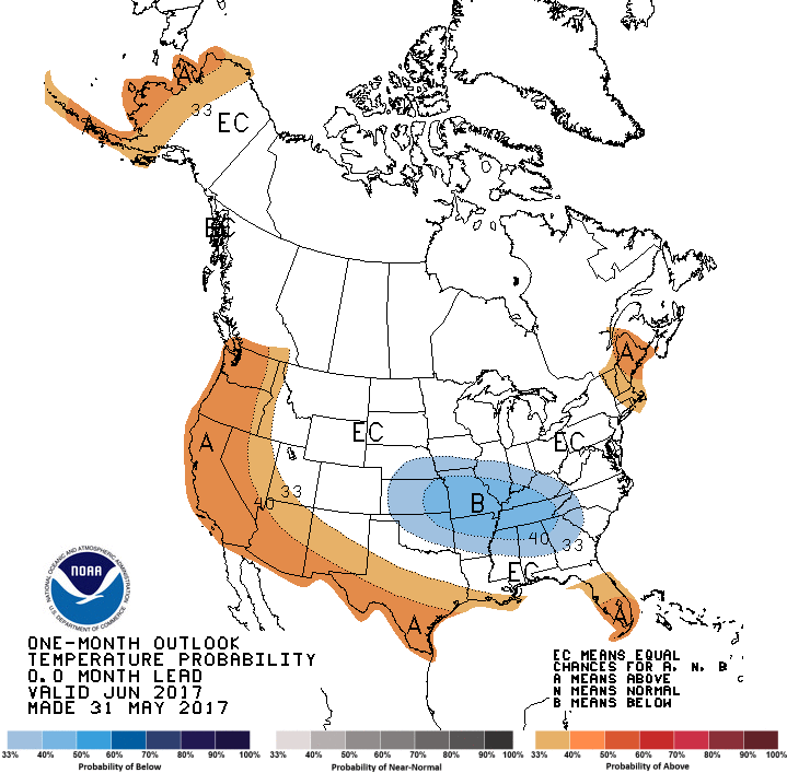
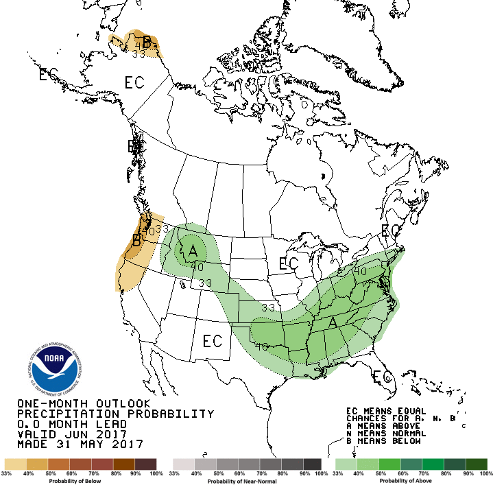
The outlook for the entire month of June looks like below normal temps with above average precipitation.
-
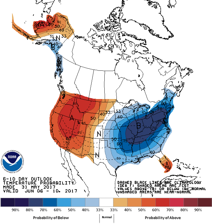
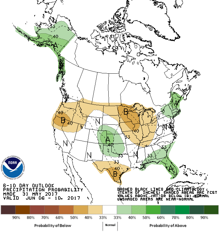
The 1st full week of June looks to be much cooler than normal. Lows in the low to mid 50s. The western part of Kentucky looks to be in the mid to upper 50s. High temps may not get out of the 50s in the eastern part of the state. While the west should reach the mid to upper 60s. Most of the state looks to receive below normal precipitation. Now that doesn't mean we could see showers or storms. Temps look to rebound the by the end of the 6-10 day outlook with the possibility of showers. I'm not seeing much in organized severe weather in the next week. Keep checking back for updates.
-
The threat for severe weather has diminished I will update again in the morning.
-
Just a quick update. No real changes in the forecast. I'll update later today.
-
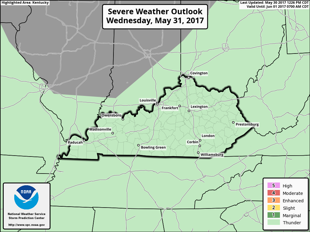
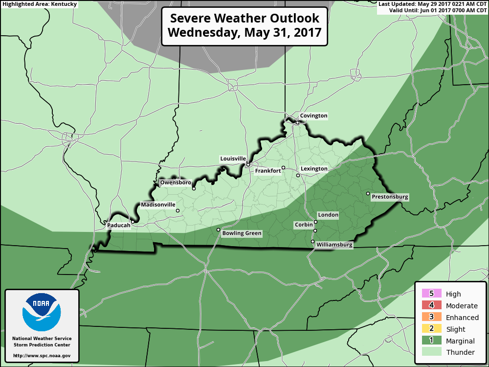
Parts of Kentucky along the Tennessee boarder and EKY could see conditions for strong to severe storms develop on Wednesday. A front is forecast to located in the Ohio Valley by midday. Thunderstorms appear likely to initiate along the front in areas that heat up the most. The greatest thunderstorm coverage should be in the Ohio Valley. The stronger thunderstorms could produce marginally severe wind gusts and hail. Check back for updates in the morning.
-
Isolated to scattered storms will be possible today. The main threats with these storms will be damaging winds and hail, although a tornado or two will be possible. Conditions are forecast to gradually organize during the afternoon along a surface trough. While I don't think it will be as organized as yesterday the possibility is there for some isolated strong storms.
-
Reports of golf ball size hail in parts of Missouri.
-
Tornado Warning Bernstadt area.
-
-Members in WKY BOLO a high end bow echo may produce winds between 75-100 mph.
-
Warnings are being forwarded on our Twitter page.
-
Just issued for the rest of Kentucky.
-
Has just been issued for most of Kentucky was of I-75
-
Severe thunderstorms are firing up now. First warning just issued.
-
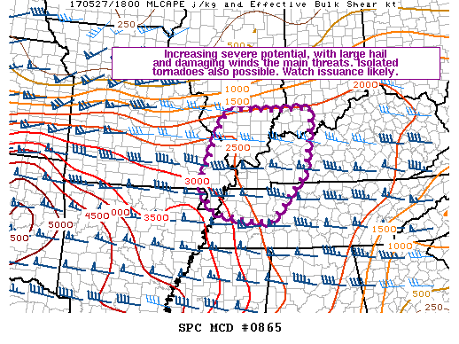
Watch maybe issued soon for WKY. Increasing severe potential is quickly increasing, with large hail and damaging winds the main threats. Isolated tornadoes will also be possible.
-
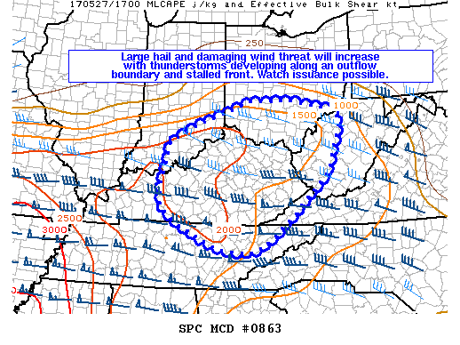
Large hail and damaging wind threat will increase with thunderstorms developing this afternoon. A severe weather watch maybe issued soon.
-
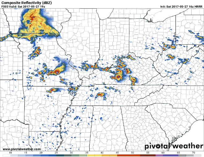
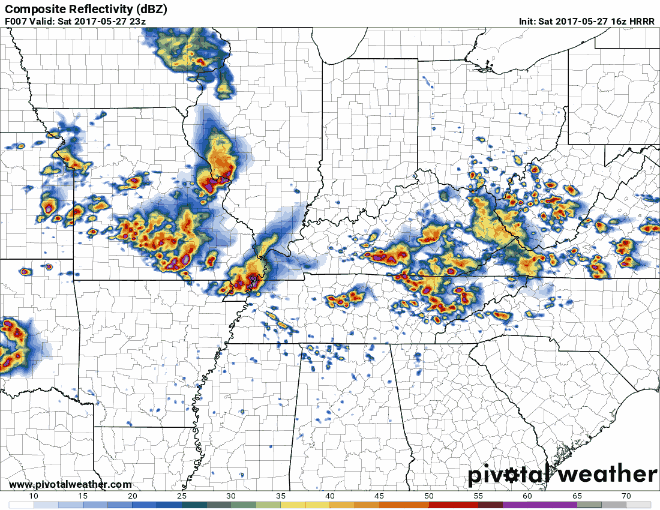
simulated radars 3-7 pm EDT 7-11 pm EDT
-
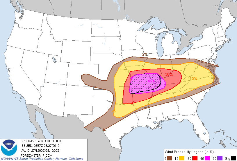
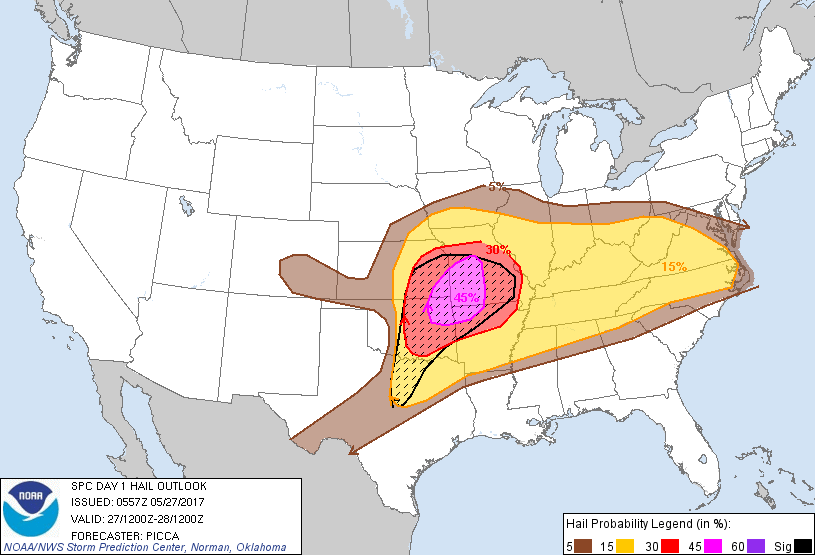
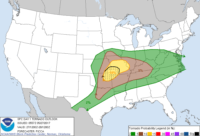
Midday update: Our Western Kentucky members should being going over their emergency action plan now. Hazards they are could be seeing are widespread damaging winds. Some could be equal to hurricane force. A few intense tornadoes. Widespread large hail. Some as big as baseballs.
-
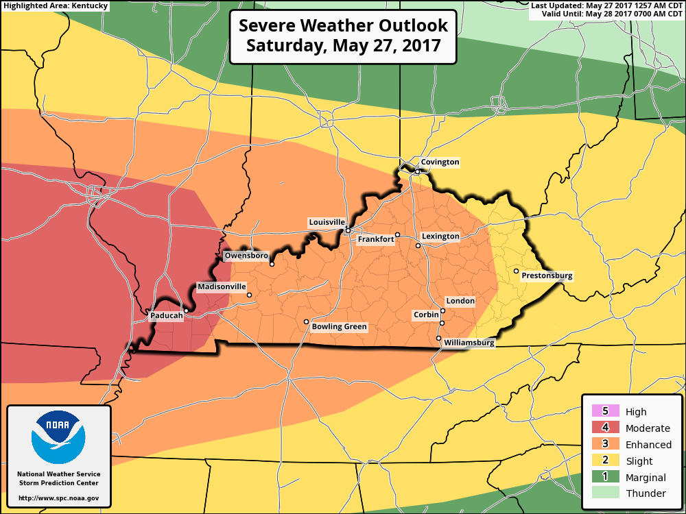
The SPC just expanded the Moderate Risk Area eastward in Kentucky to a line just west of Owensboro southward towards the Tennessee state line.
-
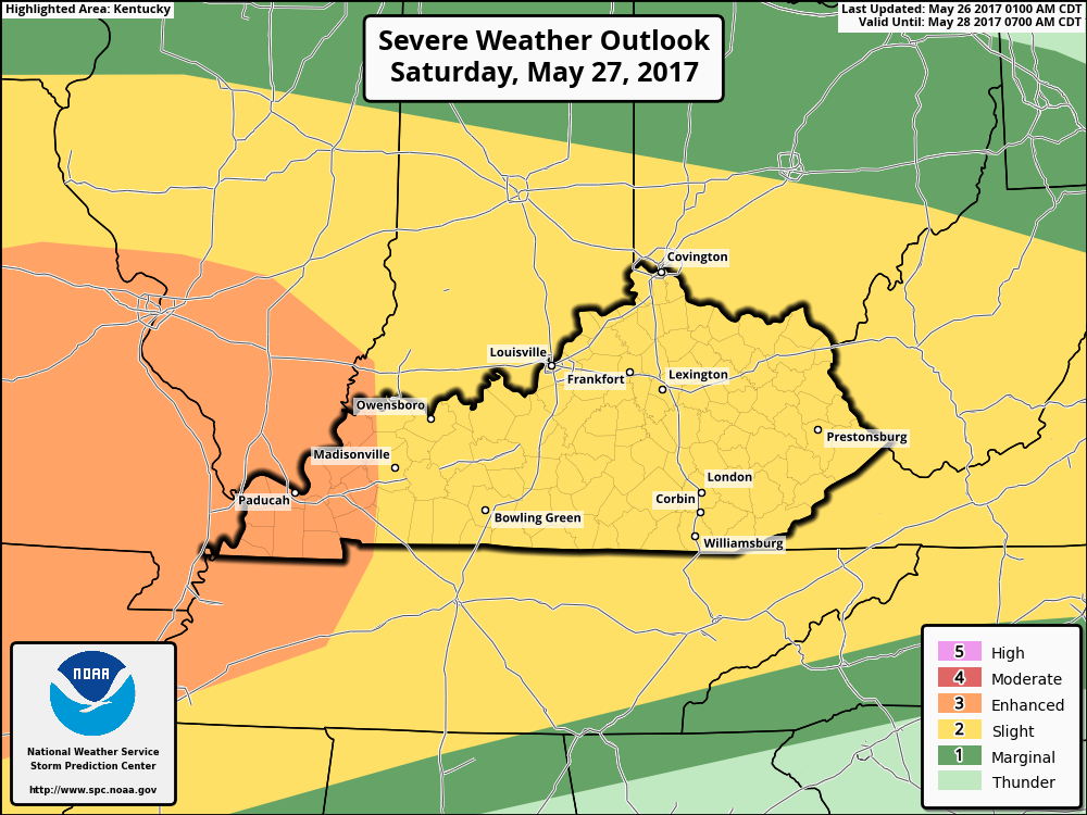
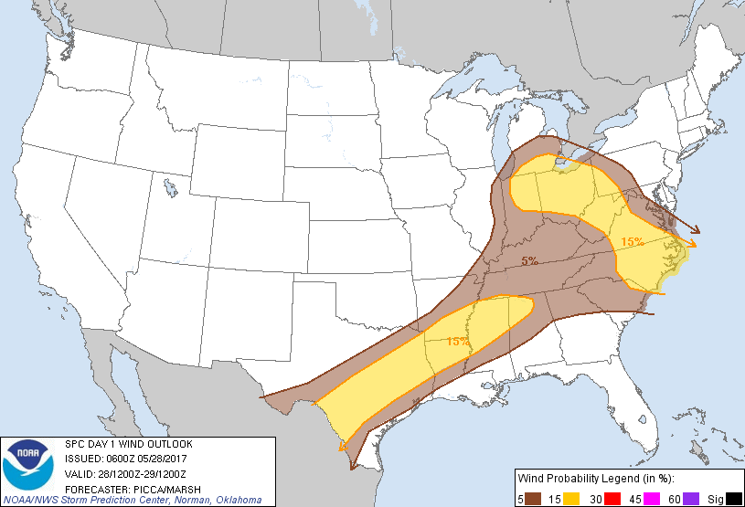
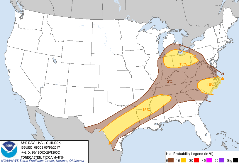
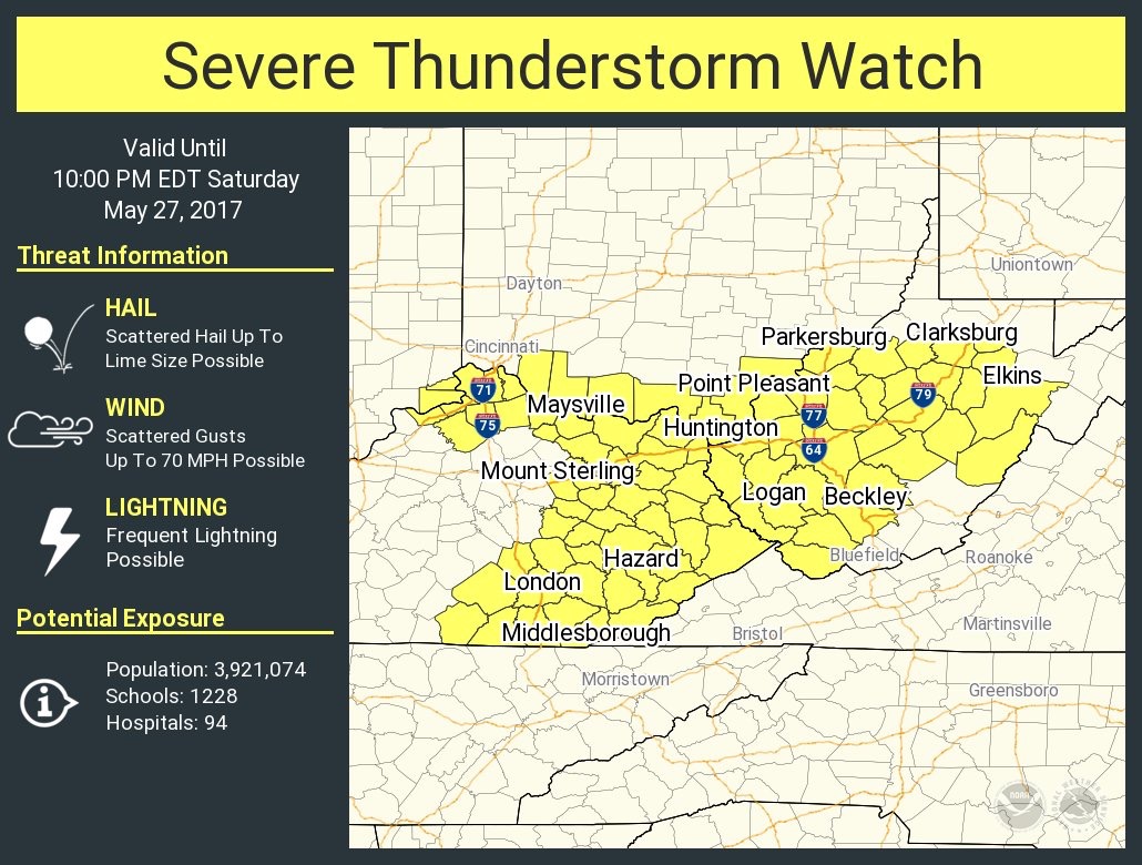
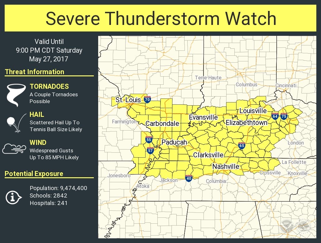
The threat for severe weather has grown for later today. As expected yesterday, the Storm Prediction Center has raised the threat level for most of Kentucky. Western Kentucky is now in a Moderate Risk Area for severe storms and most of the rest of Kentucky is in a Enhanced Risk Area for these storms. Eastern Kentucky is in a Slight Risk Area. Widespread severe winds gusts are forecast today. Damaging winds, large hail, and a couple tornadoes will be possible over most of Kentucky. Especially in Western Kentucky. There now appears there will be two waves of storms. This afternoon and then again late tonight. A third wave could form Sunday afternoon but could be limited by the storms from Saturday. Everyone should be weather aware today into Sunday. Have you phones fully charged and your NOAA weather radio close especially during the night time hours. I will try and update later today.
-
I'm having internet connection issues where I staying hopefully it will be corrected by morning
-
Is this what you are talking about?
-
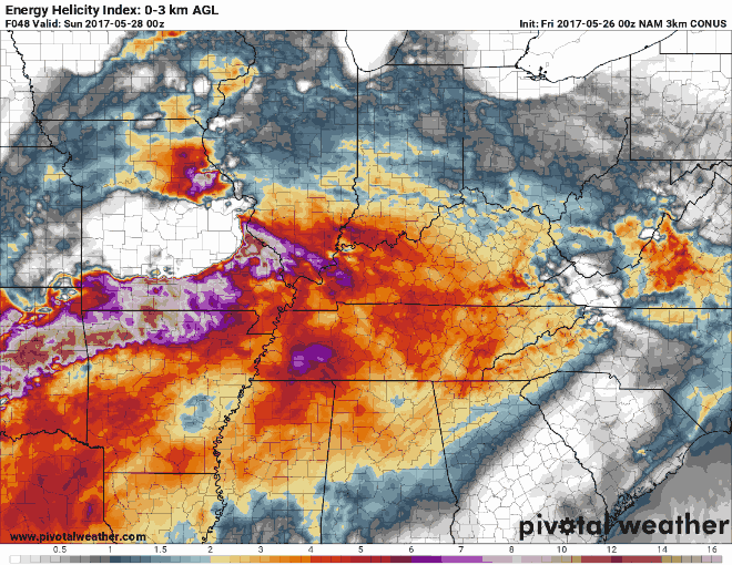
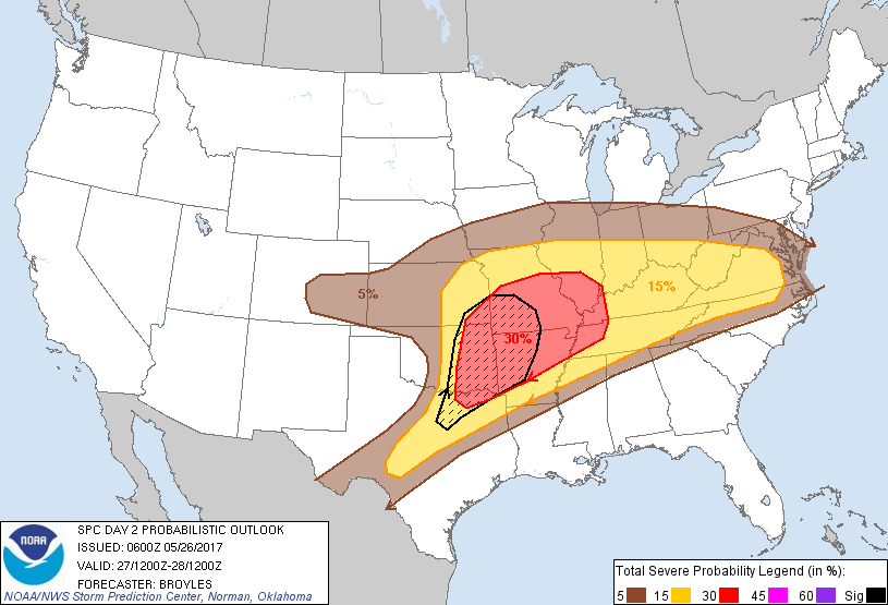
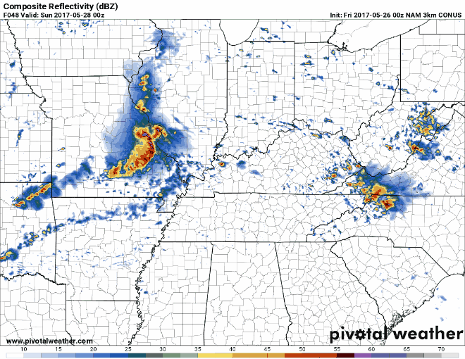
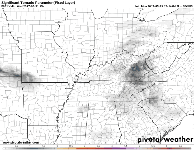
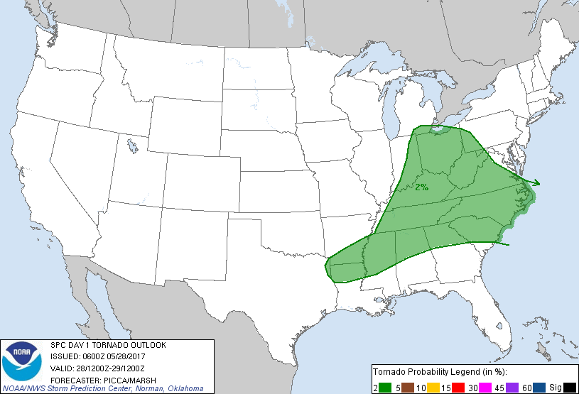
This looks like it could be a Saturday night into Sunday morning event. The severe weather, for now, doesn't look to enter Kentucky until late Saturday evening then transverse eastward across the state. My main area of concern is west of of I-65 mainly in WKY. From the NWS-Paducah office: The amount of atmospheric instability forecast late Saturday / Saturday night (needed for severe storms) are at levels we don't often see. This is a simulation from the NAM 3km CONUS model showing the atmospheric energy for Saturday night into early Sunday morning. Those in WKY should take note that after the initial energy fades it starts to build back up early Sunday morning. For now the SPC has all of Kentucky, except WKY, in a Slight Risk Area for strong to severe storms. WKY is in and Enhanced Risk Area. There is discussion that the Enhanced Risk Area is being watched very closely for possible upgrades. I look for the hatched area to be expanded to include WKY later today. For now the timing looks to be after 8 pm EDT for the storms to enter WKY then move across the state during the nighttime hours. Summary of the possible severe weather event. Widespread thunderstorms with wind damage, large hail and a few tornadoes are expected Saturday into Saturday night from parts of the the southern and central Plains east-northeastward into the mid Mississippi Valley and Mid-Atlantic. I will try and update later today as I will be traveling to Bowling Green later today for the weekend. Everyone should stay weather aware and go over your emergency action plan before any storms develop.


.png.80513f5b3af0de26f27e421ee68c4d2c.png)