.png.ffa34568722b20f38e3c3ecfcb9a2cd2.png)


nWo
-
Posts
25,605 -
Joined
-
Last visited
-
Days Won
2
5 Followers

Recent Profile Visitors
17,664 profile views


-
@TheDeuce Hey, I'll be on in the morning but I don't know when/if I'll be able to post anything tomorrow evening. My plane is not scheduled to land in Las Vegas till around 6:30 PDT. If you could, could you post anything new that comes up for Sunday?
-
Email I received from NWS-Louisville with updated information: Good morning - Organized severe storms are still expected on Sunday. Late afternoon through after midnight is the most favorable time for severe weather, but any part of the day is fair game. Damaging winds are the main threat, with localized hurricane-force gusts possible. Tornadoes, flooding, and large hail have a lower probability but are still on the table. Anorther conference call is planned this afternoon at 3 PM EDT. In the meantime, you can access the briefing slides (will be updated before the conference call) here: https://www.weather.gov/media/lmk/DssPacket.pdf Thanks, NWS Louisville, KY
-
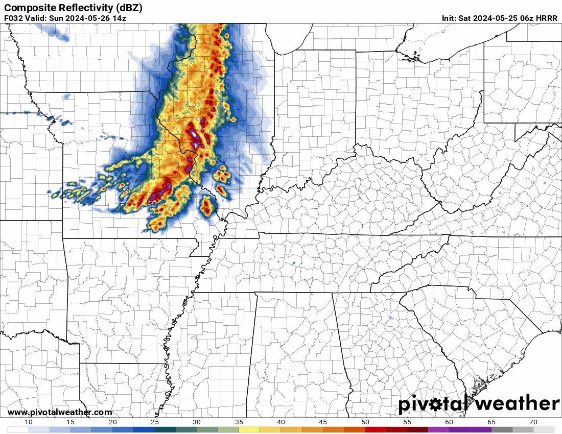
This is the 06z HRRR. If you listen to the conference call you heard, it mention individual supercells developing if the cap is broken. This shows possible cells forming ahead of the line around 2-4 pm EDT.

-
@TheDeuce @theguru
-
This is what I talk about when I say I will be on a conference call with the National Weather-Louisville. You need to fast forward to about 10:48 for the start of the conference call. There will be another one this afternoon (Saturday). This is the first time I've seen it posted on YouTube. I don't know if they will continue to post them. This is from Friday afternoon, 5/24/24.
-
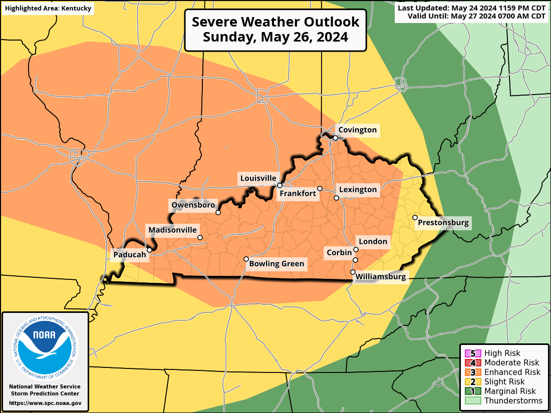
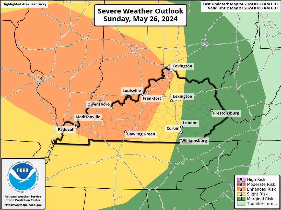
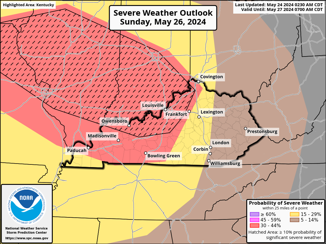
Kentucky is now more at risk of severe weather. There is currently a level 3 Enhanced Risk for strong to severe storms over most of Kentucky. Level 2 Slight Risk covers the locations that are not covered by level 3.
-
I just received a email from NWS-Louisville office there will be another conference call Saturday afternoon at 3 pm EDT.
-
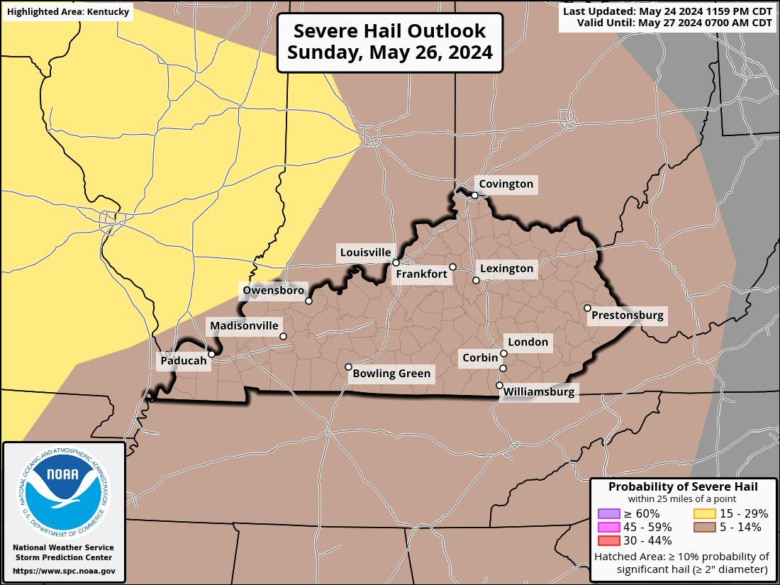
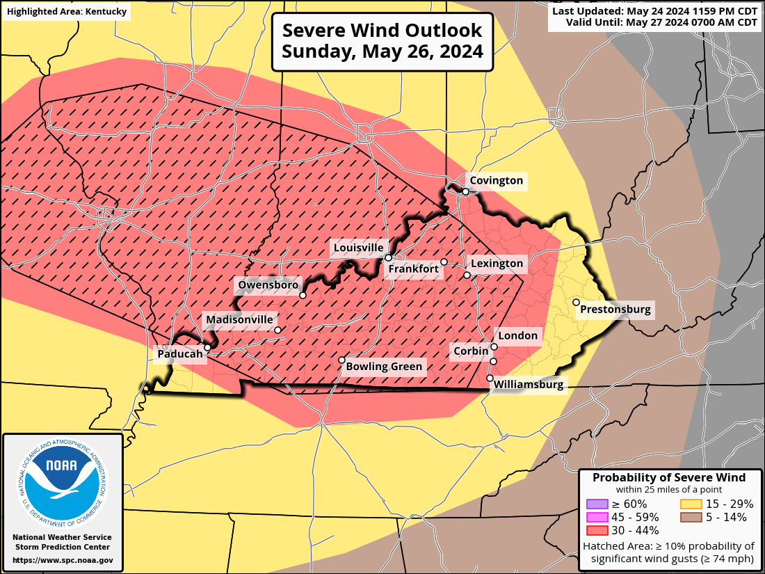
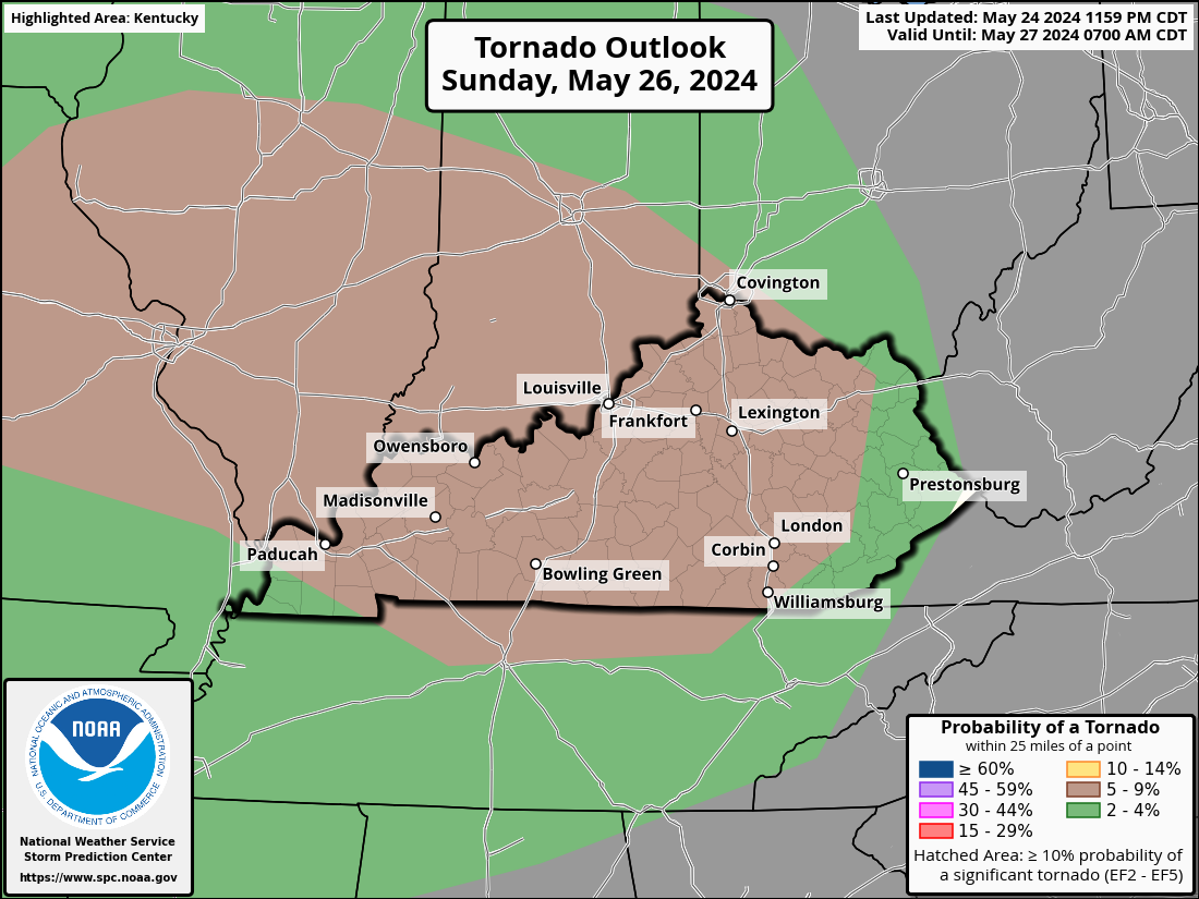
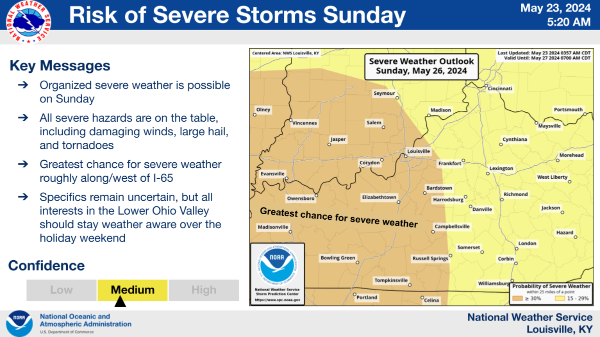
From the conference call this afternoon: Organized severe weather is possible on Sunday, with the threat continuing well into the overnight hours Sunday. All severe hazards are on the table, including damaging winds, large hail, tornadoes, and localized flooding. The greatest chance for severe weather is highlighted in orange (‘Enhanced Risk’) on the map. All interests in the Lower Ohio Valley should stay weather-aware over the holiday weekend. Multiple waves of storms are possible. Storms could start as early as Sunday morning and be isolated/scattered in nature. More widespread storms would likely arrive Sunday night. The threat could extend into the early morning hours Monday.
-
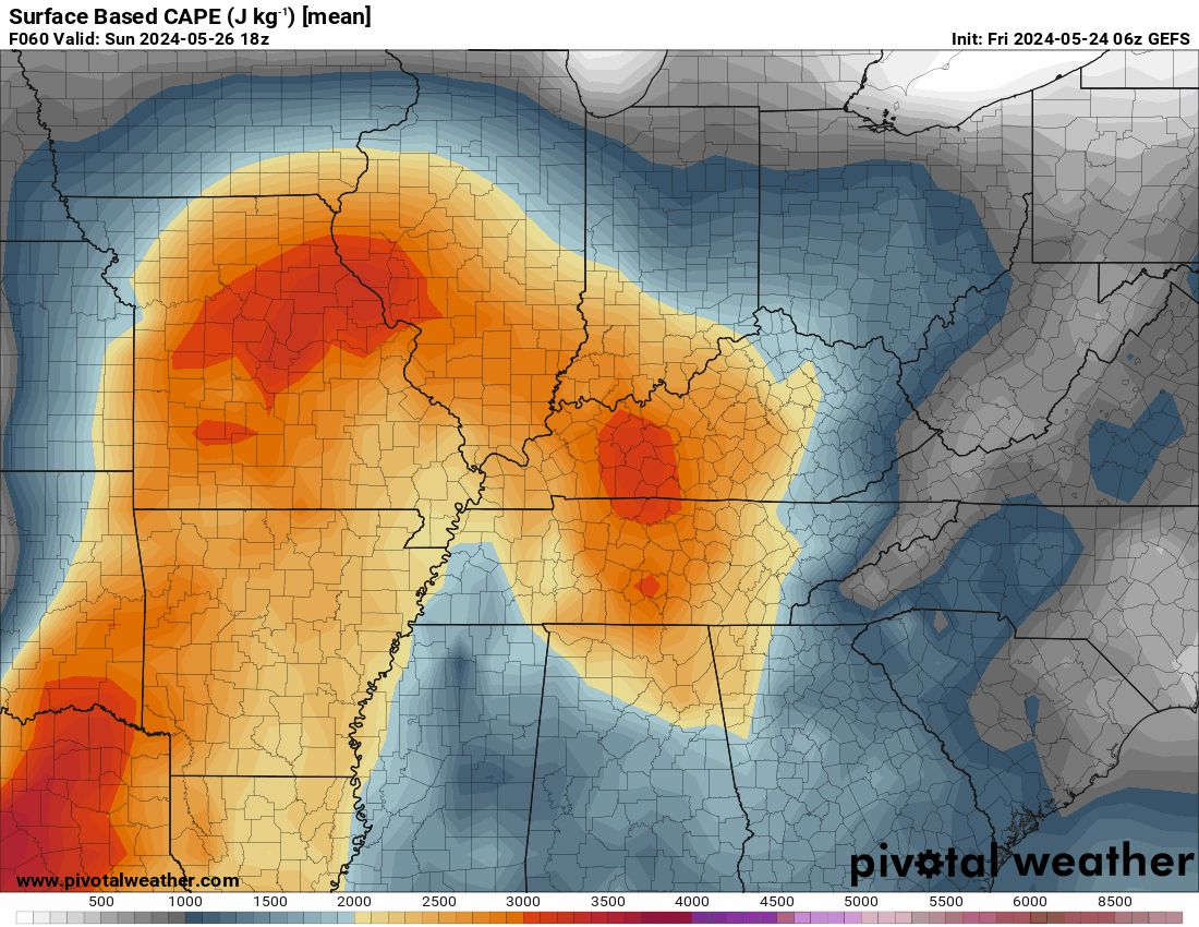
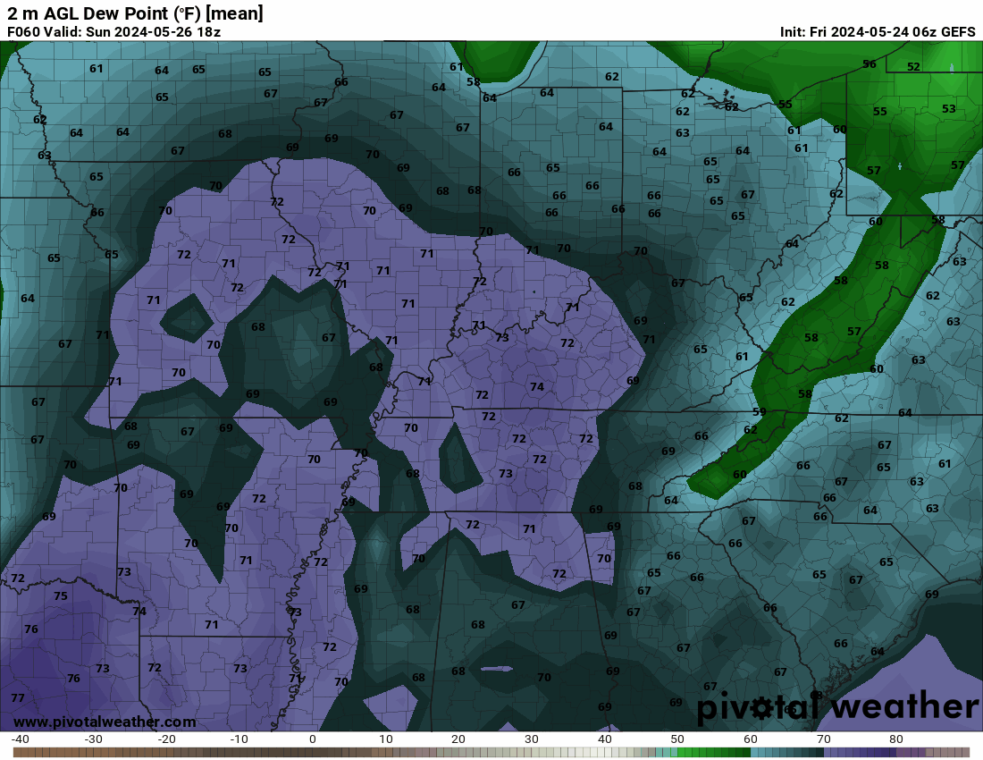
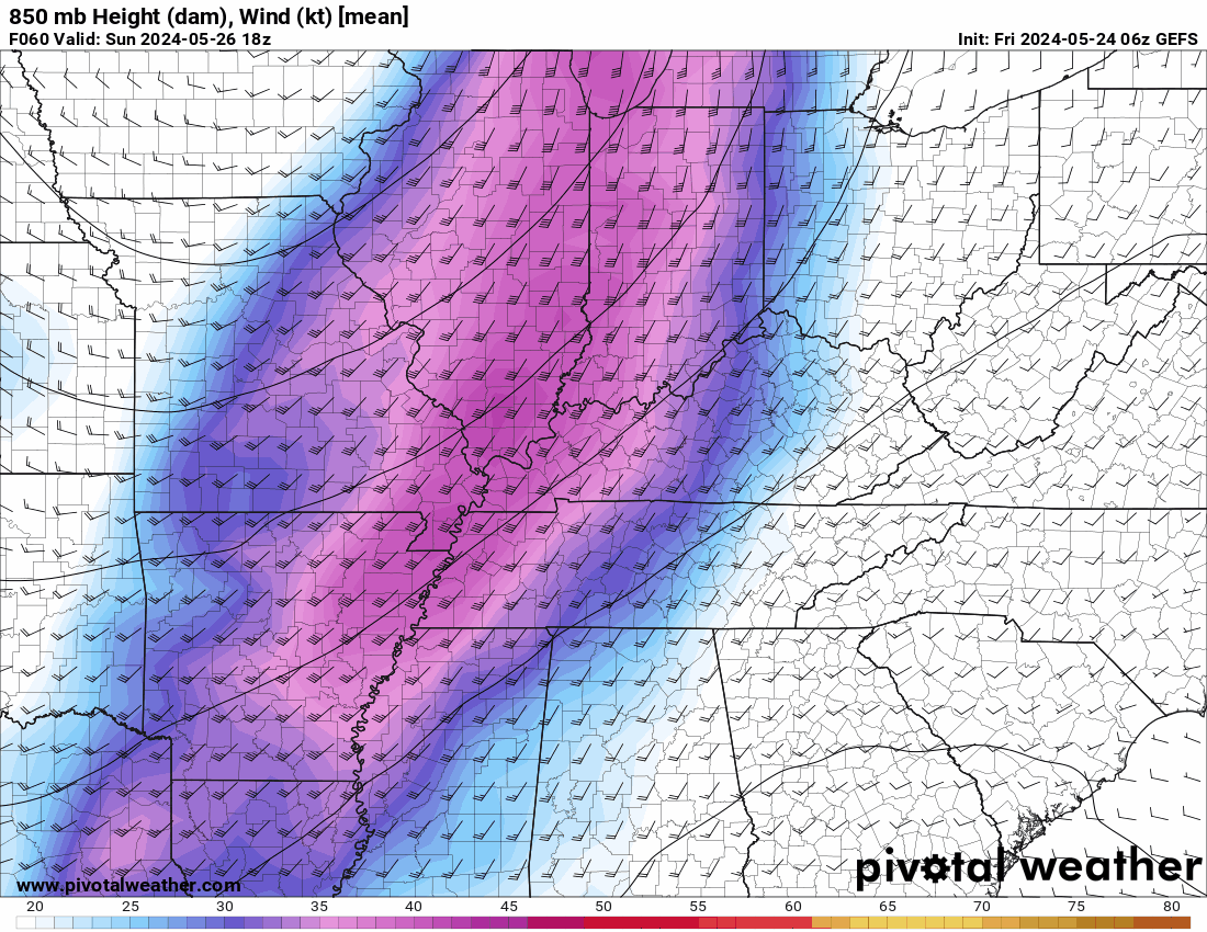
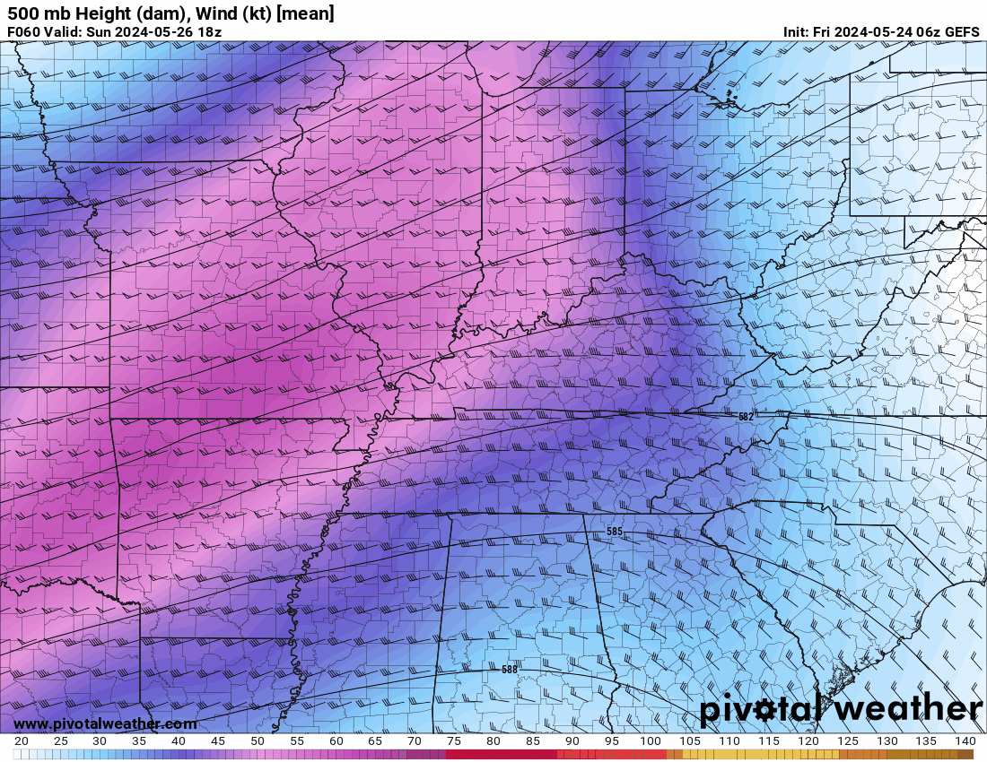
I just took a look at the GEFS Ensemble model. By producing several forecasts that, when applied to the data after it has been included in the model, yield a variety of possible outcomes, GEFS quantifies these uncertainties. Every forecast accounts for a unique combination of uncertainties. This is what it is showing for Sunday from 2 pm EDT to 7 am EDT Monday. First, surface winds are expected to blow from the southwest at a speed of 35 to 45 mph. Around 18,000 feet, there will be 50–60 mph westerly winds. It seems that the winds will have varying directions at various altitudes. This might lead to storms rotating and producing tornadoes. Additionally, Readings of 2,500 to 3,200 J/Kg (Joule per Kilogram)of surface-based CAPE. Generally, a CAPE of 1000 J/Kg is adequate for powerful to severe storms. Generally a CAPE of 3,000 to 4,000 J/Kg or above indicates an extremely volatile atmosphere. When combined with dew points that are expected to reach the mid-70s in western Kentucky and the low to mid-60s in the majority of the state, this could create an environment where all modes of severe weather will be possible from Sunday afternoon into the nighttime hours.
-
Just received this from the National Weather Service-Louisville
-
 nWo changed their profile photo
 -
I will post information on this possible situation until late Sunday morning. My wife and I are scheduled to fly out of Lexington early that afternoon. ...THERE IS AN ENHANCED RISK OF SEVERE THUNDERSTORMS SUNDAY INTO SUNDAY NIGHT ACROSS PARTS OF SOUTHEASTERN IOWA...EASTERN MISSOURI...MUCH OF CENTRAL AND SOUTHERN ILLINOIS...MUCH OF CENTRAL AND SOUTHERN INDIANA...WESTERN AND CENTRAL KENTUCKY... Strong to severe thunderstorm development may accompany mid-level height falls across a potentially sizable area of the interior United States due to the significant potential instability associated with low-level moisture return through the warm sector of the developing cyclone, beneath at least initially capping elevated mixed-layer air. Due to variations in the model output on the synoptic and sub-synoptic developments—which might have included one or two significant clusters of convective development across the lower Missouri Valley at the beginning of the period—the specifics of this evolution are still unknown. By Sunday afternoon, there may be a concentration of convective activity again close to the point where the outflow meets the southward-moving cold front that is passing across the eastern Missouri and west central Illinois regions. The environment is expected to be favorable for supercells initially due to the large mixed-layer CAPE and strong shear. However, an upscale growing cluster will be supported by low-level warm advection along the remnant outflow, and it is expected to propagate southeastward across the lower Ohio and into Tennessee Valley until Sunday evening. The main severe weather hazards, such as a large hail/supercell tornado risk to damaging winds and possibly a persistent QLCS tornado threat, seem likely to center around the outflow boundary/differential heating zone, even though convection may gradually increase along the southward advancing front to the southwest of the outflow boundary. With this information, the Storm Prediction Center has a large section of Kentucky in a level 3 Enhanced Risk for Sunday. A portion of western Kentucky and around the I-75 corridor is in a level 2 Slight Risk area while eastern Kentucky is under a level 1 Marginal Risk.
-
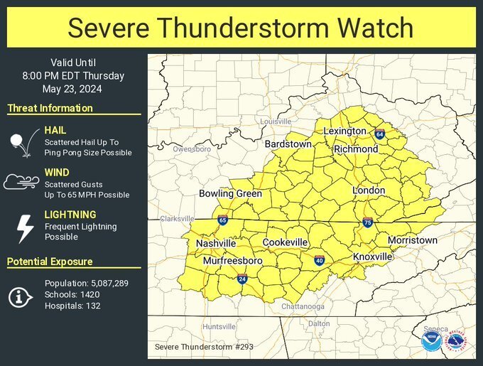
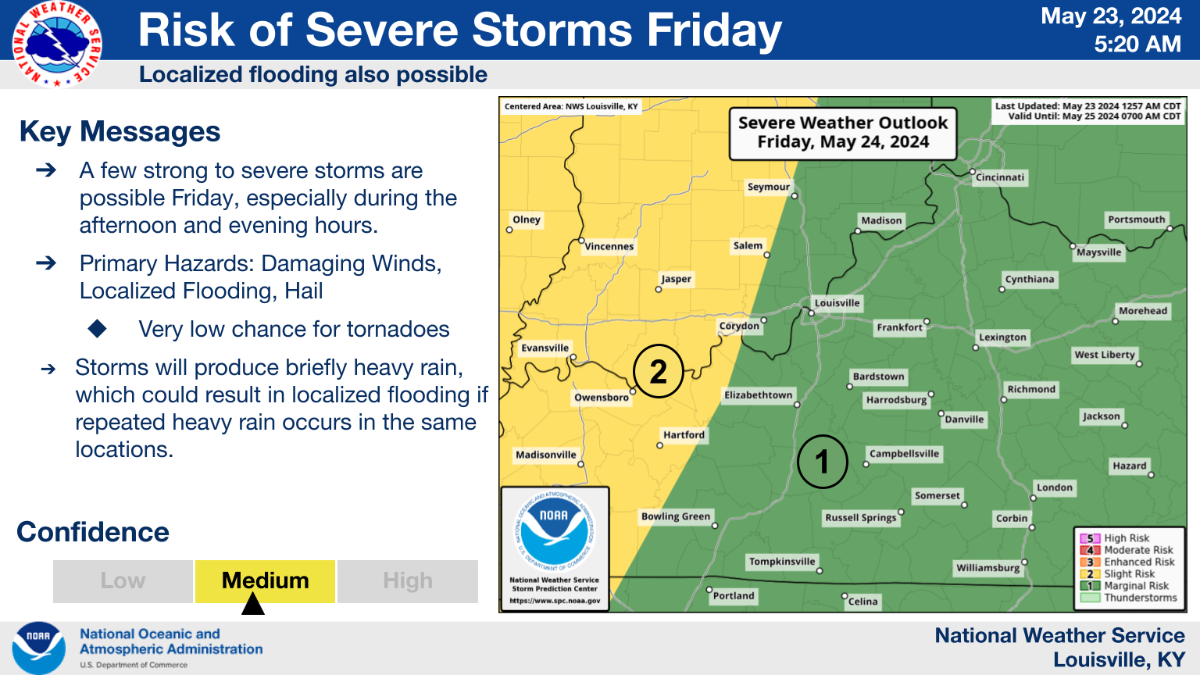
We will remain on severe Severe Alert through Sunday. While we could see some severe weather on Friday, the best chance seems to be on Sunday.
-