.png.ffa34568722b20f38e3c3ecfcb9a2cd2.png)


nWo
-
Posts
25,592 -
Joined
-
Last visited
-
Days Won
2
Everything posted by nWo
-
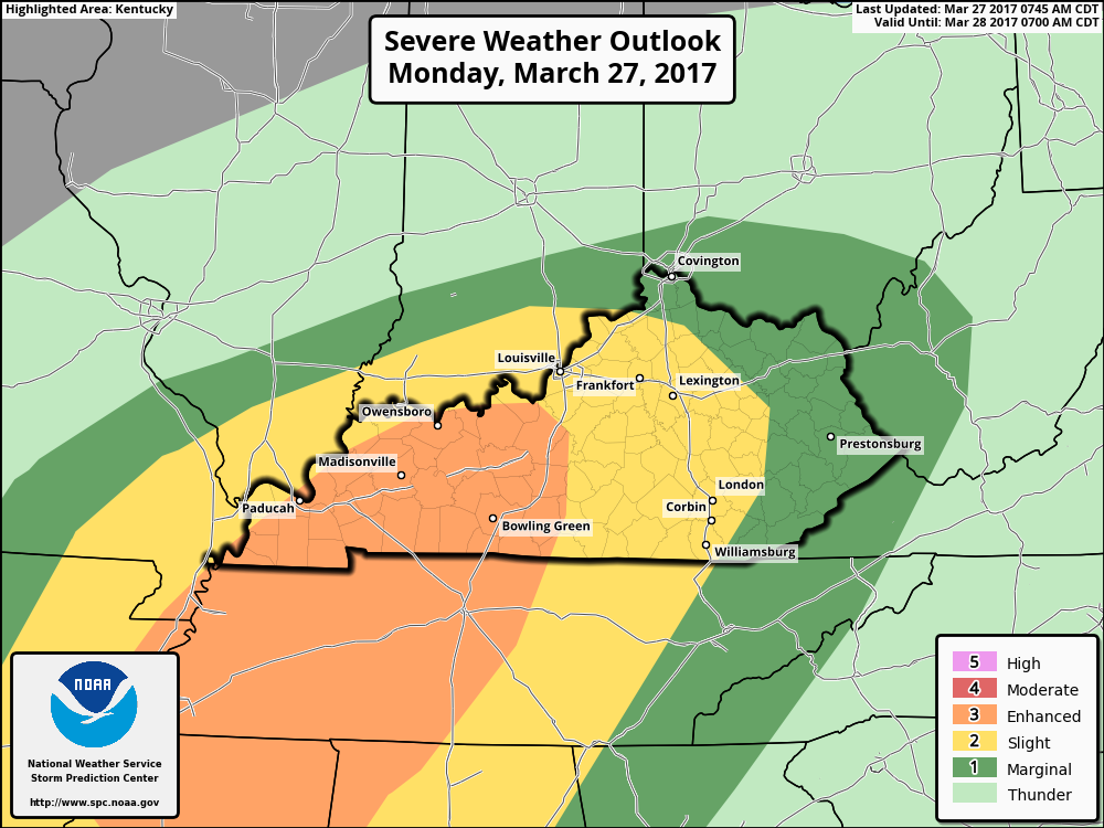
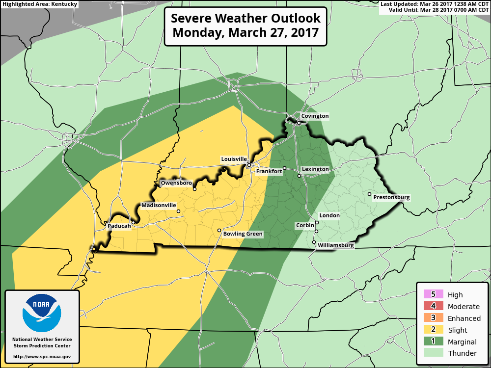
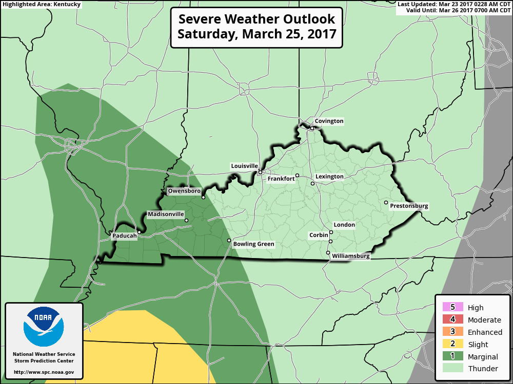
As I expected this morning the Enhanced Risk Area has just been expanded in KY.

-
Just took a look ahead to later in the week. Looks like we'll get a break on Tuesday then the possibility of strong to severe storms could return for parts of Kentucky starting on Wednesday into Thursday.
-
-
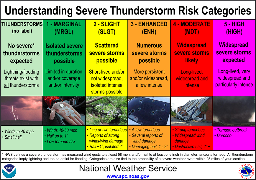
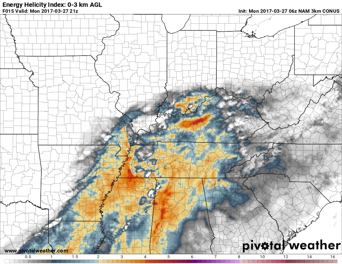
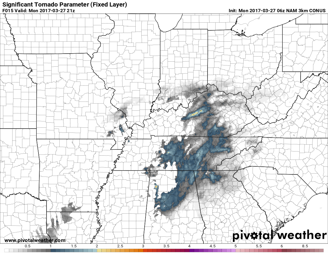
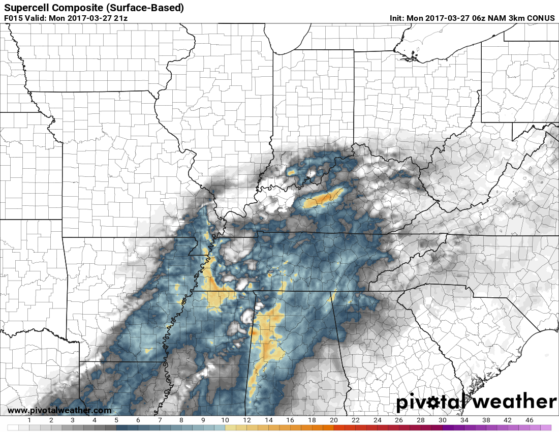
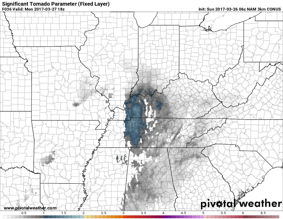
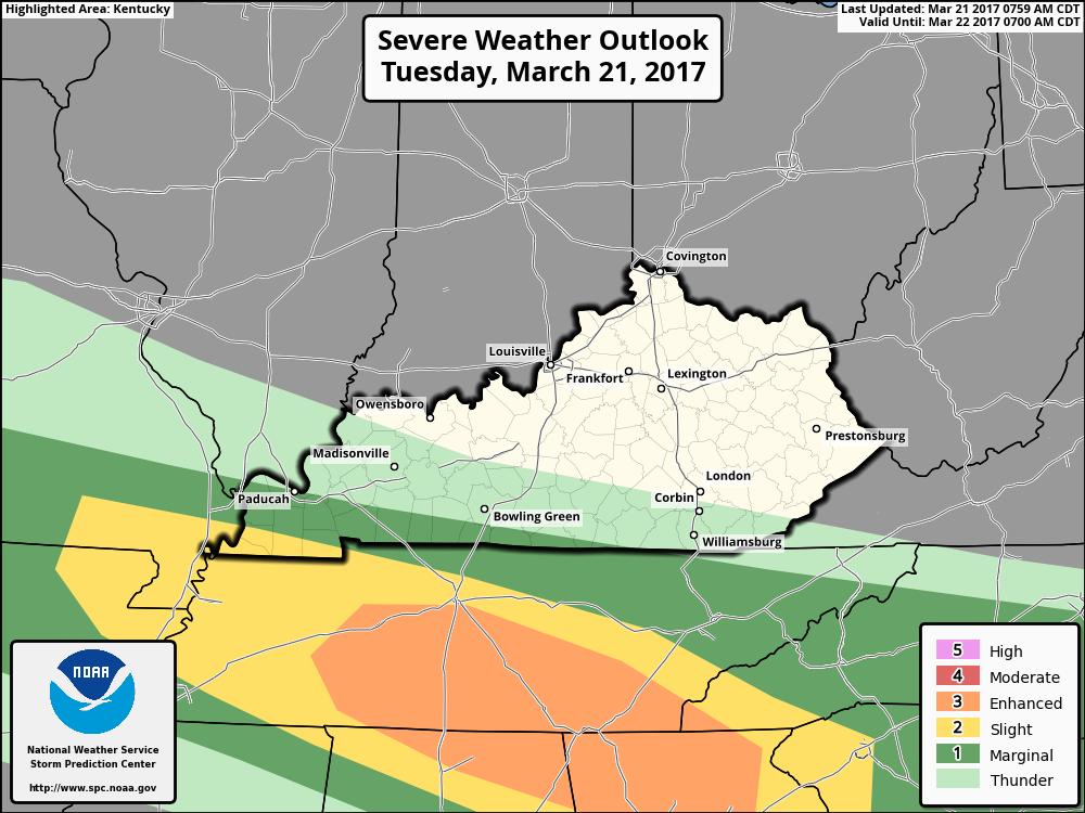
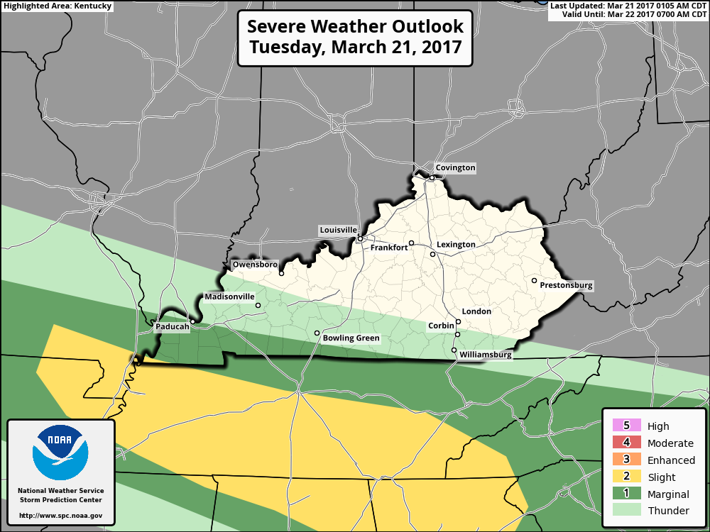
I'm issuing a Severe Weather Alert Day for today. Parts of Kentucky are now in a category 3 Enhanced Risk Area for strong to severe storms later this afternoon. Cellular clusters of supercells and organized multicells storms are forecast with hail (perhaps very large with the most intense storms). Damaging winds and a possible tornado or two. The main area of concern for me this morning looks to be centered on the Bluegrass PKWY from around Elizabethtown to Lexington. The 3km NAM is showing this area with the strongest possibility of a significant tornado or two. I wouldn't be surprised to see the Enhanced Risk Area expanded some later today. Now this doesn't mean that there will be one but the possibility is there. You can see that in the significant tornado parameter map below. For now the timing looks to be after 2 pm EDT and the best time for the possible strongest storms after 5 pm EDT. Everyone should be weather aware later today. I will post updates on here when I can. I will be updating on our twitter feed throughout the day.
-
I'm issuing a Severe Alert Day mode for later today. I'll be back in a few with a forecast of the possible severe weather.
-
Sunday evening update. The models are in good agreement for the chance of strong to severe storms Monday afternoon. The main threats look to be damaging winds, hail and maybe a tornado or two. After Monday's possible storms we look to get a break until the end of the week. Then the chance for strong to severe storms ramp up again. I'll update again the morning.
-
If you are using Firefox that is a new item added with their last update. I use Firefox and I get the same thing on every site that is not a secure sign in. Also a new thing you might run into is some of your saved links will no longer work because of some security certificate issue. I just deleted the old link and made a new one to the same site and that fixed the problem for me.
-
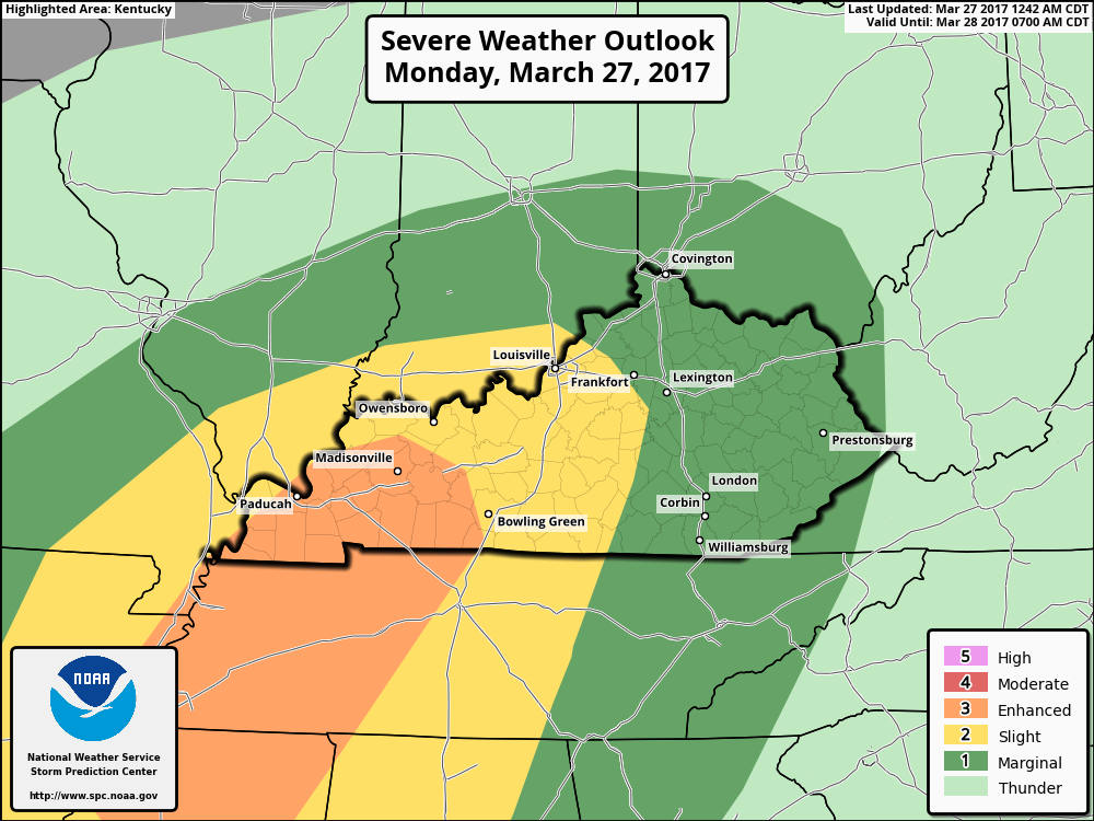
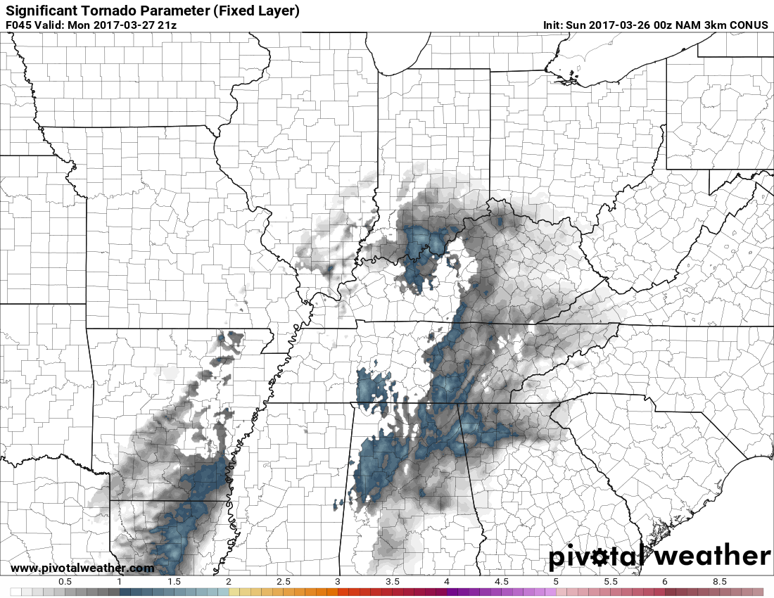
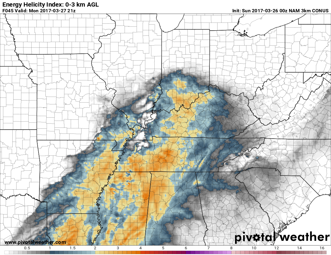
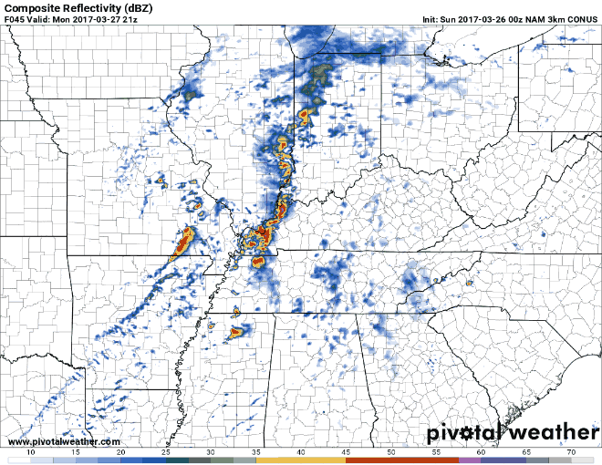
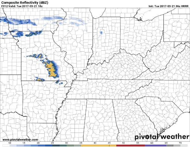
The Storm Prediction Center parts of Kentucky west of I-65 in a Slight Risk Area for strong to severe storms late Monday afternoon into the evening hours. East of I-65 to about the I-75 corridor is in a Marginal Risk Area for these possible storms. A relatively moist and unstable air mass will be present where scattered afternoon thunderstorms will develop. The main risks of large hail. Stronger wind field in parts of western KY will also support the potential for bowing storms that will be capable or damaging winds and perhaps a tornado or two as the storms across KY and southern IN during the evening. The main areas I'm seeing with the possiblities of seeing these tornadoes are western KY and in the Louisville/southern IN area. I will update later today. Simulated radar from 5 pm to 5 am EDT Tornado probability WKY 2 pm EDT Tornado probability Louisville/southern IN 5 pm EDT EHI around 5 pm EDT
-
 If everything works out the way I have it planned my wife's car is paid off next year and our house will be paid off in about a little over 4 years. Just about the time I plan to retire. The only holdup to that will be medical insurance. I won't be eligible for medicare until a couple of years later. So Mrs. nWo and I will be quite comfortable with our retirement. Won't have nearly a million dollars but we will be able to do some traveling without any trouble. We plan on going to Hawaii right after I retire.
 -
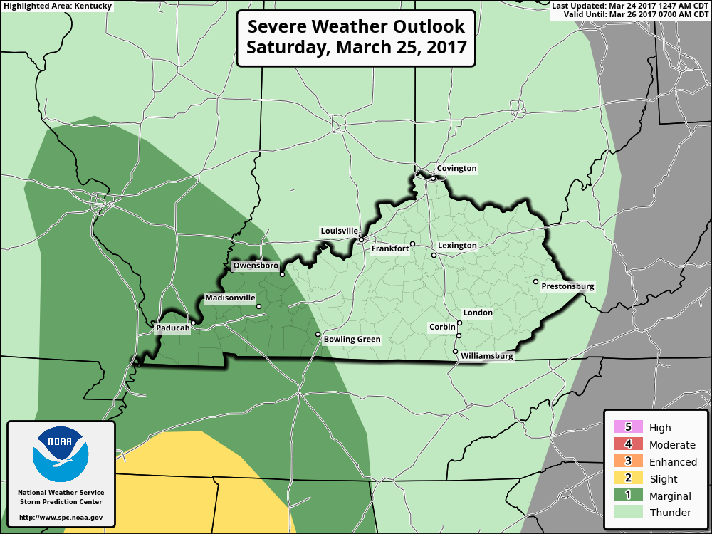
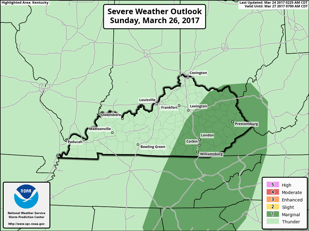
Friday morning update. The threat has increased some for strong to severe storms late Saturday afternoon into the early evening hours in WKY. The main threat looks to be damaging winds and hail. This morning I see and increased chance of possbile supercell and tornadic storms for WKY. I also seeing these possible storms between 5-8 pm EDT. These storms look to move eastward and weaken. Storms look to fire back up Sunday afternoon for central and eastern Kentucky. Those parts of the state are now in a Marginal Risk Area for Sunday afternoon. I will update later today. Be weather aware this weekend.
-
Forgot to mention that this is the new NAM 3km weather model. It is supposed to show a more detailed look at weather.
-
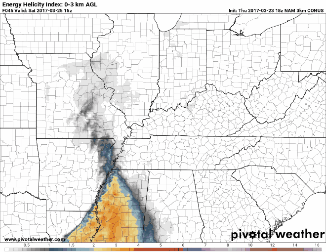
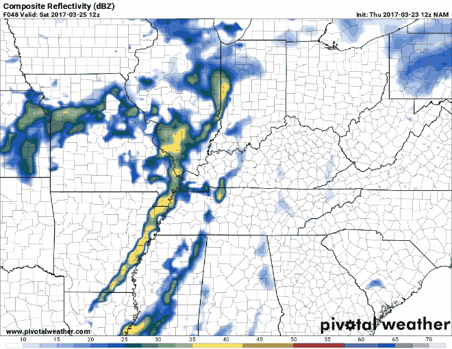
Thursday evening update. Looks like most of the possible severe weather will be west of I-65 for Saturday afternoon into the early evening hours. The following map shows the energy in the atmosphere as it builds up then starts to die down. The EHI model is a combination of two other models, the CAPE and Helicity, it shows where strong or tornadic thunderstorms may develop. Damaging winds and hail look to be the main threats. I'll post another update in the morning.
-
As of now it looks like the rain may hold off until late Saturday night or during the early morning hours on Sunday.
-
For now looks like there maybe some scattered showers during the early afternoon. The main line looks to hold off until the early evening hours maybe after 8 pm EDT.
-
There appears to be a possibility of strong to severe storms on Saturday. Especially in WKY. I'll post more info later today.
-
I wanted to post this disclaimer this morning. As defined by the Oxford dictionary. A meteorologist is, "An expert in or student of meteorology; a weather forecaster." So I want everyone to know I'm a student of meteorology and this is my hobby. During my free time I study what I can about weather forecasting. I do not hold a bachelor's or higher degree in atmospheric science or meteorology from any accredited college or university. Nor do I hold any of the following American Meteorological Society certifications. Certified Broadcast Meteorologist(CBM), Certified Consulting Meteorologist(CCM), or the American Meteorological Society Seal of Approval. I am a registered weather spotter with the NOAA weather office located in Louisville, KY. I have passed this years classes and am now waiting on my new SKYWarn certificate to be sent to me. So I classify myself as an "Amateur Meteorologist". I just don't want any misconceptions that I am passing myself off as a professional holding any degrees or certifications. I do this to try and help people because after the 2009 Ice Storm I swore, to myself, I would never get caught off guard like that again.
-
The southern part of WKY is now in a Slight Risk Area for strong to severe storms this afternoon. The main threats still look to be damaging winds and hail.
-
Our members in western Kentucky should be on the look out for strong to severe storms this afternoon. That part of the state is in a Marginal Risk Area for strong to severe storms. Right now the time period is between 2-8 pm EDT. The main threats look to be damaging winds and hail. I will update on here when possible. Updates through the day on our twitter page.
-
Thank for the compliments.
-
I'm glad you both made it home ok. Right now look for morning temps on Sunday to be in the low to mid 50s with a chance of showers. In around the Cleveland area morning temps in the low to mid 30s and the highs in the mid 30s. With little or no rain chance.
-
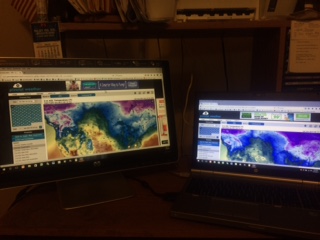
Finally got the following set up going. I now have a monitor hooked up to my laptop so I can look at two different weather models at the same time. On the left is the GFS and on the right the NAM model. Before this I was having to minimize one to look at the other. This should cut down on the time it takes me to read them. I'm happy !! :clap::banana::ylsuper: :clap:
-
[video=youtube;UaEC-lWSlmI]
-
Mom use to tell the story that they all thought something was wrong with Mr. Berry because all he would do in class is right songs. Wouldn't do his school.
-
This is sad to me because my mother went to high school with him. Mr. Berry used to come to my dad's gas station and my father worked on his car.
-
(CNN)Chuck Berry, a musical pioneer often called "the Father of Rock 'n' Roll," was found dead Saturday at a residence outside St. Louis, police in St. Charles County said. Berry, 90, wrote and recorded the rock standards "Johnny B. Goode" and "Sweet Little Sixteen." Chuck Berry, rock 'n' roll pioneer, dead at 9