.png.ffa34568722b20f38e3c3ecfcb9a2cd2.png)

.jpg.f607a105a9049bd28b594967f8dbef8e.jpg)
nWo
-
Posts
25,544 -
Joined
-
Last visited
-
Days Won
1
5 Followers

Recent Profile Visitors
15,226 profile views


-
At least one person was killed and several others were injured when a tornado tore through the community of Westmoreland in Kansas outside of Topeka on Tuesday, April 30, 2024
-
-
-
-
-
-
-
.thumb.jpg.169116dce0817c0c6ec2a84331c97531.jpg) nWo changed their profile photo
nWo changed their profile photo -

-
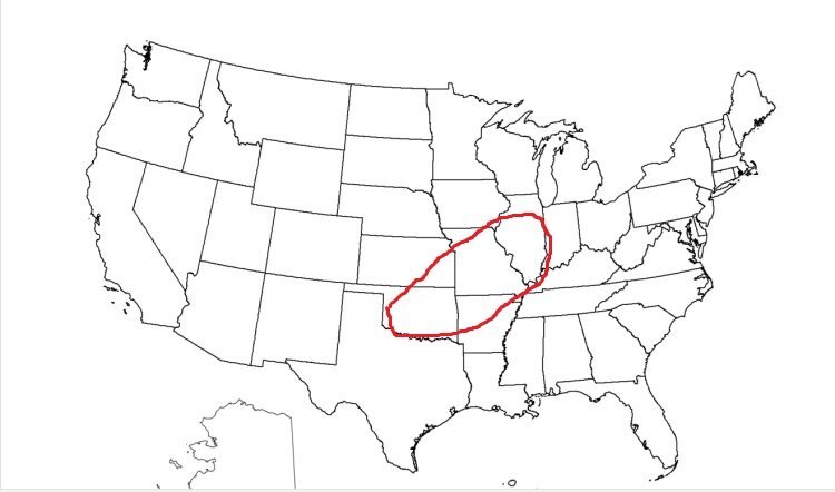
This is the area I'll be watching for tornadoes until around 11 pm EDT tonight.
-
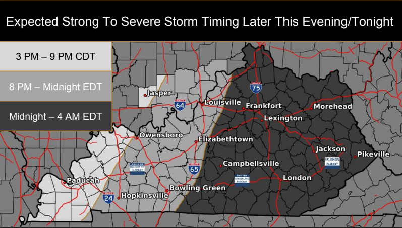
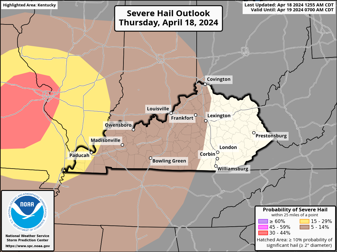
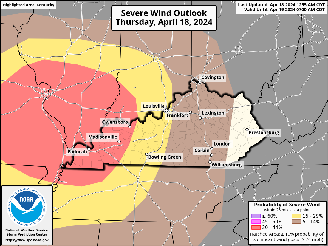
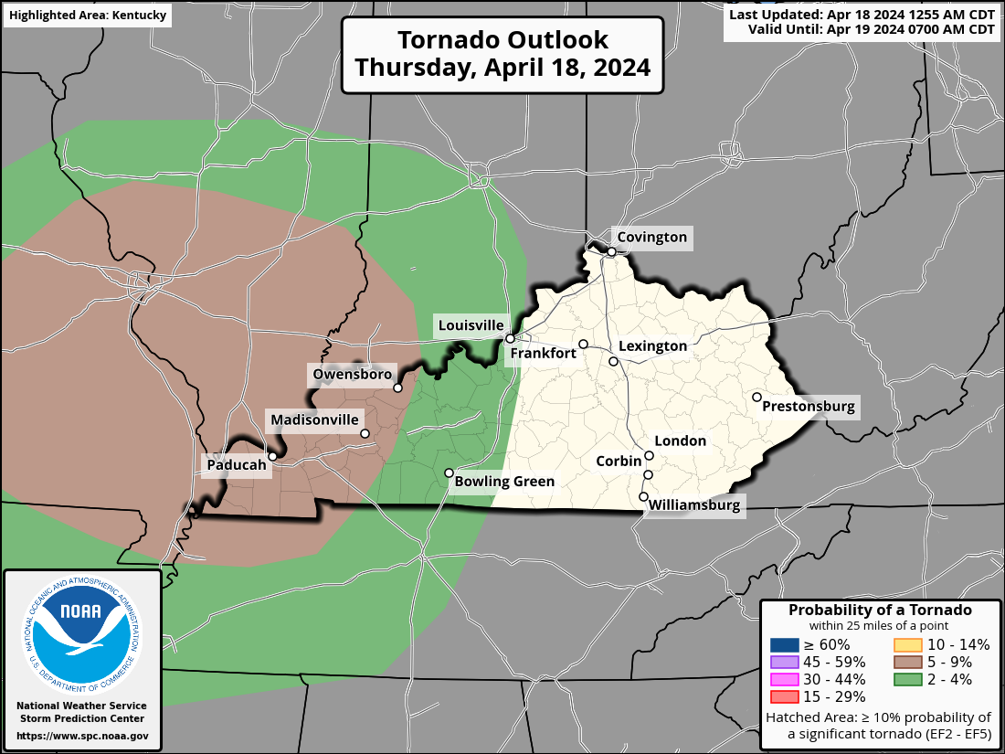
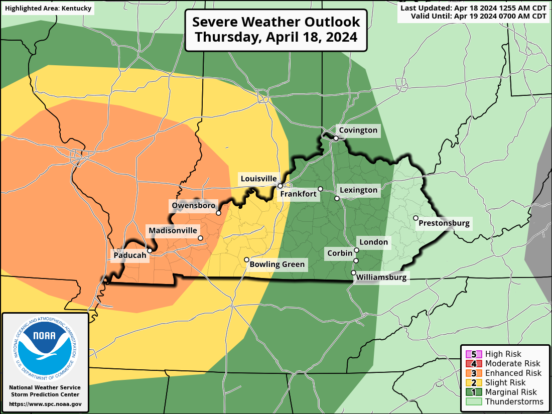
This afternoon and tonight, a line of strong to severe storms with wind damage, sporadic large hail, and a few tornadoes is expected to affect the Ozarks, mid-Mississippi Valley, and lower Ohio Valley. Today, a mid-level jet and upper-level trough will pass through the north-central United States. A cold front will be moving east-southeast into the Ozarks, causing a low to pass over Missouri at the surface. The wet sector will move in ahead of the front by late morning, covering a large portion of central and southern Missouri and spreading eastward into the Mid-Mississippi Valley. Convection in western Missouri will gradually build during the early hours due to surface heating and enhanced wind fields, which will enable storms to form ahead of the front. Eventually, a line of dispersed storms will form and move eastward from the Ozarks into the mid-Mississippi Valley in the middle of the day. By midday, an airmass that is moderately unstable will be in position ahead of the front. At the early stages of the event, when cells are more likely to be discrete, this should be adequate for supercell growth. Supercells will increase the likelihood of large hail. As a practically continuous line of storms develops, wind damage will become probable. While low-level shear is not expected to be very strong, there is a chance of a few QLCS tornadoes, which often form at night, with rotating cells embedded in the line. The line that crosses the Mississippi River and passes through the lower Ohio Valley before spreading eastward into the Mid-Mississippi Valley is expected to provide a serious hazard well into the evening. Improved wind fields and surface heating will enable storms to form ahead of the The Storm Prediction Center has western Kentucky under a level 3 Enhanced Risk for severe storms. An area east of that is under a level 2 Slight Risk Area. This extends to just east of I-65. A level 1 Marginal Risk covers the rest of Kentucky except for eastern Kentucky.
-
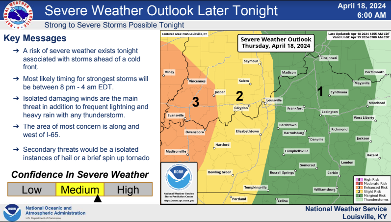
Due to the low, taking a more northerly track, the forecast for later this evening and overnight remains pretty much the same. Showers and thunderstorms are expected, however, the threat of any severe weather will remain low. For Wednesday, the main focus for severe storm potential has shifted north, primarily into Ohio. I still can't rule out isolated severe storms Wednesday afternoon in southern Indiana and central Kentucky, but confidence is low. Another round of strong to severe storms may occur on Thursday night ahead of a cold front. We'll have to watch this one as well.
-
The forecast for later this evening and overnight remains pretty much the same. Showers and thunderstorms are expected, however, the threat of any severe weather will remain low due to a stable layer near the surface. Some notable changes to the Wednesday forecast have lowered confidence in whether we will see strong to severe storms. 1.) The main focus for the best chance of severe weather has shifted northward to along and north of the Ohio River for Wednesday. 2.) A capping inversion may limit storms from firing at all on Wednesday, thus hurting confidence. It is very important to note that if the cap does not hold, then any storm that does develop could still turn strong to severe. So, we can't let our guard down just yet for Wednesday. The Storm Prediction Center has kept KY in a Marginal risk, with southern IN still in the Slight Risk. Stay up-to-date with the latest forecasts. Another round of strong to severe storms may occur on Thursday night ahead of a cold front. We'll have to watch this one as well.