.png.ffa34568722b20f38e3c3ecfcb9a2cd2.png)


nWo
-
Posts
25,547 -
Joined
-
Last visited
-
Days Won
1
5 Followers

Recent Profile Visitors
15,552 profile views


-
 nWo changed their profile photo
 -
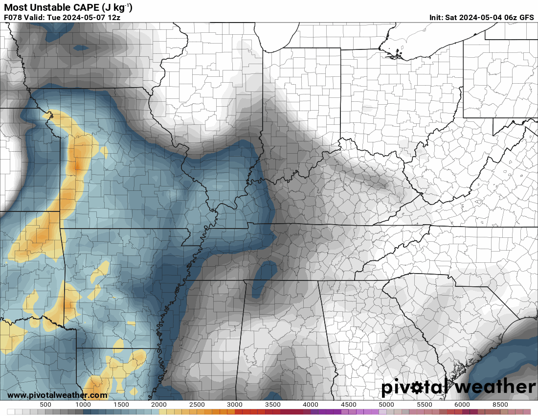
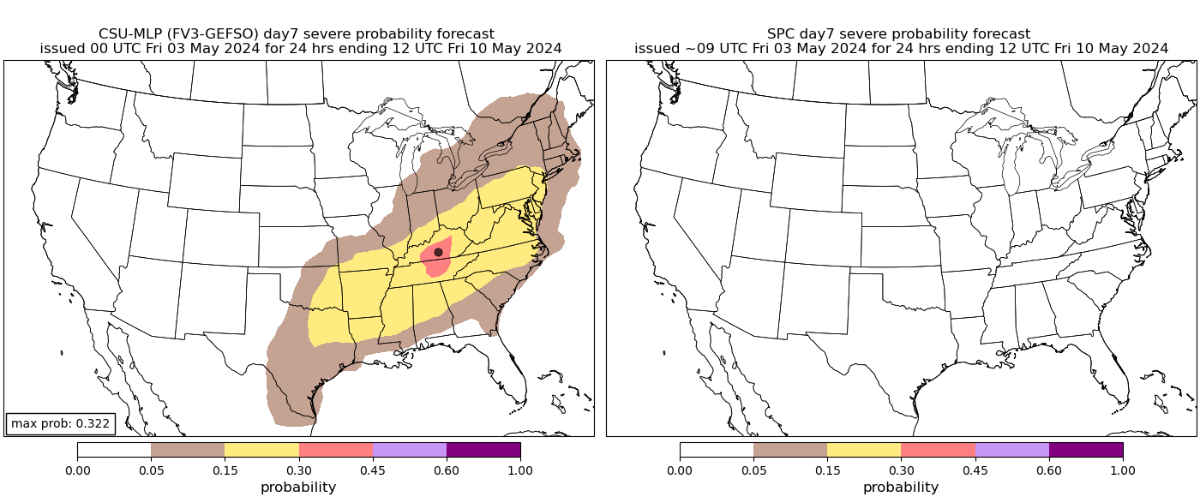
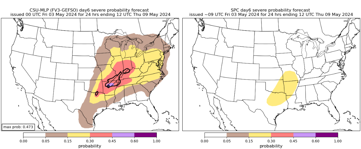
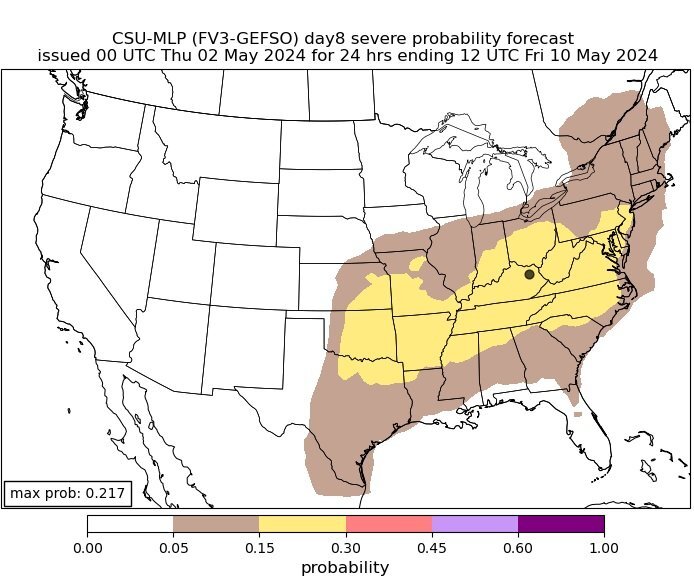
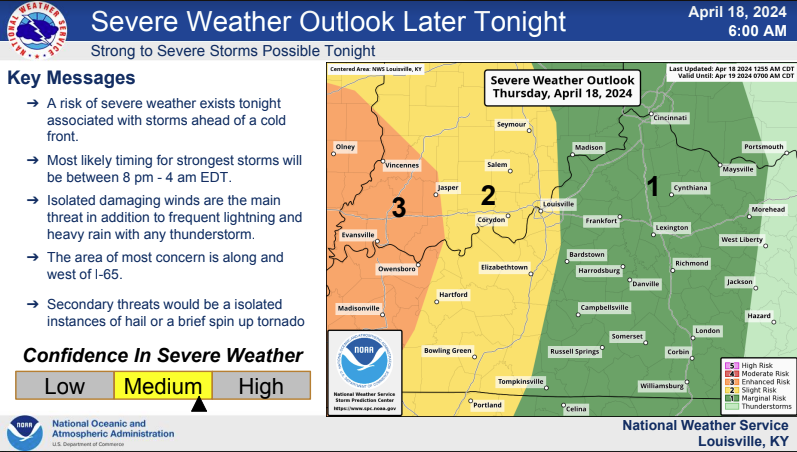
Around midweek, the elements are beginning to assemble for what might be a multi-day severe weather event. It is possible that Kentucky may experience severe weather beginning on Tuesday and continuing intermittently until Thursday night. I want to display the mid-level winds (about 18,000 feet) first. The winds at this altitude are represented by the purple hues. The wind speed increases with the depth of color. This will enable moisture from the Pacific and the Gulf to be drawn into our region. The uplift will be along this trough's leading edge, which will facilitate the development of storms. Particularly on Wednesday, the dew points can be in the low seventies. The potential energy in the atmosphere for storm formation is displayed on the Must Unstable Cape map. That is, if convection occurs in those areas. The Storm Prediction Center has a 15% area in days 4 and 5 Convection Outlooks. This is equal to a level 2 Slight Risk condition. Tuesday Wednesday The Colorado State University Severe Probability Map is showing a 30% chance in the same area for day 4 from the Storm Prediction Center. This covers all of WKY and along the Ohio River area to the Cincinnati/NKY area. The day 5 map for Wednesday from CSU shows a 45% chance in the area the Storm Prediction Center shows a 15% chance. The Louisville This includes the same area as on Wednesday but is expanded eastward to include much of Kentucky except for EKY and SEKY. It is really almost impossible to show the precipitation map this early because we are still a little too far in the future. Check back for updates.

-
The most recent maps are available here. About a week remains till this potentially multi-day storm occurs. These are the predicted maps as of late. The Storm Prediction Center's maps of the likelihood of severe weather are placed next to them. Day 5 for Wednesday 5/8/24 Day 6 for Thursday 5/9/24 Day 7 5/10/24
-
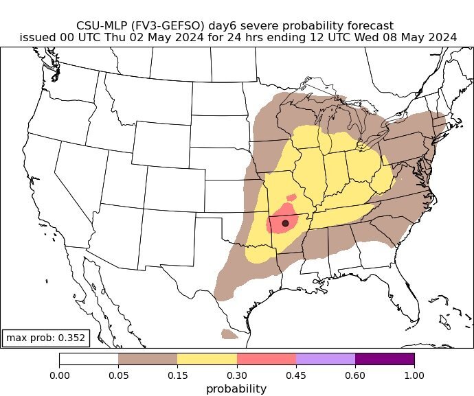
We could see some severe weather in Kentucky starting around midweek. Right now, May 9th seems to be the best opportunity, as the bullseye is located in NKY. The Colorado State University MLP prediction page is where I got the forecast maps I am sharing. A week prior to the catastrophic weather outbreak of last week, this is what the page was displaying. You can see that it was largely accurate. This is what it is showing for possible severe weather in Kentucky next week starting on May 6th and continuing until the 8th. This is for Thursday, May 9th. Everyone can see the bullseye is centered in NKY. It is prediction a 30 to 45% chance for severe weather. This is pretty high this far in advance. I will be watching this possible situation and posting updates as we get closer.
-
At least one person was killed and several others were injured when a tornado tore through the community of Westmoreland in Kansas outside of Topeka on Tuesday, April 30, 2024
-
-
-
-
-
-
-
-
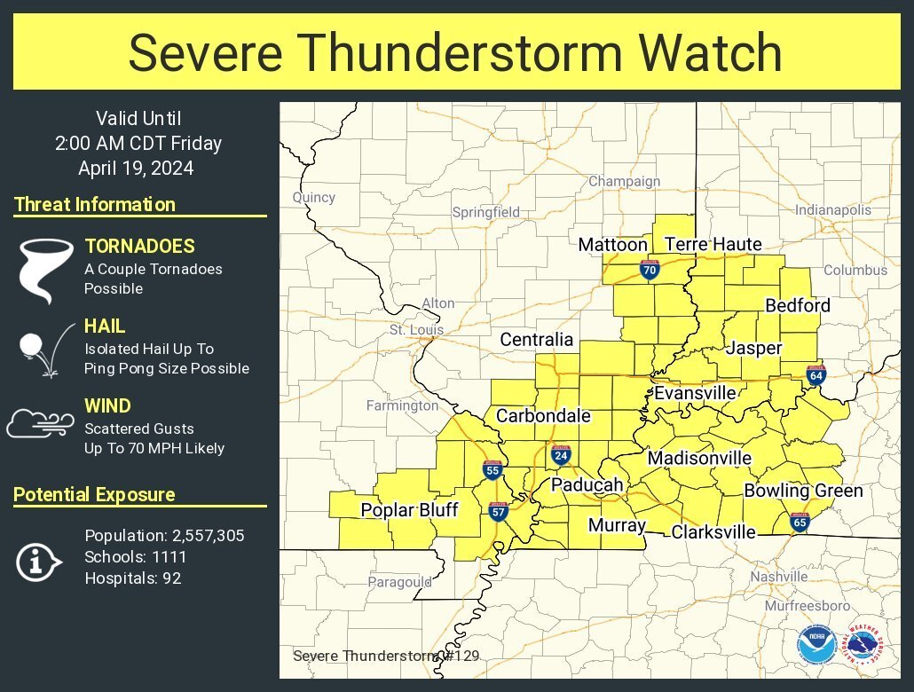
This is the area I'll be watching for tornadoes until around 11 pm EDT tonight.