.png.ffa34568722b20f38e3c3ecfcb9a2cd2.png)

.jpg.dff87640c6ed93f4bdf8eebdf96f5dec.jpg)
nWo
-
Posts
25,624 -
Joined
-
Last visited
-
Days Won
4
5 Followers

Recent Profile Visitors
17,751 profile views


-
I forgot to mention that it was coming in from Vegas that's why it ran short of fuel.
-
Mine circled in that area northeast of Lexington then it had to divert to Huntington for fuel.
-
I just received a message from my daughter that she thought it was a tornado because it sounded like one.
-
The damage near my daughter's house has been rated, at least EF-1 by the NWS-Louisville office.

-
The survey in Northern Warren County is close to where Plum Springs is.
-
Damage at my daughter's house. She lives in Plum Springs.
-
My daughter sent me these pictures of damage near Plum Springs, which is just north of Bowling Green.
-
.thumb.jpg.dc448957daf4ddf2823660190e844abb.jpg) nWo changed their profile photo
nWo changed their profile photo -
Everyone be safe! We finally made it to Vegas.
-
They were circling around around cynthia eky and the like trying to wait out the storm and started running low on fuel.
-
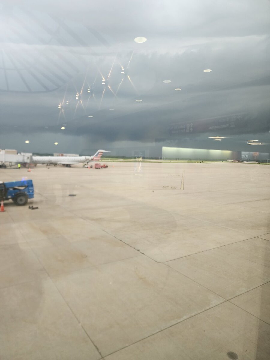
I'm sitting at bluegrass field. The second round of storms will start around 8 pm edt. Round #1 is over. ➔ Round #2 will begin around 8pm ET (7pm CT). ◆ Individual storms will develop over Western Kentucky and southern Indiana and congeal into a line moving southeast through the region. ➔ Expecting widespread damaging winds, spin-up tornadoes and hail. ➔ Flash flooding, especially over south-central Kentucky. Another 1-3 inches of rainfall, with locally higher amounts possible.
-
Las Vegas, our plane had to divert to Huntington to refuel. First time we've flown Allegiant the gate attends are great!
-
Our flight has been delayed. May be 1 1/2 hours.
-
-
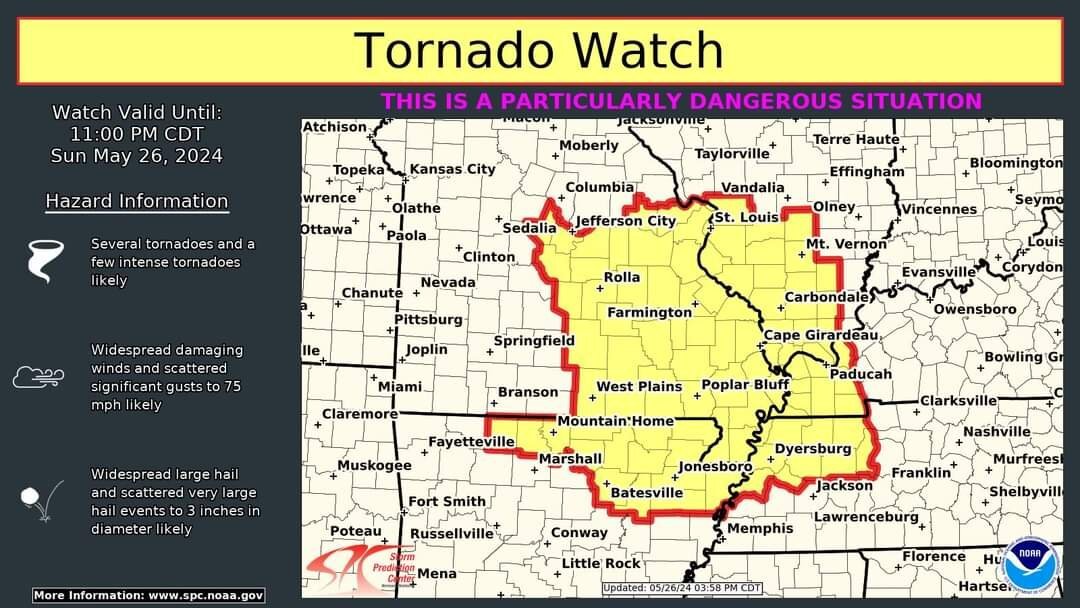
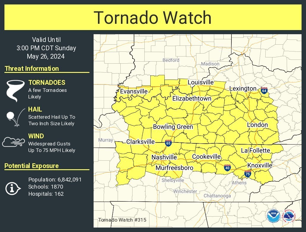
URGENT - IMMEDIATE BROADCAST REQUESTED Tornado Watch Number 315 NWS Storm Prediction Center Norman OK 855 AM CDT Sun May 26 2024 The NWS Storm Prediction Center has issued a * Tornado Watch for portions of Southern Indiana Western and Central Kentucky Western and Middle Tennessee * Effective this Sunday morning and afternoon from 855 AM until 300 PM CDT. * Primary threats include... A few tornadoes likely with a couple intense tornadoes possible Widespread damaging winds and isolated significant gusts to 75 mph likely Scattered large hail and isolated very large hail events to 2 inches in diameter likely SUMMARY...A bowing complex of severe thunderstorms will continue moving rapidly east, with widespread damaging winds likely. Some gusts may exceed 75 mph. A few tornadoes are also possible. The tornado watch area is approximately along and 80 statute miles north and south of a line from 10 miles northwest of Fort Campbell KY to 40 miles south southeast of London KY. For a complete depiction of the watch see the associated watch outline update (WOUS64 KWNS WOU5). PRECAUTIONARY/PREPAREDNESS ACTIONS... REMEMBER...A Tornado Watch means conditions are favorable for tornadoes and severe thunderstorms in and close to the watch area. Persons in these areas should be on the lookout for threatening weather conditions and listen for later statements and possible warnings.