.png.ffa34568722b20f38e3c3ecfcb9a2cd2.png)

.jpg.f607a105a9049bd28b594967f8dbef8e.jpg)
nWo
-
Posts
25,546 -
Joined
-
Last visited
-
Days Won
1
5 Followers

Recent Profile Visitors
15,324 profile views


-
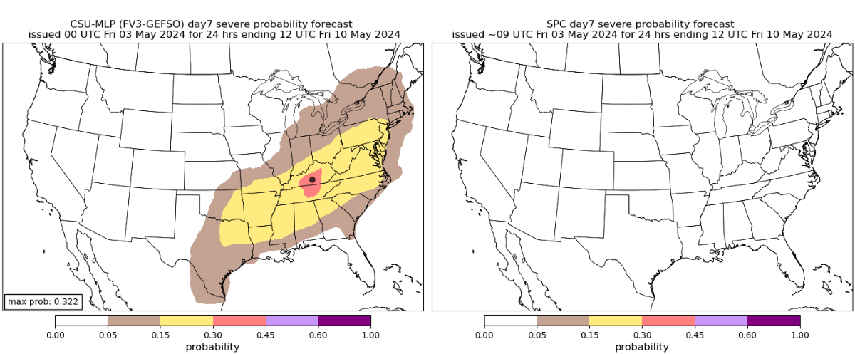
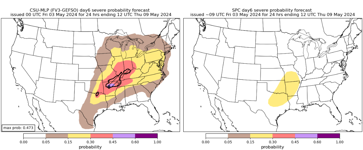
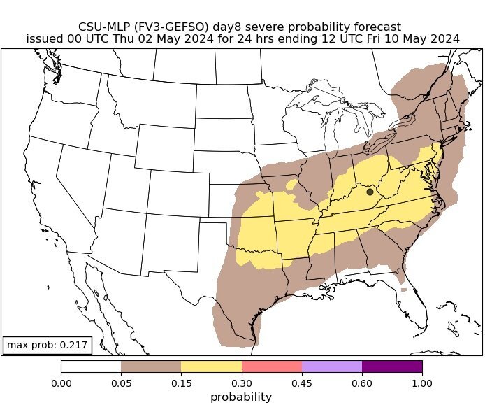
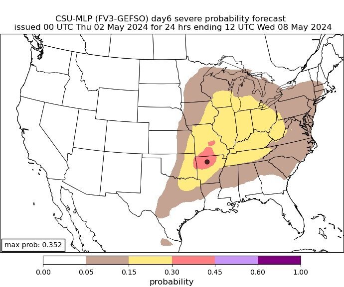
The most recent maps are available here. About a week remains till this potentially multi-day storm occurs. These are the predicted maps as of late. The Storm Prediction Center's maps of the likelihood of severe weather are placed next to them. Day 5 for Wednesday 5/8/24 Day 6 for Thursday 5/9/24 Day 7 5/10/24

-
We could see some severe weather in Kentucky starting around midweek. Right now, May 9th seems to be the best opportunity, as the bullseye is located in NKY. The Colorado State University MLP prediction page is where I got the forecast maps I am sharing. A week prior to the catastrophic weather outbreak of last week, this is what the page was displaying. You can see that it was largely accurate. This is what it is showing for possible severe weather in Kentucky next week starting on May 6th and continuing until the 8th. This is for Thursday, May 9th. Everyone can see the bullseye is centered in NKY. It is prediction a 30 to 45% chance for severe weather. This is pretty high this far in advance. I will be watching this possible situation and posting updates as we get closer.
-
At least one person was killed and several others were injured when a tornado tore through the community of Westmoreland in Kansas outside of Topeka on Tuesday, April 30, 2024
-
-
-
-
-
-
-
.thumb.jpg.169116dce0817c0c6ec2a84331c97531.jpg) nWo changed their profile photo
nWo changed their profile photo -
-
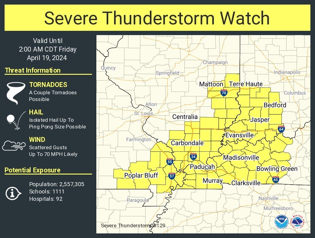
This is the area I'll be watching for tornadoes until around 11 pm EDT tonight.
-
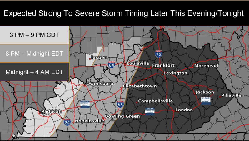
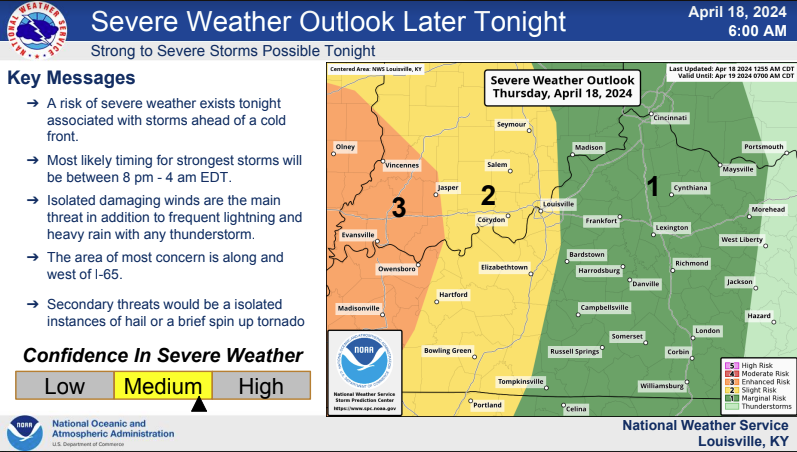
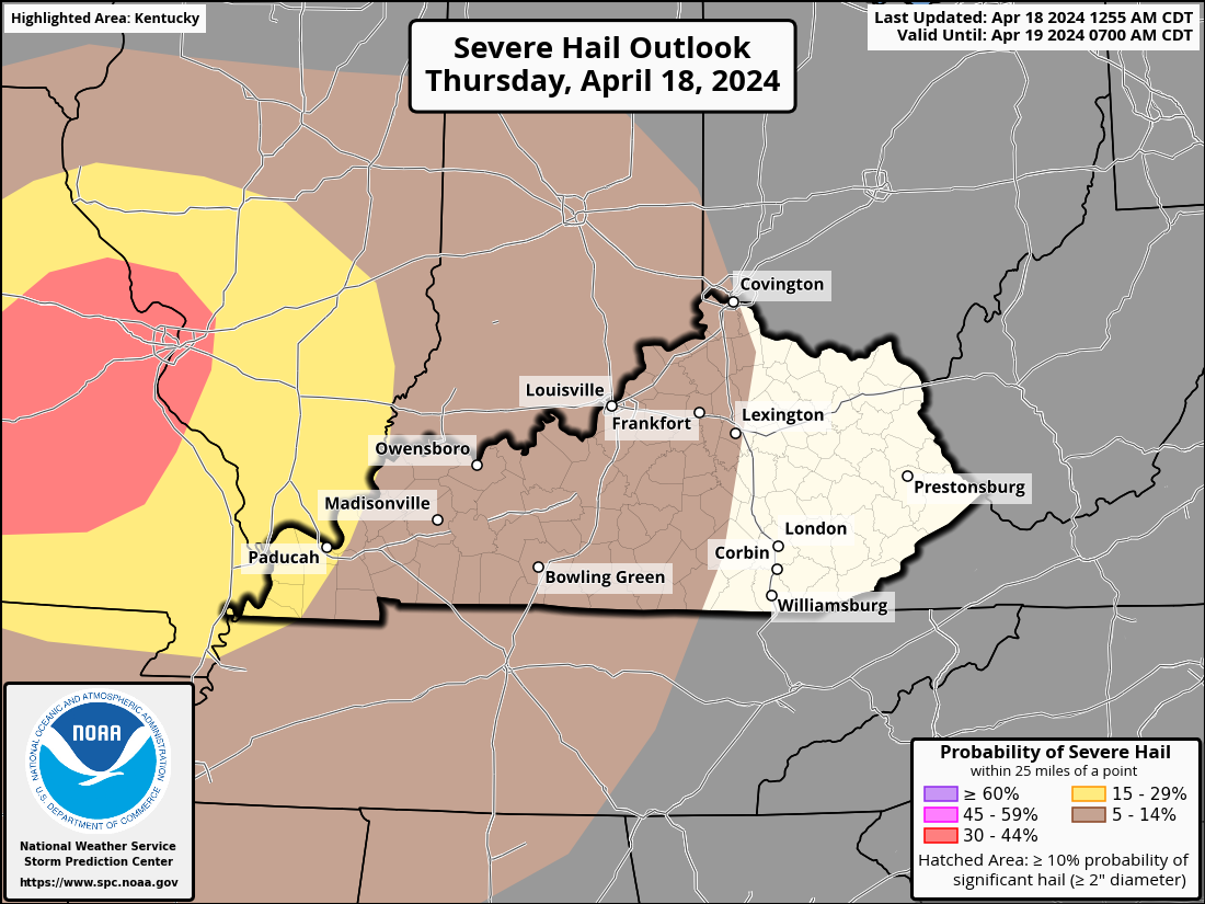
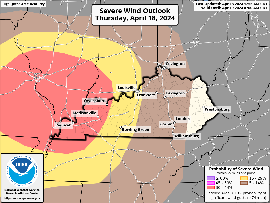
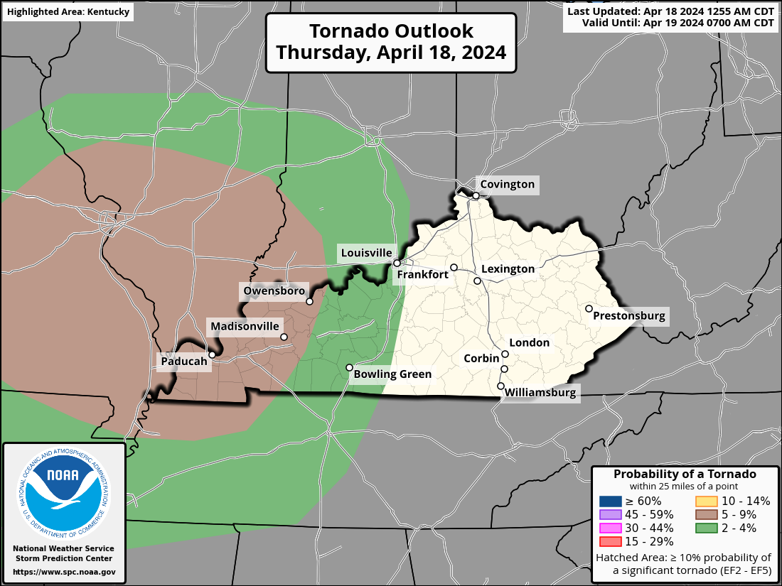
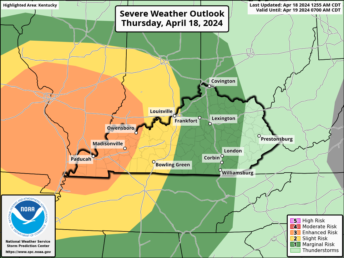
This afternoon and tonight, a line of strong to severe storms with wind damage, sporadic large hail, and a few tornadoes is expected to affect the Ozarks, mid-Mississippi Valley, and lower Ohio Valley. Today, a mid-level jet and upper-level trough will pass through the north-central United States. A cold front will be moving east-southeast into the Ozarks, causing a low to pass over Missouri at the surface. The wet sector will move in ahead of the front by late morning, covering a large portion of central and southern Missouri and spreading eastward into the Mid-Mississippi Valley. Convection in western Missouri will gradually build during the early hours due to surface heating and enhanced wind fields, which will enable storms to form ahead of the front. Eventually, a line of dispersed storms will form and move eastward from the Ozarks into the mid-Mississippi Valley in the middle of the day. By midday, an airmass that is moderately unstable will be in position ahead of the front. At the early stages of the event, when cells are more likely to be discrete, this should be adequate for supercell growth. Supercells will increase the likelihood of large hail. As a practically continuous line of storms develops, wind damage will become probable. While low-level shear is not expected to be very strong, there is a chance of a few QLCS tornadoes, which often form at night, with rotating cells embedded in the line. The line that crosses the Mississippi River and passes through the lower Ohio Valley before spreading eastward into the Mid-Mississippi Valley is expected to provide a serious hazard well into the evening. Improved wind fields and surface heating will enable storms to form ahead of the The Storm Prediction Center has western Kentucky under a level 3 Enhanced Risk for severe storms. An area east of that is under a level 2 Slight Risk Area. This extends to just east of I-65. A level 1 Marginal Risk covers the rest of Kentucky except for eastern Kentucky.