.png.ffa34568722b20f38e3c3ecfcb9a2cd2.png)

.jpg.67ca52c6df25163f3af009c91bda1717.jpg)
nWo
-
Posts
25,586 -
Joined
-
Last visited
-
Days Won
2
Everything posted by nWo
-
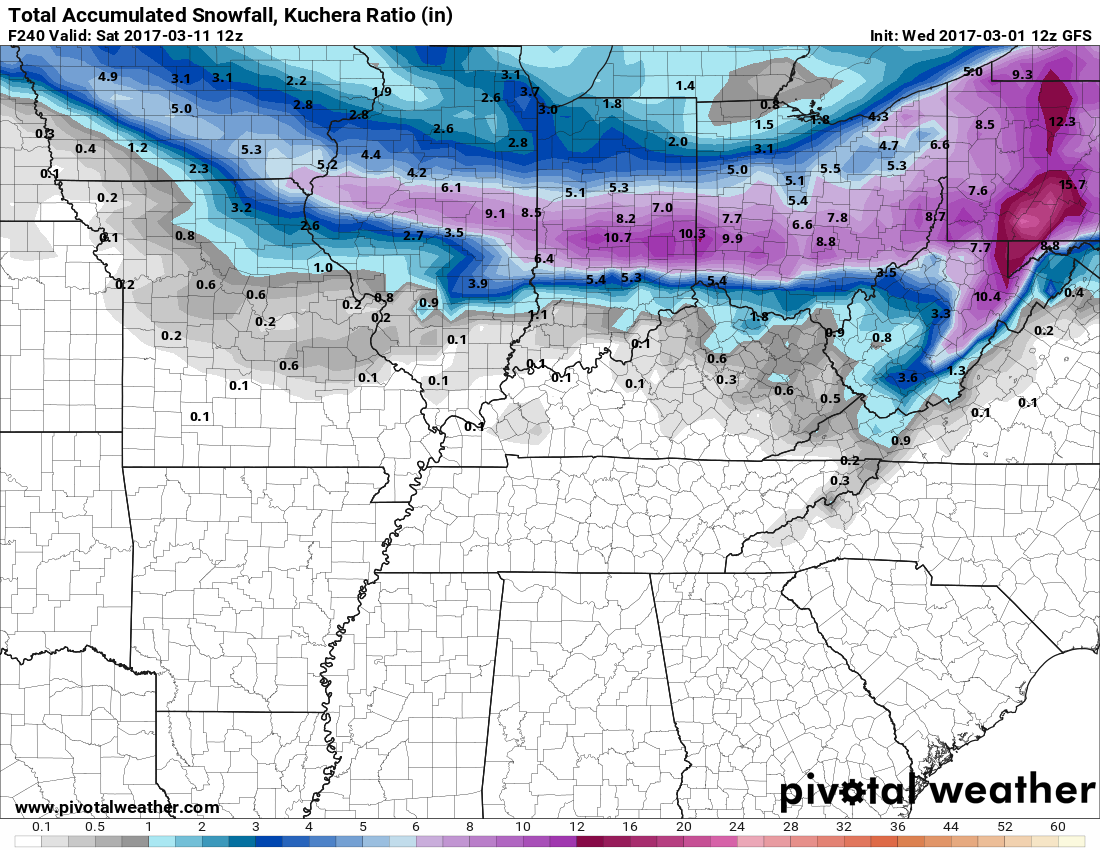
By Saturday March 11 now this doesn't mean we'll see that just a snapshot in time. Yep!!
-
Just putting it out there. Nothing definite yet.

-
I'm happy it wasn't as bad as it could have been. This was the first time I was nervous looking at the weather models.
-
Yep!!
-
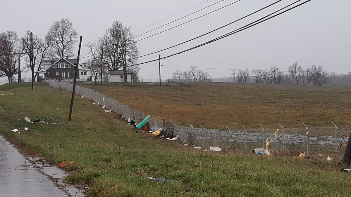
At the corner of US 25 and Duncannon Lane. I was told about 30 ft of the roof at Gil factory was torn off.
-
For the most part yes. There maybe some scattered showers and storms that fire up this afternoon but I don't think anything severe will pop up.
-
We may have had a brief tornado touchdown here in Richmond over on Ducannon Lane. A guy who used to work with me called his sister here at work and told her he saw it. There was some damage to some of the factories over there but I don't think there were any major injuries.
-
-
-
Flash Flood Warning Ft. Thomas Area!!
-
Also for WKY
-
-
-
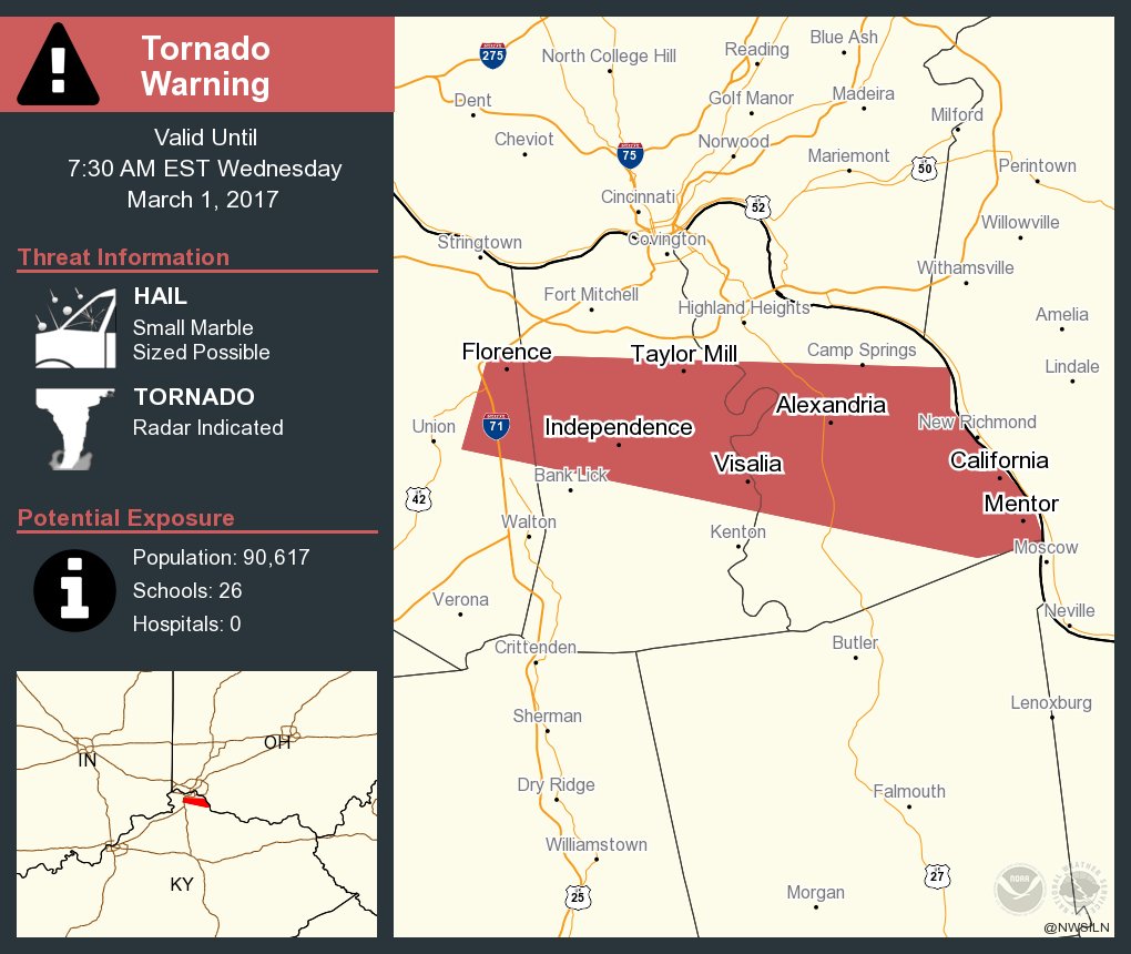
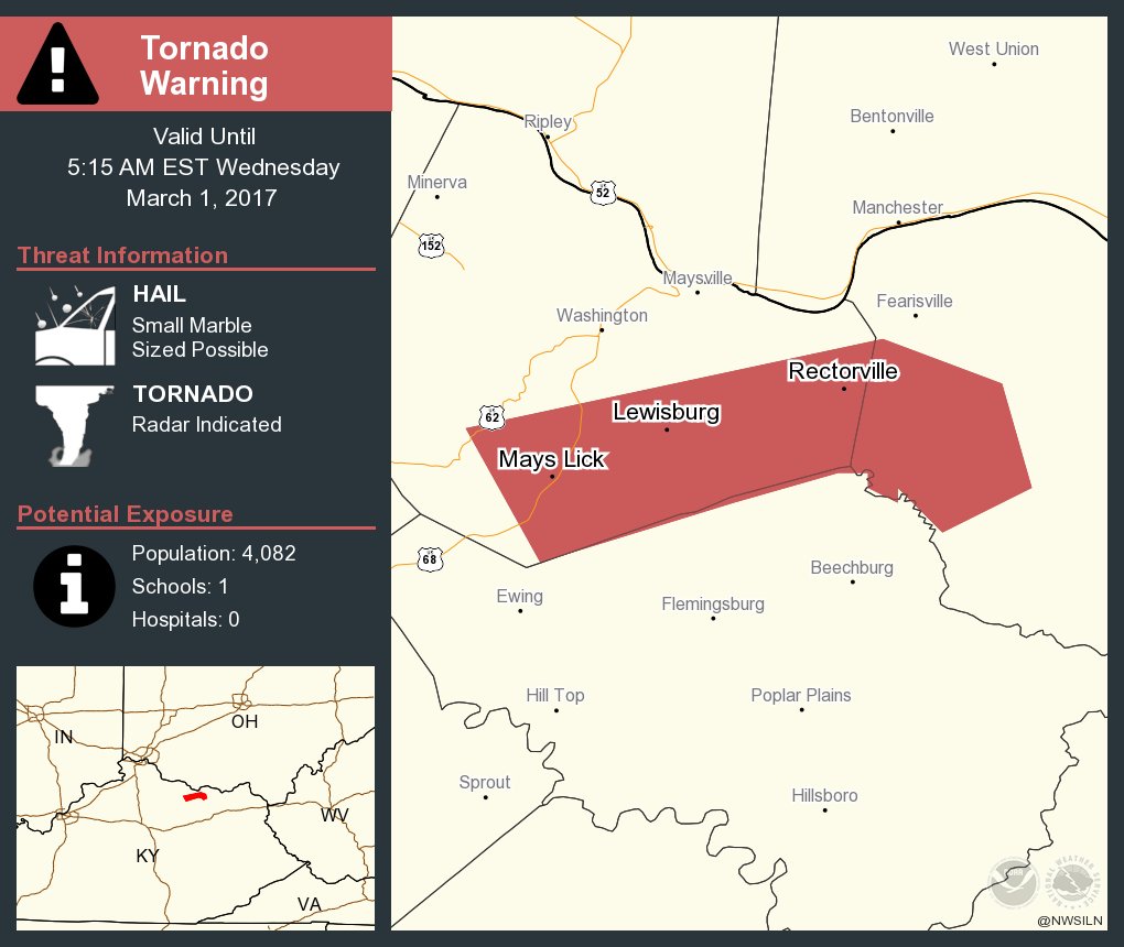
Tornado Warning Mays Lick, Ky area.
-
There are several apps you could get: Weather Channel WeatherBug Weather Nation Local broadcast TV channels
-
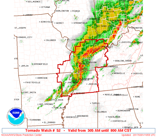
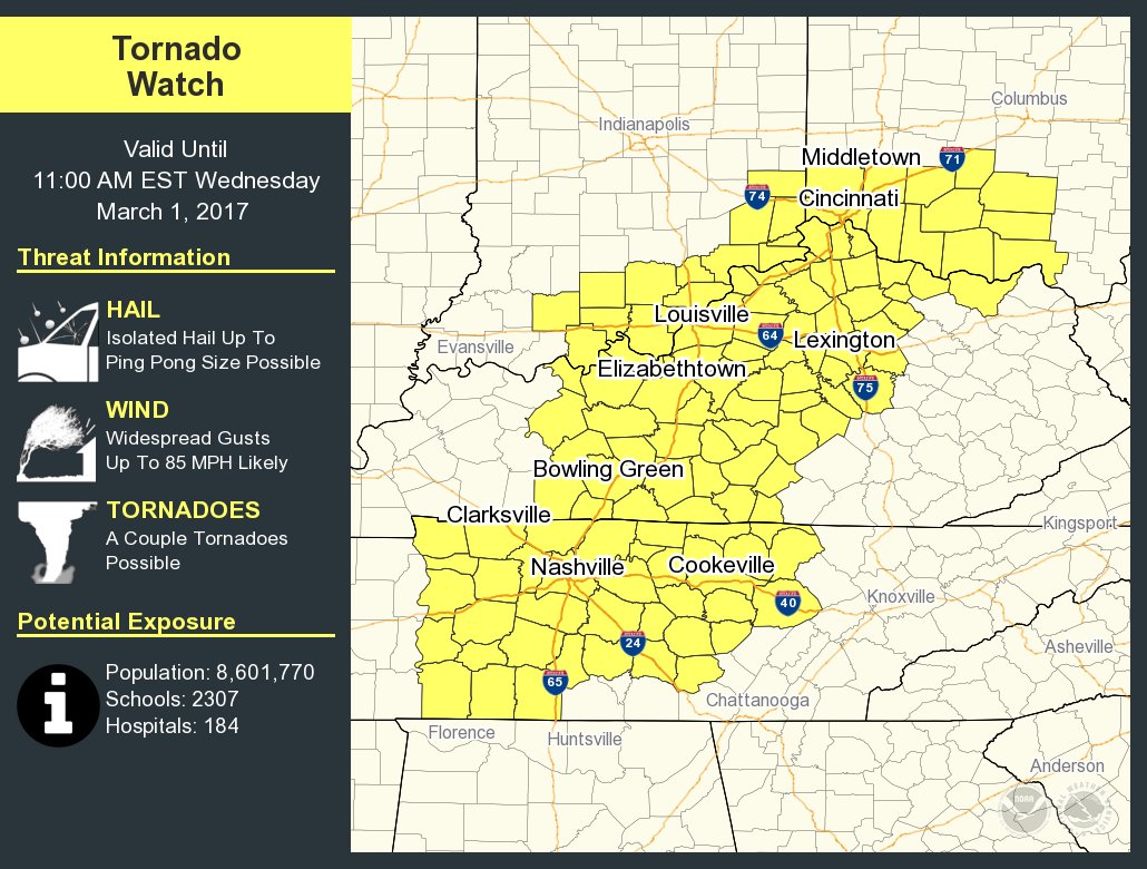
Tornado Watch for WKY just extended till 8 AM EST
-
7:50 am to 4:30 pm
-
There should be another round coming around 7 am or so.
-
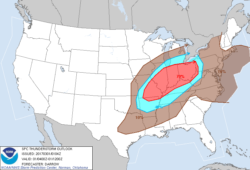
New Thunderstorm Outlook map for from 11 pm to 7 am EST.
-
Be careful tonight.
-
I agree
-
Tornado Watch maybe issued soon for parts of western Kentucky.
-
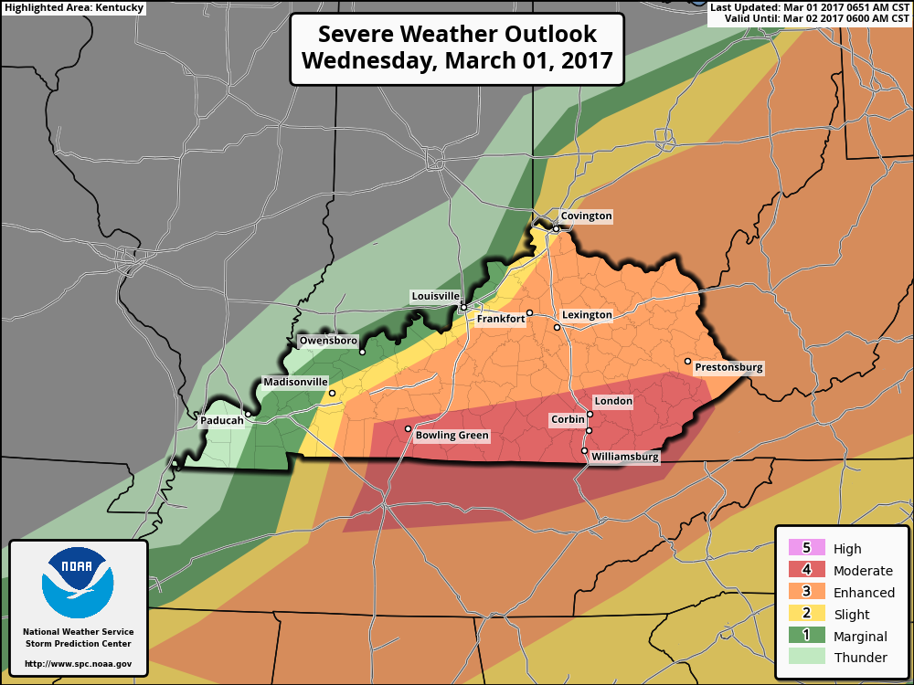
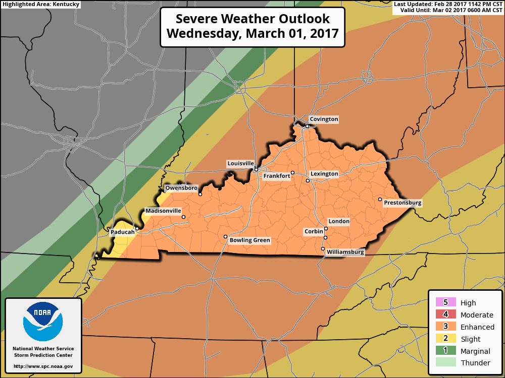
I just received this in a email from Joe Sullivan-Warning Coordinator Meteorologist NWS-Louisville. This is the office I'm registered with as a weather spotter. http://www.weather.gov/media/lmk/briefing/Feb282017/SvrWx02282017_330pm.pdf
-
No you did feel that. That is the warm moist air that is to move in before the cold front comes through that will cause the severe weather later tonight and Wednesday morning.
-
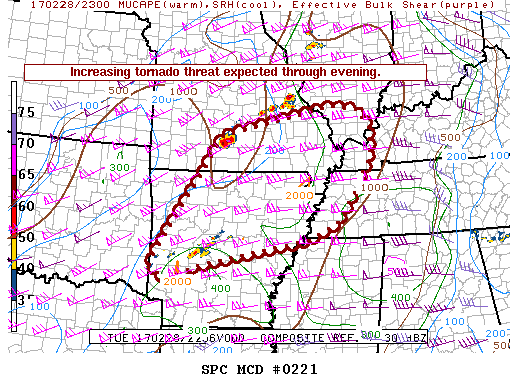
I know what you mean. I've had this nervous feeling all day about the weather that I've never had before. Be careful Tornado Watches are up in Missouri and Illinois right now.
.thumb.jpg.d475a671bdc851f901dea439c04b8f9d.jpg)