.png.ffa34568722b20f38e3c3ecfcb9a2cd2.png)


TheDeuce
-
Posts
52,209 -
Joined
-
Last visited
-
Days Won
131
Recent Profile Visitors
60,239 profile views


-
Missed this, but yes, it wasn’t bad here at all. Thanks for asking!
-
-
-
Main line getting ready to head into Louisville Metro.
-
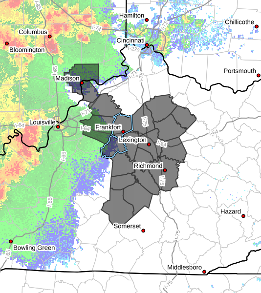
THE NATIONAL WEATHER SERVICE HAS ISSUED TORNADO WATCH 327 IN EFFECT UNTIL 6 AM EDT MONDAY FOR THE FOLLOWING AREAS IN INDIANA THIS WATCH INCLUDES 1 COUNTY IN SOUTH CENTRAL INDIANA JEFFERSON IN KENTUCKY THIS WATCH INCLUDES 19 COUNTIES IN CENTRAL KENTUCKY ANDERSON BOURBON BOYLE CASEY CLARK FAYETTE FRANKLIN GARRARD HARRISON HENRY JESSAMINE LINCOLN MADISON MERCER NICHOLAS SCOTT SHELBY TRIMBLE WOODFORD

-
We are transitioning to a more linear risk for severe weather. Extremely gusty, potentially damaging winds, torrential rain and spin up tornadoes.
-
Thankfully, that supercell that has been producing a large damaging tornado is beginning to be overtaken by the mainline which should drastically reduce the tornado potential. The last few scans have shown a significant decrease in the rotation.
-
-
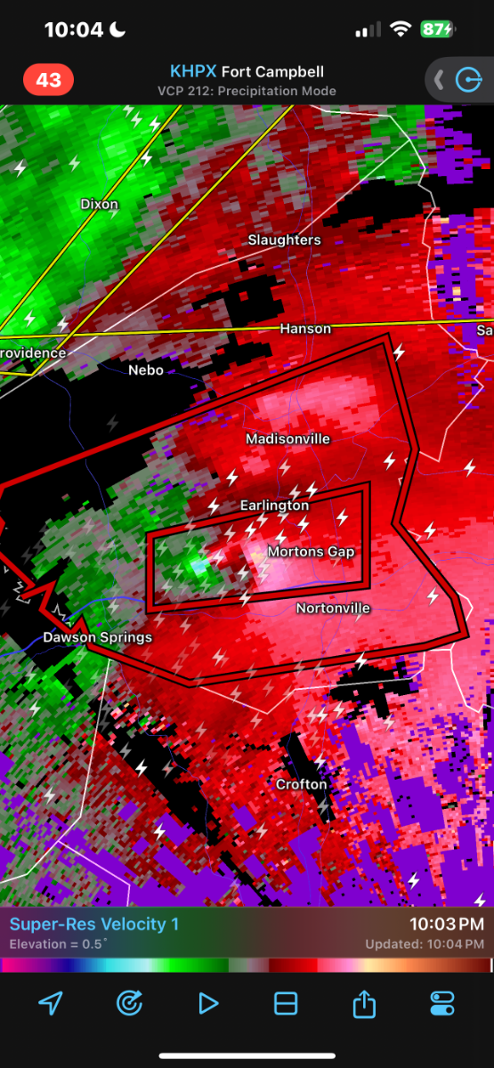
Still a monster tornado on the ground bearing down on Morton’s Gap, just south of Madisonville.
-
-
-
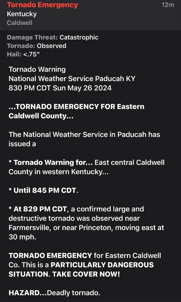
Debris being detected 30,000 feet in the air on the tornado near Dawson Springs… That would indicate an EF-3 tornado or stronger.
-
-
-
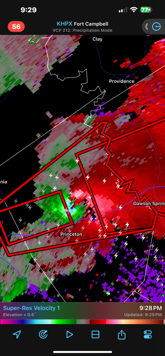
This is not good at all. Disturbing velocity signature on this storm just north of Princeton.