.png.ffa34568722b20f38e3c3ecfcb9a2cd2.png)

.jpg.f607a105a9049bd28b594967f8dbef8e.jpg)
nWo
-
Posts
25,535 -
Joined
-
Last visited
-
Days Won
1
Posts posted by nWo
-
-
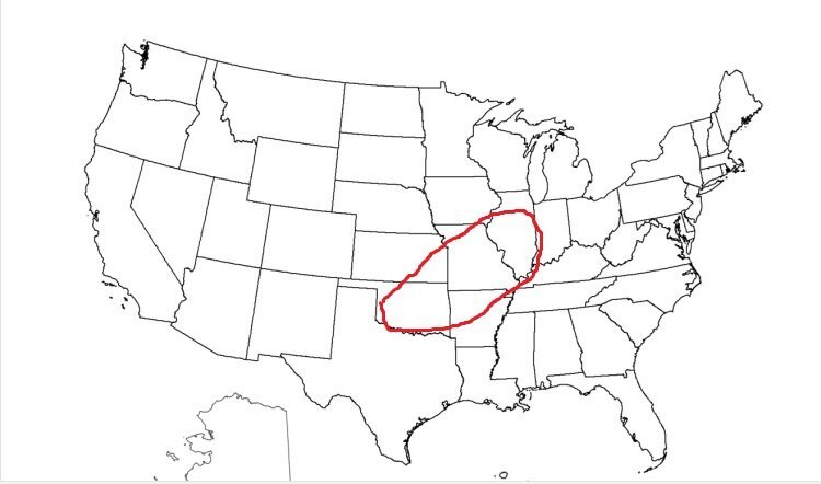
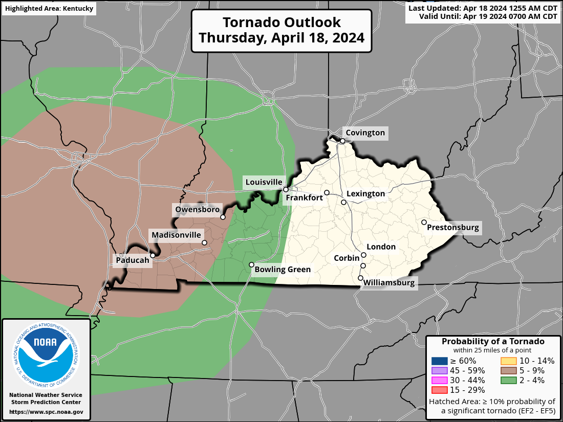
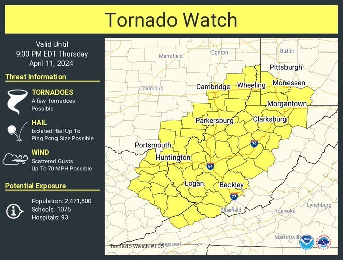
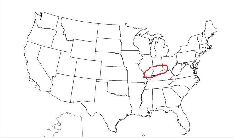
This is the area I'll be watching for tornadoes until around 11 pm EDT tonight.

-
-
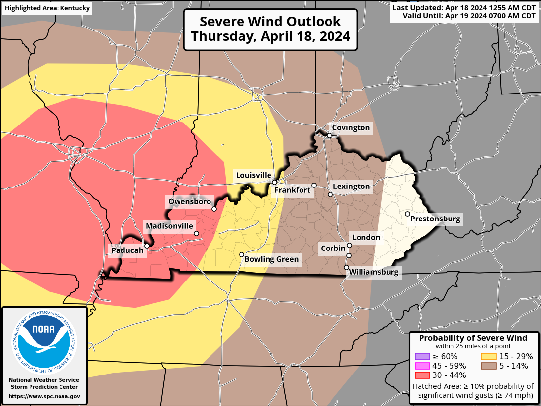
This afternoon and tonight, a line of strong to severe storms with wind damage, sporadic large hail, and a few tornadoes is expected to affect the Ozarks, mid-Mississippi Valley, and lower Ohio Valley.
Today, a mid-level jet and upper-level trough will pass through the north-central United States. A cold front will be moving east-southeast into the Ozarks, causing a low to pass over Missouri at the surface. The wet sector will move in ahead of the front by late morning, covering a large portion of central and southern Missouri and spreading eastward into the Mid-Mississippi Valley. Convection in western Missouri will gradually build during the early hours due to surface heating and enhanced wind fields, which will enable storms to form ahead of the front. Eventually, a line of dispersed storms will form and move eastward from the Ozarks into the mid-Mississippi Valley in the middle of the day.
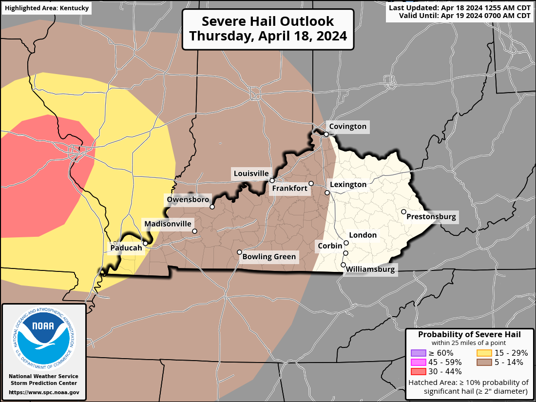
By midday, an airmass that is moderately unstable will be in position ahead of the front. At the early stages of the event, when cells are more likely to be discrete, this should be adequate for supercell growth. Supercells will increase the likelihood of large hail. As a practically continuous line of storms develops, wind damage will become probable. While low-level shear is not expected to be very strong, there is a chance of a few QLCS tornadoes, which often form at night, with rotating cells embedded in the line. The line that crosses the Mississippi River and passes through the lower Ohio Valley before spreading eastward into the Mid-Mississippi Valley is expected to provide a serious hazard well into the evening. Improved wind fields and surface heating will enable storms to form ahead of the
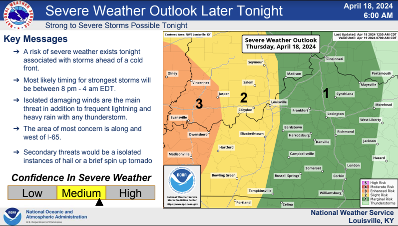
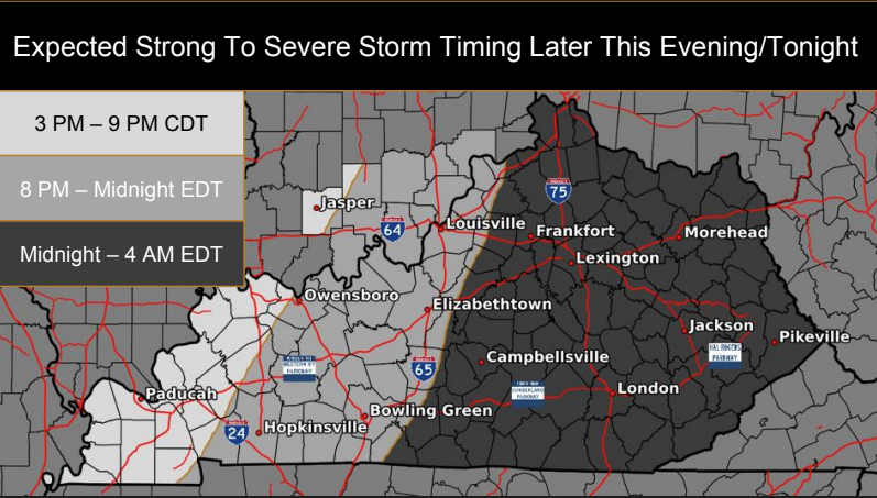
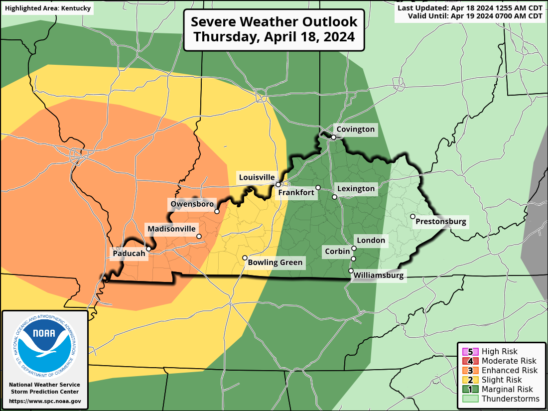
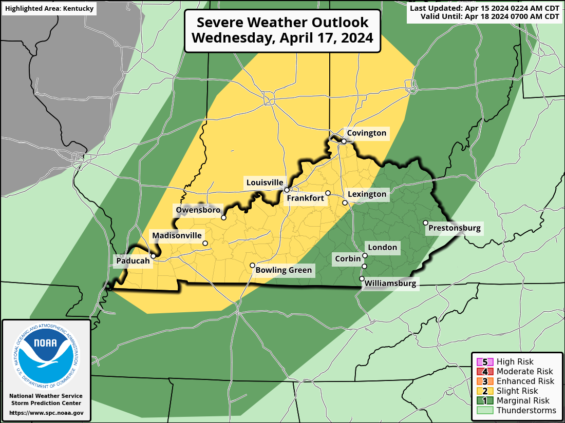
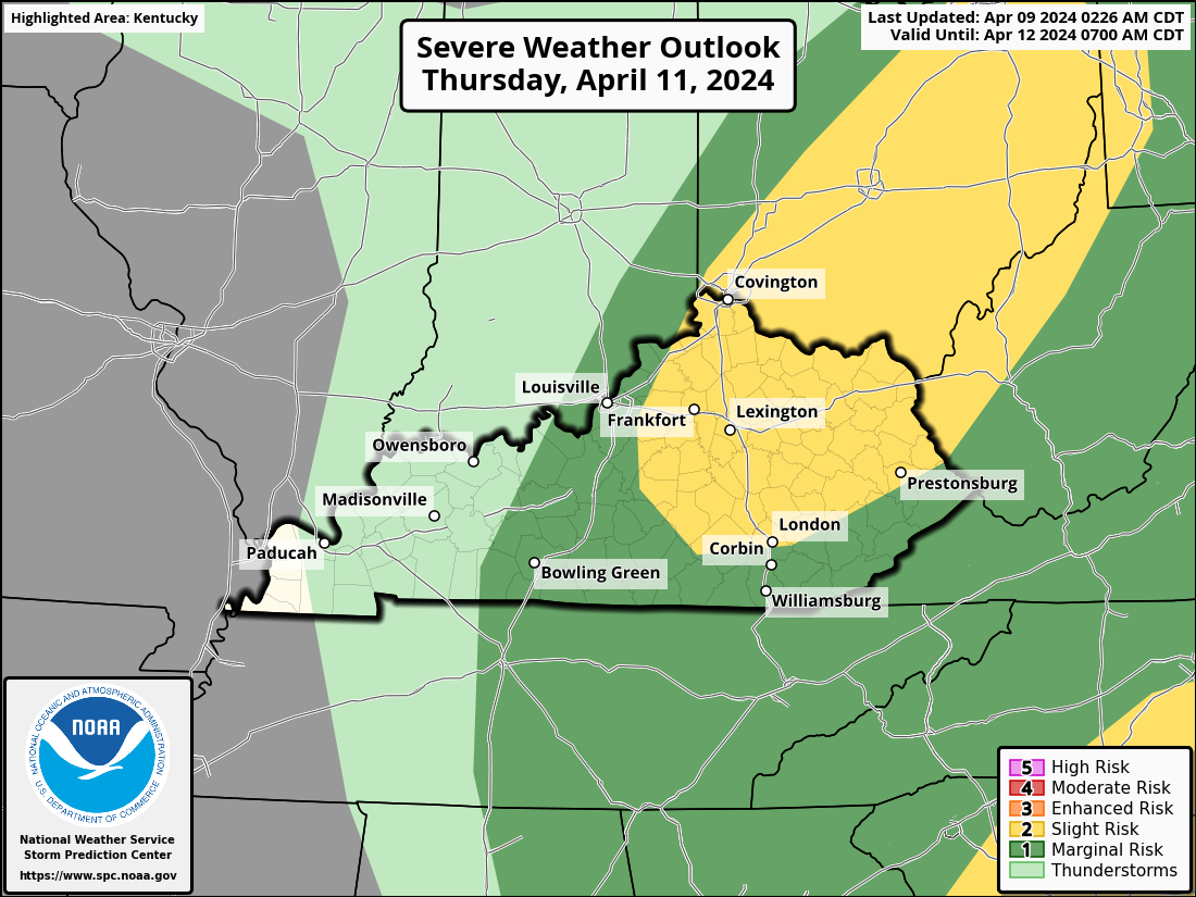
The Storm Prediction Center has western Kentucky under a level 3 Enhanced Risk for severe storms. An area east of that is under a level 2 Slight Risk Area. This extends to just east of I-65. A level 1 Marginal Risk covers the rest of Kentucky except for eastern Kentucky.

-
Due to the low, taking a more northerly track, the forecast for later this evening and overnight remains pretty much the same. Showers and thunderstorms are expected, however, the threat of any severe weather will remain low.
For Wednesday, the main focus for severe storm potential has shifted north, primarily into Ohio. I still can't rule out isolated severe storms Wednesday afternoon in southern Indiana and central Kentucky, but confidence is low.
Another round of strong to severe storms may occur on Thursday night ahead of a cold front. We'll have to watch this one as well.
-
The forecast for later this evening and overnight remains pretty much the same. Showers and thunderstorms are expected, however, the threat of any severe weather will remain low due to a stable layer near the surface.
Some notable changes to the Wednesday forecast have lowered confidence in whether we will see strong to severe storms. 1.) The main focus for the best chance of severe weather has shifted northward to along and north of the Ohio River for Wednesday. 2.) A capping inversion may limit storms from firing at all on Wednesday, thus hurting confidence.
It is very important to note that if the cap does not hold, then any storm that does develop could still turn strong to severe. So, we can't let our guard down just yet for Wednesday. The Storm Prediction Center has kept KY in a Marginal risk, with southern IN still in the Slight Risk. Stay up-to-date with the latest forecasts.
Another round of strong to severe storms may occur on Thursday night ahead of a cold front. We'll have to watch this one as well.
-
Most model forecasts indicate that convective initiation will happen in the early afternoon along the cold front that trails southwest from the low pressure system. A combination of both supercells and multicell clusters seems to have the potential to produce all serious threats. The area north and north of the Lower to Central Ohio Valley is predicted to see the greatest convective concentration.
-
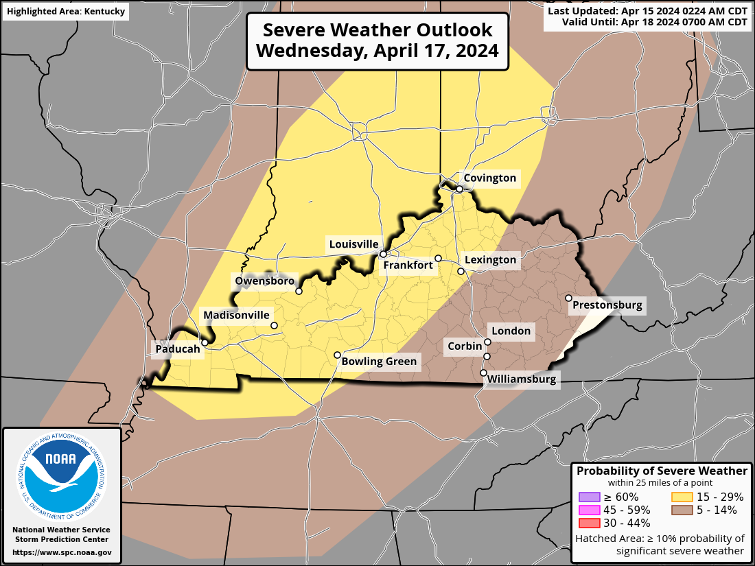
There is a chance of showers and thunderstorms on Wednesday morning before daybreak. There will not be much of a serious threat from those. There will be another round of storms in the late morning or early afternoon. It is more likely that these storms will be strong or severe. By late Wednesday night, storms are predicted to move east of the area.
Severe storms have the potential to produce localized tornadoes, large hail, and damaging winds. It is also conceivable for locations that receive frequent rainfall to experience minor flooding.
-
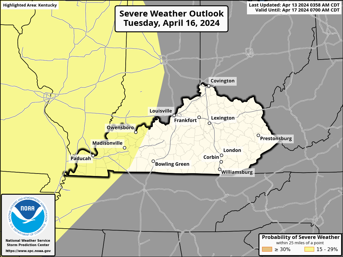
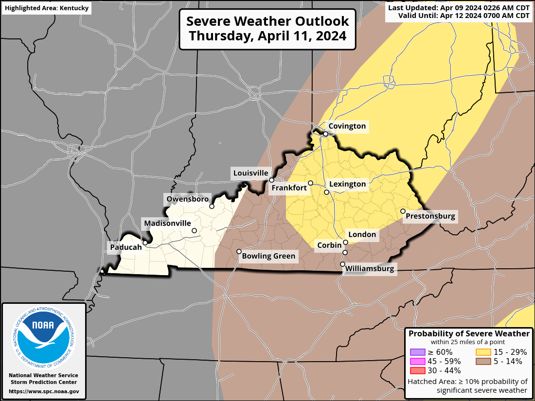
A severe weather event may be in store for us, maybe beginning on Tuesday and continuing into Wednesday. Western Kentucky is currently categorized as a level 2 out of 5 Slight Risk Area, with a 15% probability of strong to severe storms on Tuesday, according to the Storm Prediction Center. As we approach closer, there is a risk that this gets bumped up to level 3 out of 5 Enhanced Risk Area. The exact location, severity, and timing of the extreme weather are still somewhat unknown. The course of events will change during the following few days. Return for updates. As always, be prepared for everything.
Remember, forewarned is forearmed!
-
-
 1
1
-
-
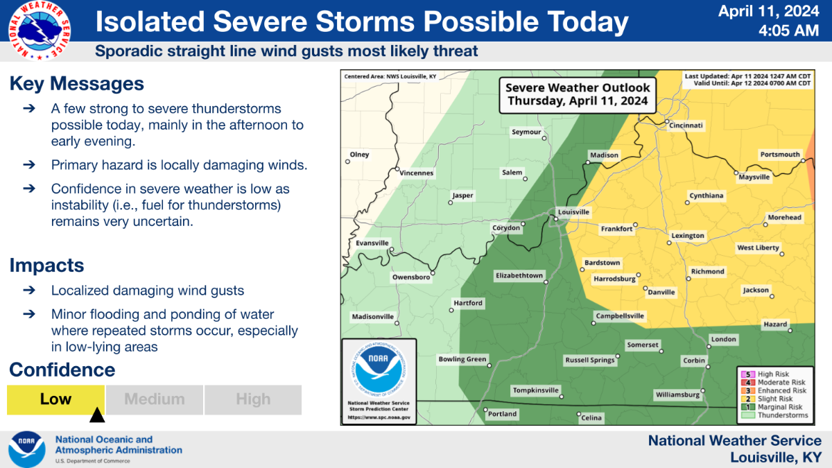
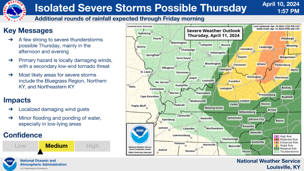
There is an isolated threat for a few strong to severe storms, mainly in the afternoon and early evening hours, across southern Indiana and central Kentucky. The best chances for any severe weather will generally be east of the I-65 corridor, but confidence in severe storms remains low.
-
Tonight and Thursday are predicted to see more waves of showers and thunderstorms, with Friday morning seeing a decrease in precipitation. Locally, on Thursday, a few strong storms are probable in central Kentucky and southern Indiana (primarily in the afternoon and evening). There will be a comparatively higher risk of severe storms from northeastern Kentucky into Ohio.
-
East of the surface cyclone track that is steadily deepening, a synoptically conducive corridor for a few supercells and organized clusters should form. In this area, there should be a time when the daytime heating cycle and an overspreading mid-level dry slot coincide, resulting in an occurrence of early afternoon convection in the left-exit region of the strong mid-level jet over the Southeast and southern Appalachians. A supercell wind profile should be evident, even though potential energy will remain weak. There is a chance of a few tornadoes, isolated to dispersed damaging winds, and isolated, powerful hail.
-
-
Latest maps
-
1
-
-
-
-
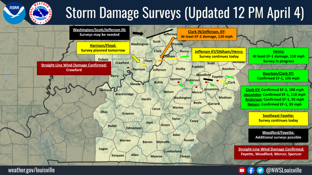
I have to admit, I'm impressed with the SPC Mesoscale Analysis 3Cape model data. The confirmed tornadoes were pretty close to the area that it showed. I will be using it in the future during severe weather events.
-
 1
1
-
-
-
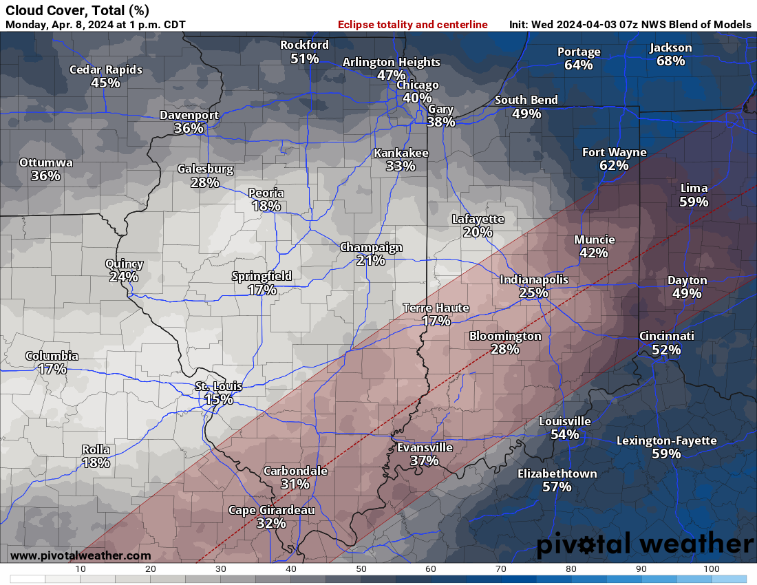
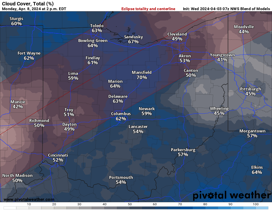
22 minutes ago, TheDeuce said:
Trying to decide if I want to head west or north for totality. I'm trying to get home before 10pm, lol.
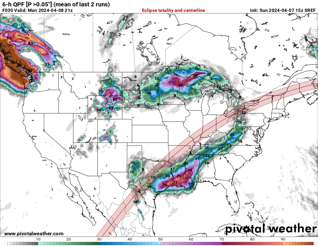
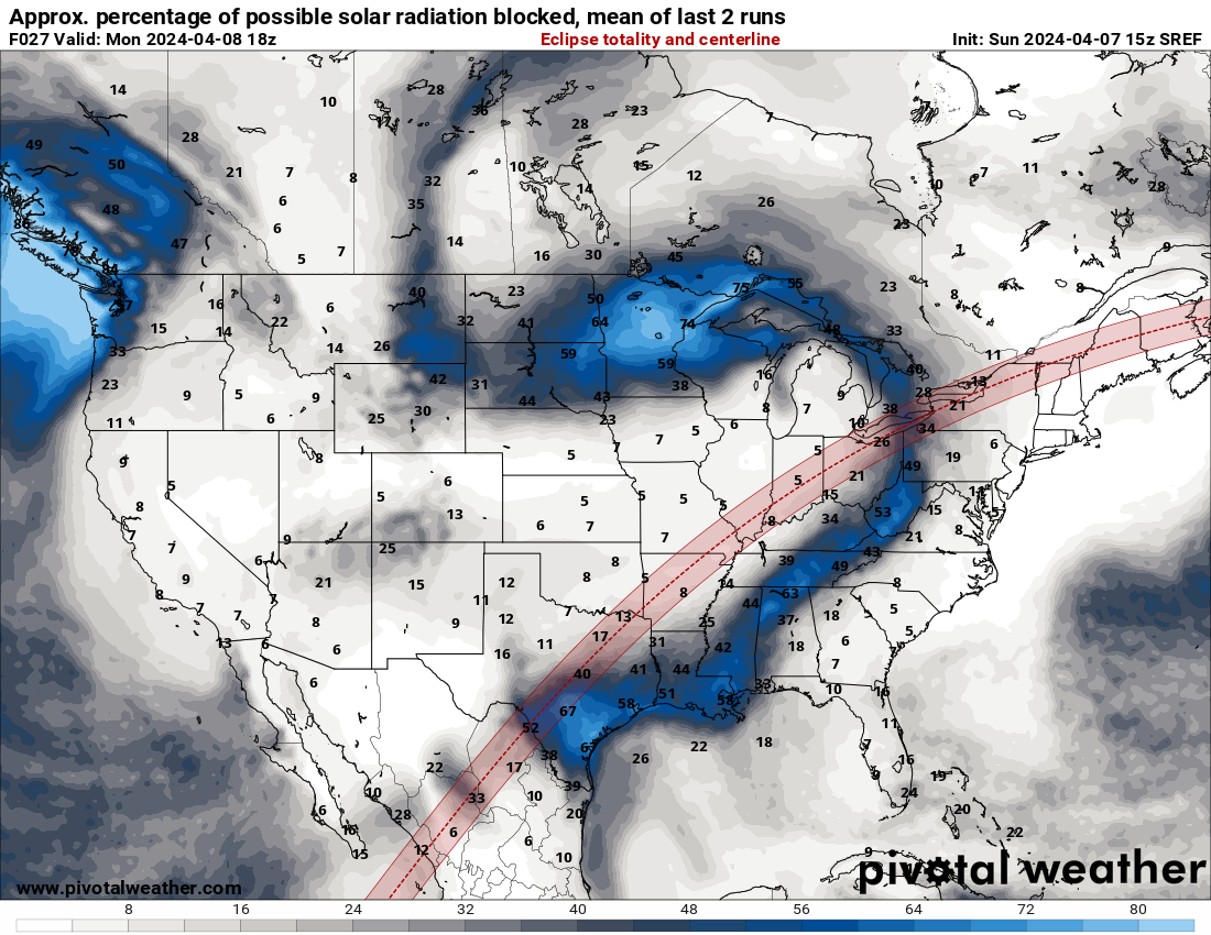
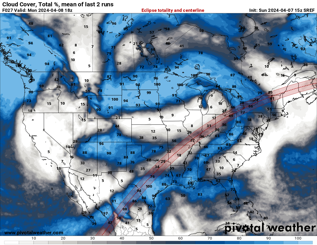
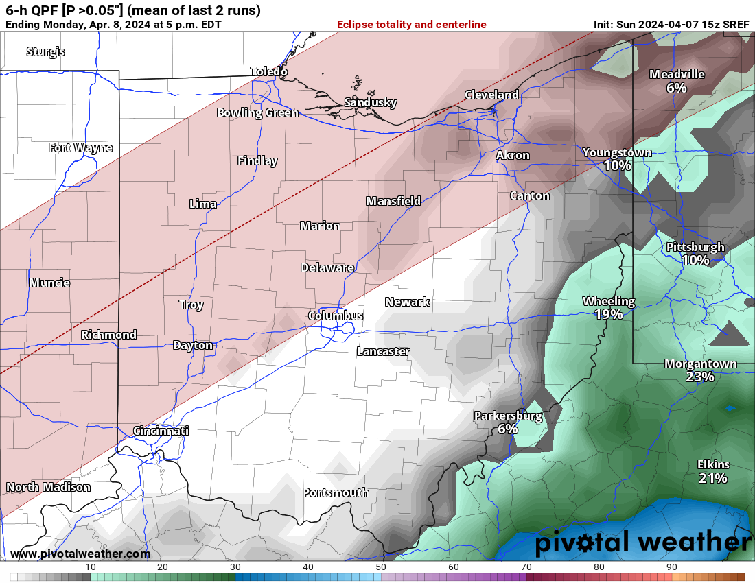
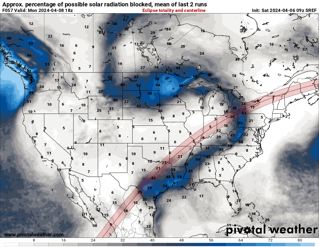
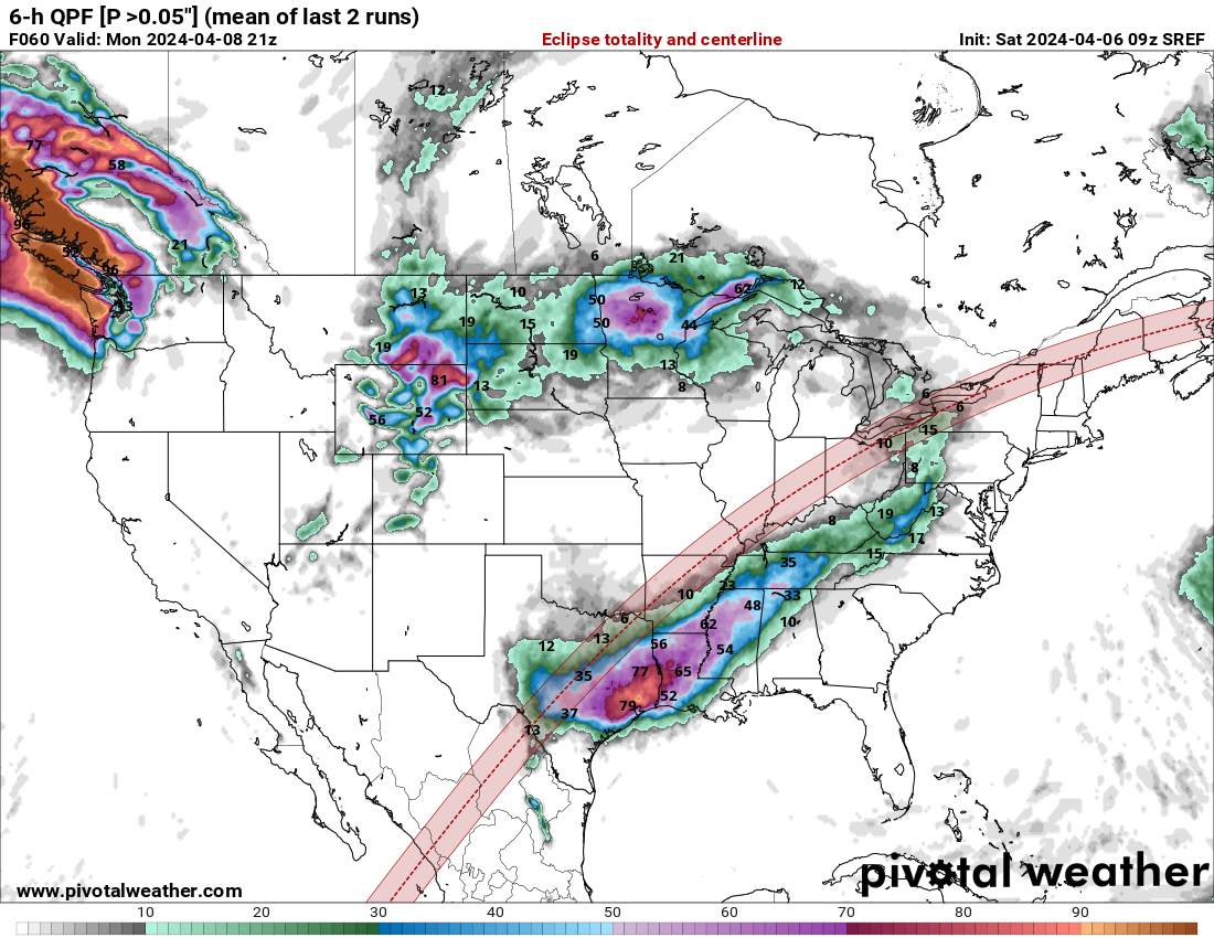
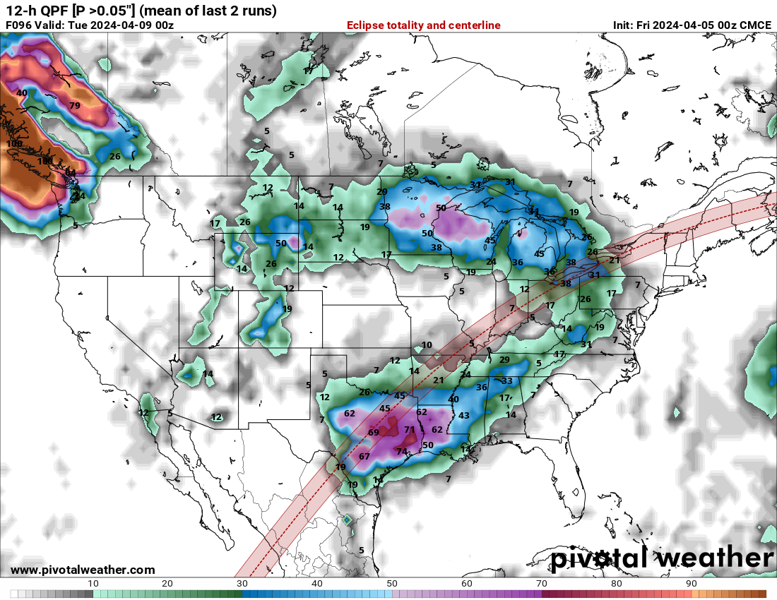
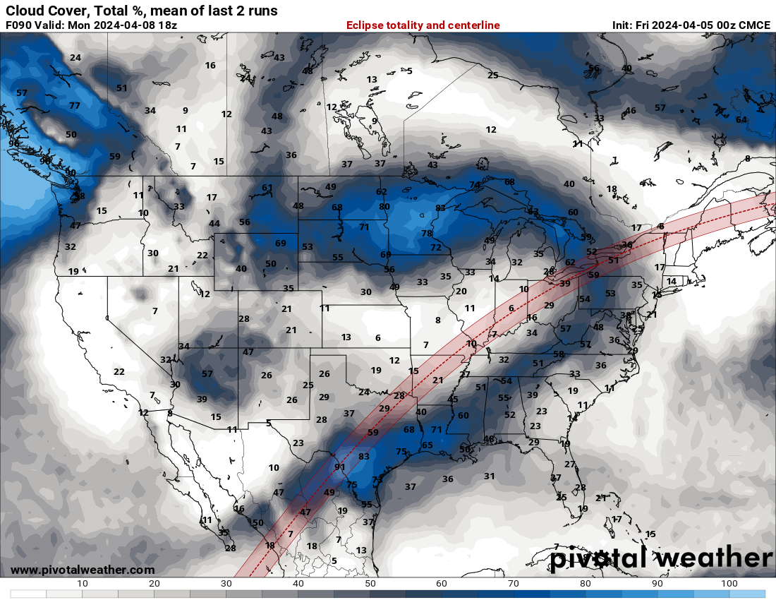
It looks like it will be best to travel to Illinois or Missouri.
-
These maps are at 2 pm EDT on Monday, April 8, 2024.
-
1
-
-
-
Tornado Warning NKY
-
-
Severe Weather Statement
National Weather Service Morristown TN
548 PM EDT Tue Apr 2 2024TNC013-151-022230-
/O.CON.KMRX.TO.W.0002.000000T0000Z-240402T2230Z/
Campbell TN-Scott TN-
548 PM EDT Tue Apr 2 2024...A TORNADO WARNING REMAINS IN EFFECT UNTIL 630 PM EDT FOR CAMPBELL
AND EAST CENTRAL SCOTT COUNTIES...At 548 PM EDT, a confirmed large and extremely dangerous tornado was
located 7 miles east of Huntsville, or 11 miles southeast of Oneida,
moving northeast at 35 mph.This is a PARTICULARLY DANGEROUS SITUATION. TAKE COVER NOW!
HAZARD...Damaging tornado.
SOURCE...Public confirmed tornado.
IMPACT...You are in a life-threatening situation. Flying debris may
be deadly to those caught without shelter. Mobile homes
will be destroyed. Considerable damage to homes,
businesses, and vehicles is likely and complete destruction
is possible.Locations impacted include...
La Follette, Jacksboro, Jellico, Caryville, Elk Valley, Indian
Mountain State Park, Fincastle, Royal Blue, and White Oak.This includes Interstate 75 in Tennessee between mile markers 138 and
161.PRECAUTIONARY/PREPAREDNESS ACTIONS...
To repeat, a large, extremely dangerous and potentially deadly
tornado is on the ground. To protect your life, TAKE COVER NOW! Move
to a basement or an interior room on the lowest floor of a sturdy
building. Avoid windows. If you are outdoors, in a mobile home, or in
a vehicle, move to the closest substantial shelter and protect
yourself from flying debris.Torrential rainfall is occurring with this storm, and may lead to
flash flooding. Do not drive your vehicle through flooded roadways.

.png.f20b24dc60ec9f24fdbc9acf7e8f9636.png)
Severe Thunderstorm Watch WKY
in Weather
Posted